We
sailed into Papeete (pa-pe-et-ay) late in the afternoon. We were scheduled to arrive the following
morning, but, since the Easter Island landing was aborted, we had a little
extra time—and perhaps they wanted to make up to us for missing Easter
Island. Apparently several people were bitterly
disappointed and complained vociferously—some saying it was the main reason
they had chosen the cruise. I admit,
when people asked us before we left what we were looking forward to most, we
mentioned Easter Island ourselves. I
think Viking could have prevented some of the complaints had they been
forthcoming in the cruise description about Easter Island (and actually the
other tender ports) being potentially unsuccessful.
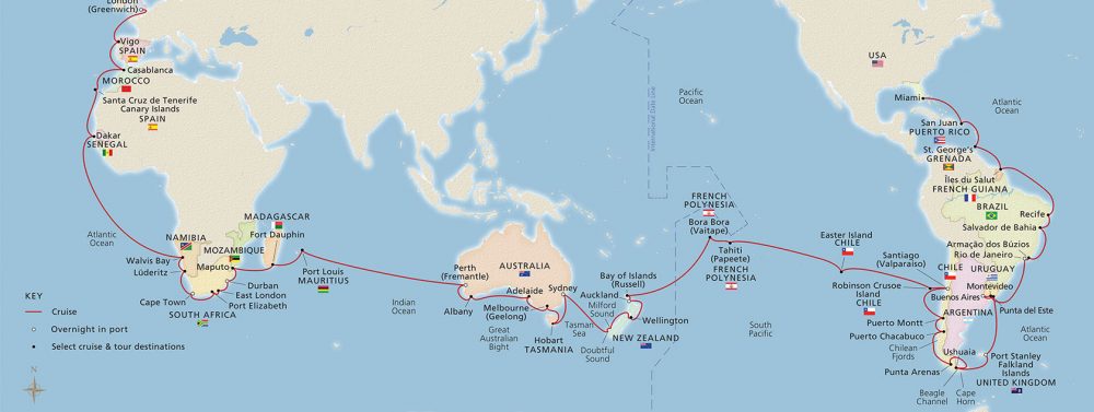
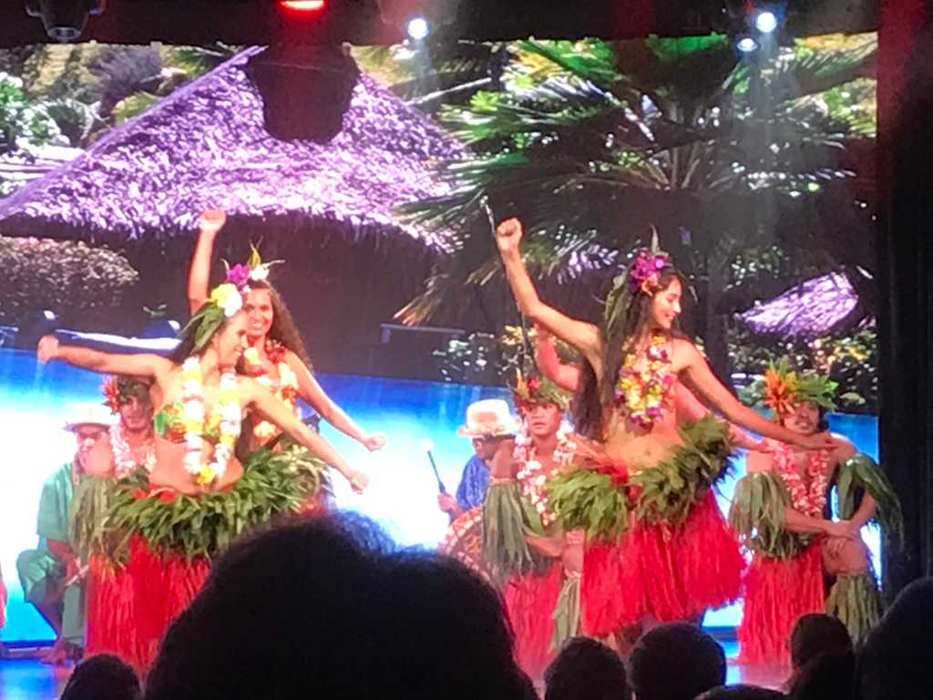
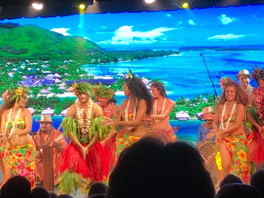
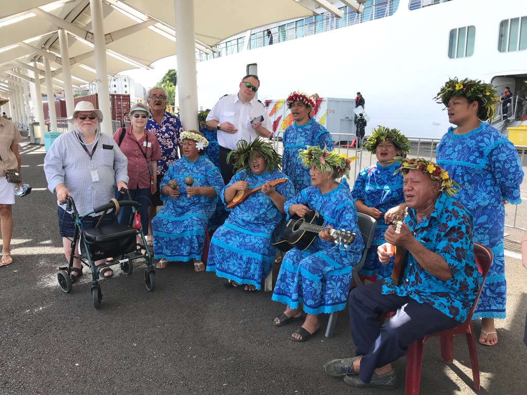
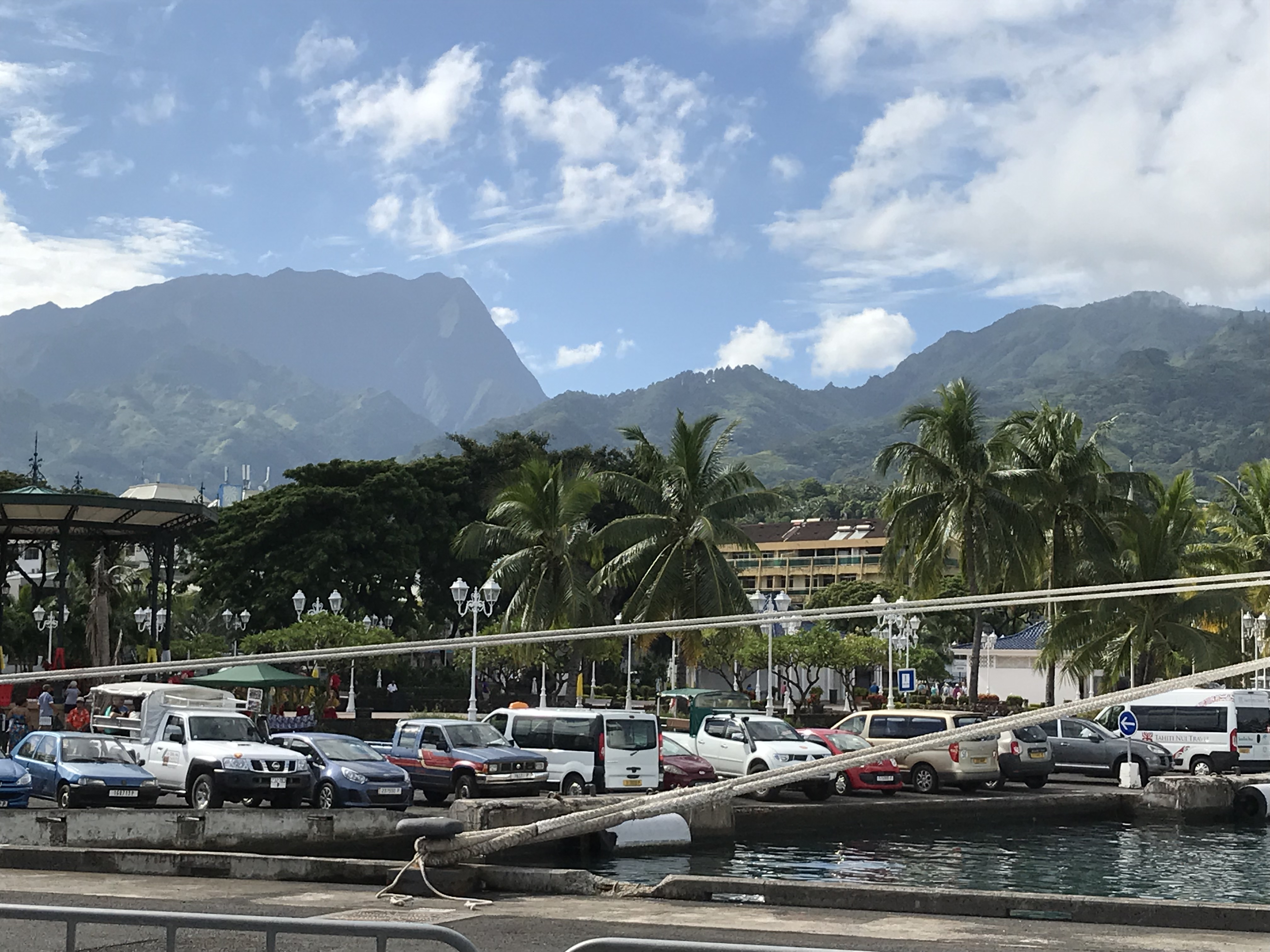
At any rate, the overnight in Tahiti allowed the ship to bring aboard ‘O Tahiti E’ for a performance of Tahitian music and dance that was well-received—even we enjoyed it immensely and, indeed, arrived in the theater an hour plus early in order to assure seats. The theater seats about 400 I think and I believe we have about 830 passengers (somewhat fewer during this leg than the capacity 930), and, although they simulcast it on the pool deck and made it available for a day or two afterwards through our tvs, the theater seemed preferable.
French
Polynesia is part of France and the languages are French and Polynesian but
English is widely spoken. The population
of Tahiti, the largest of the French Polynesian islands, is about 200,000, most
of whom live in Papeete, the capital of both Tahiti and all of French
Polynesia.
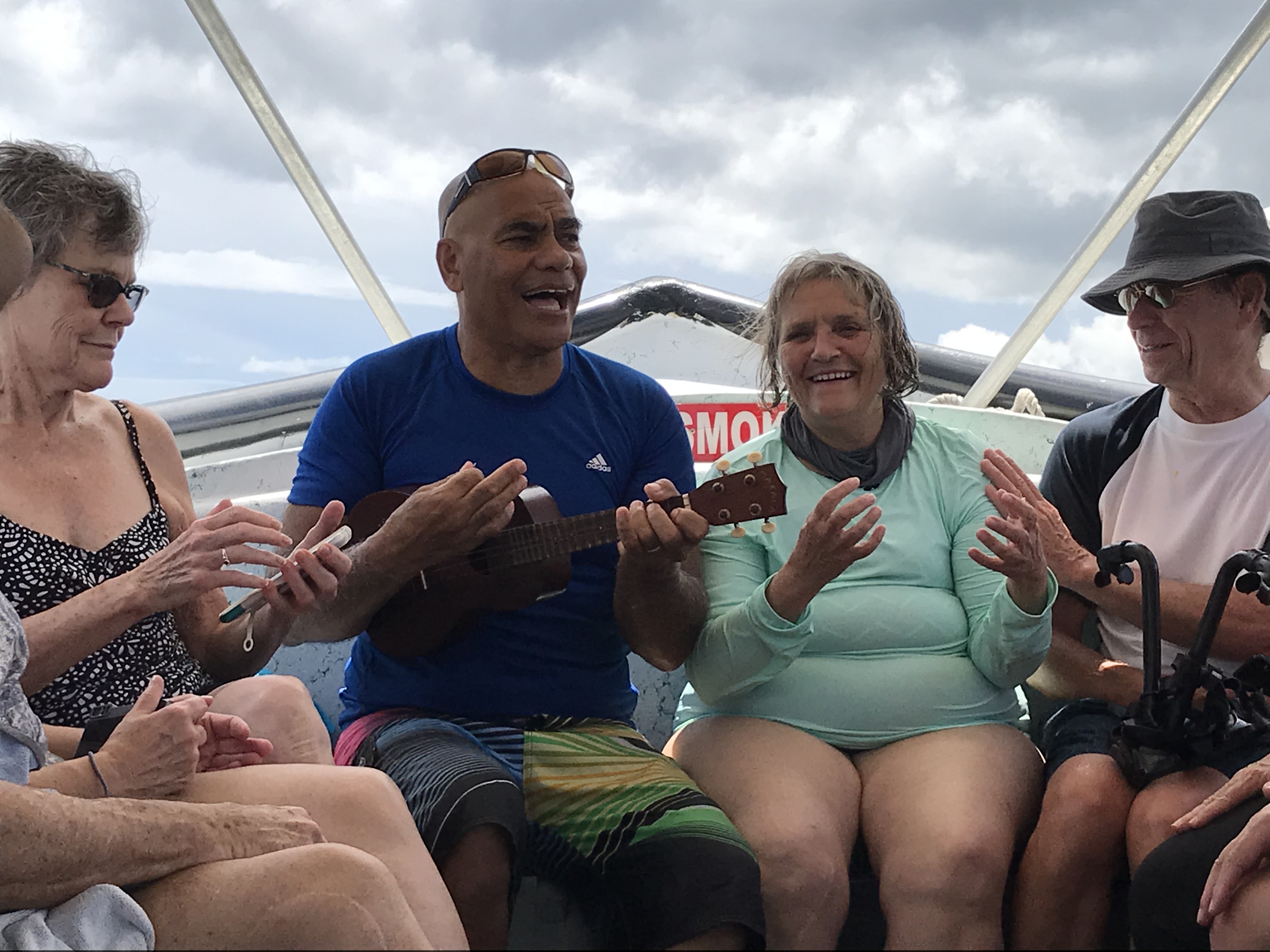
Many
passengers went ashore when we docked, but we waited until morning when we
walked down the quay to a smaller boat and went snorkeling. It was lovely being in the water! Snorkeling made me miss diving, and I kept
forgetting I had to keep my snorkel out of the water so got a snorkelful of
water many times. There wasn’t a lot to
see– a variety of tropical fish (whose names I used to know and have
forgotten) and I did see a Christmas tree worm.
But I was delighted with the experience and ready to go again tomorrow…
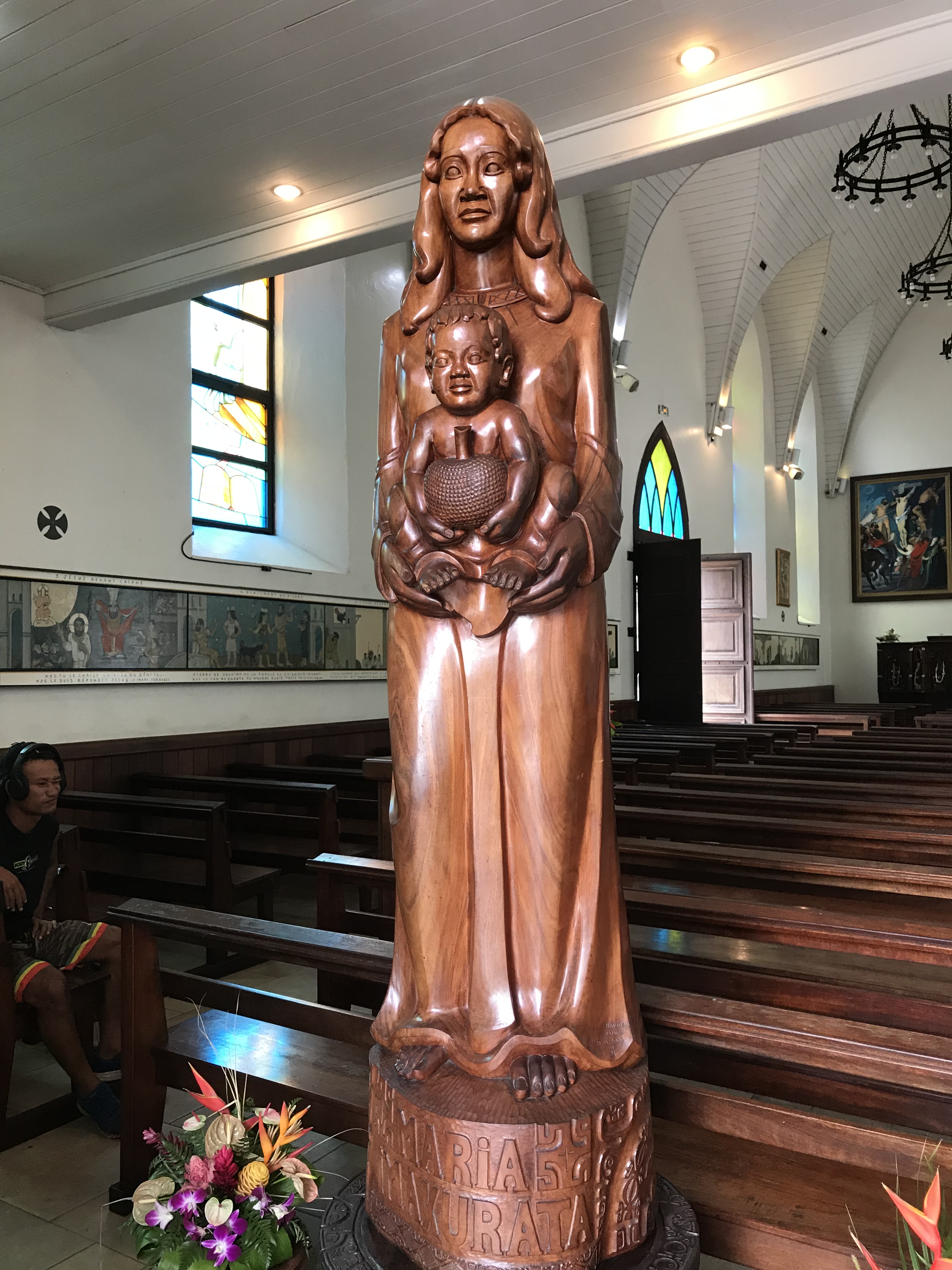
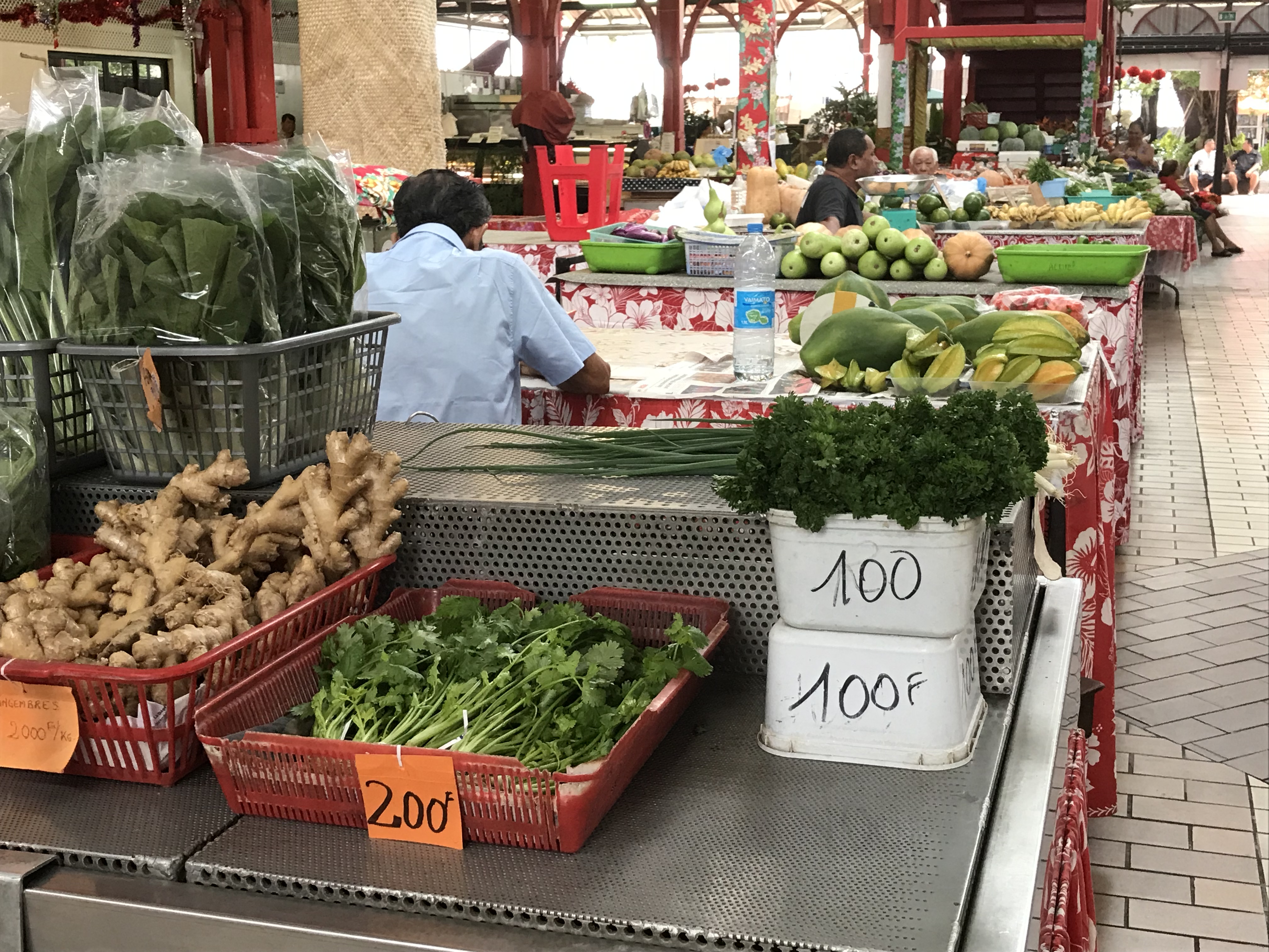
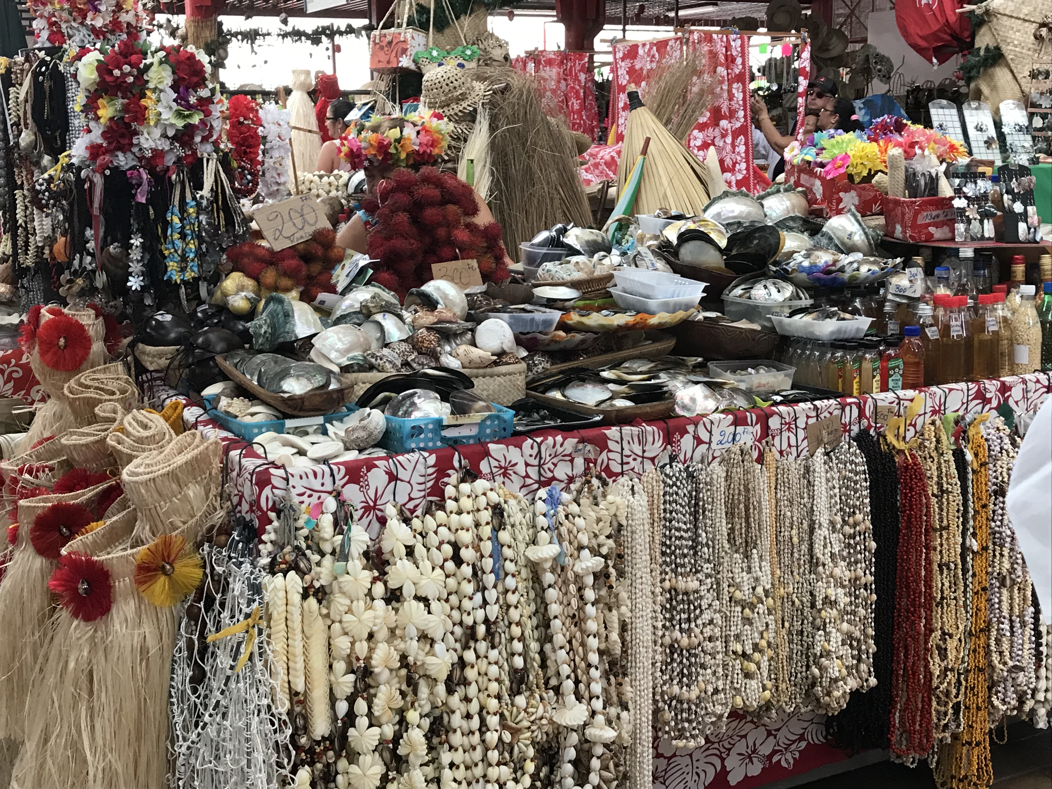
In the
afternoon I did the walking tour around Papeete. We saw various buildings including the
parliament house and the cathedral plus the 19th century Queen’s
bathing pool and the Market, which was like a large farmers’ market with
produce grown at people’s homes, crafts, and flowers.
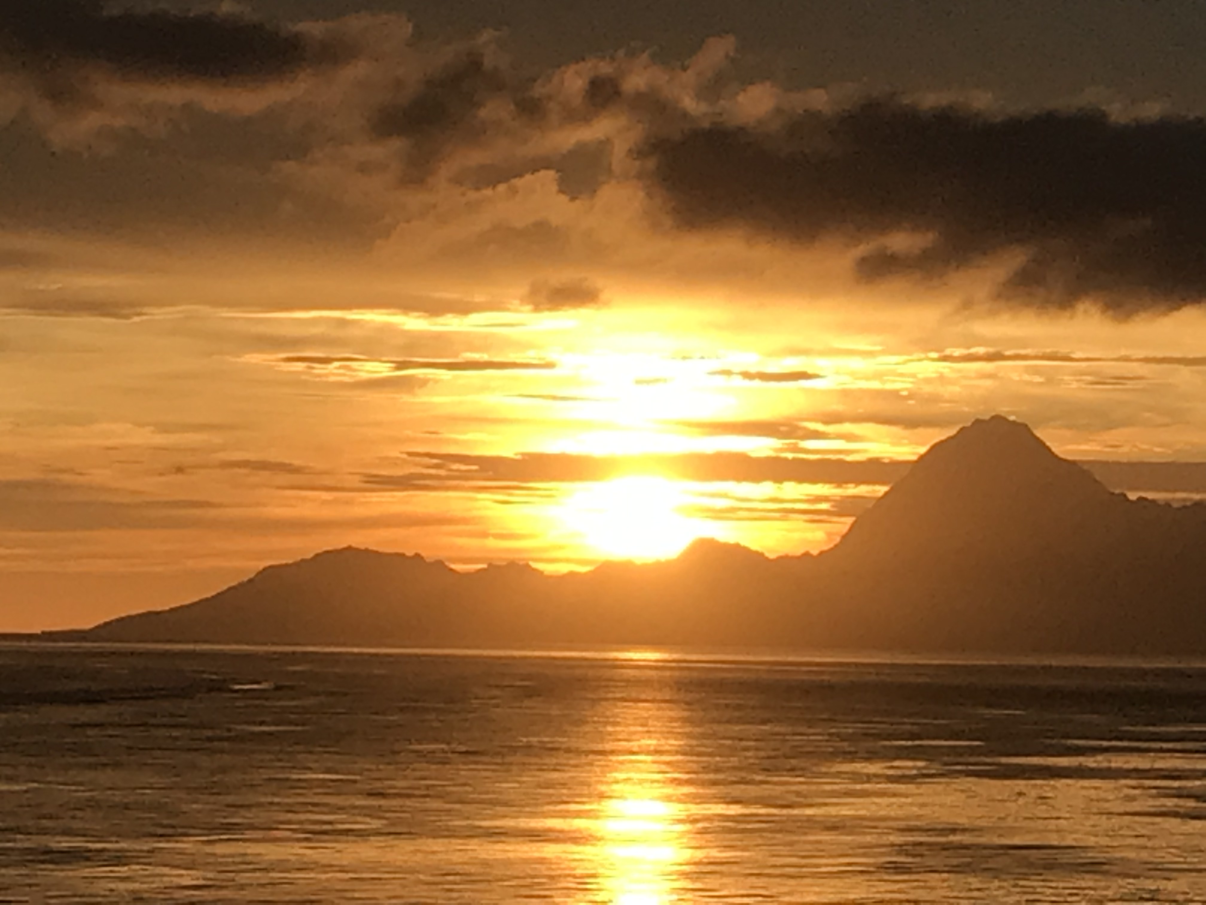
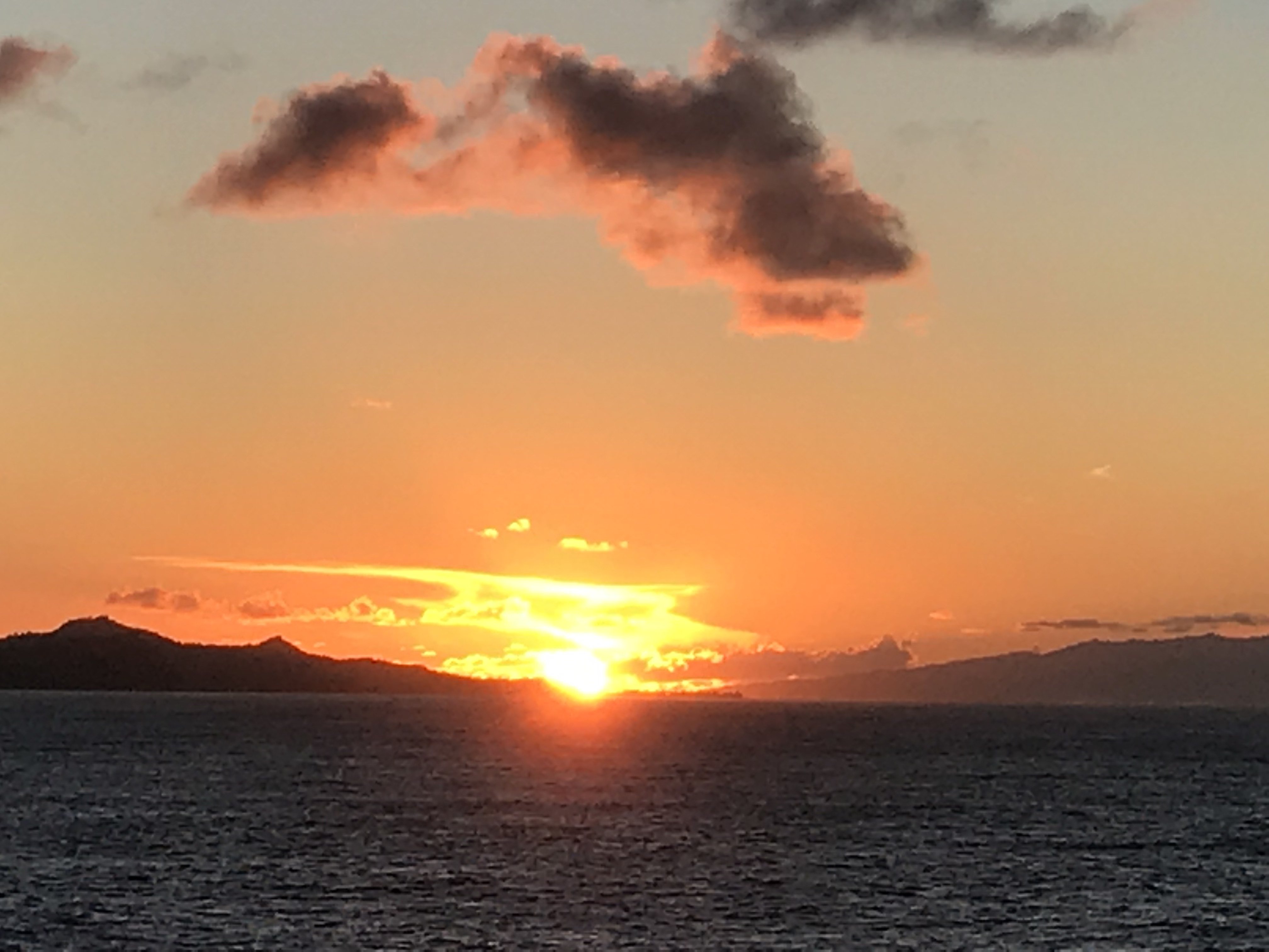
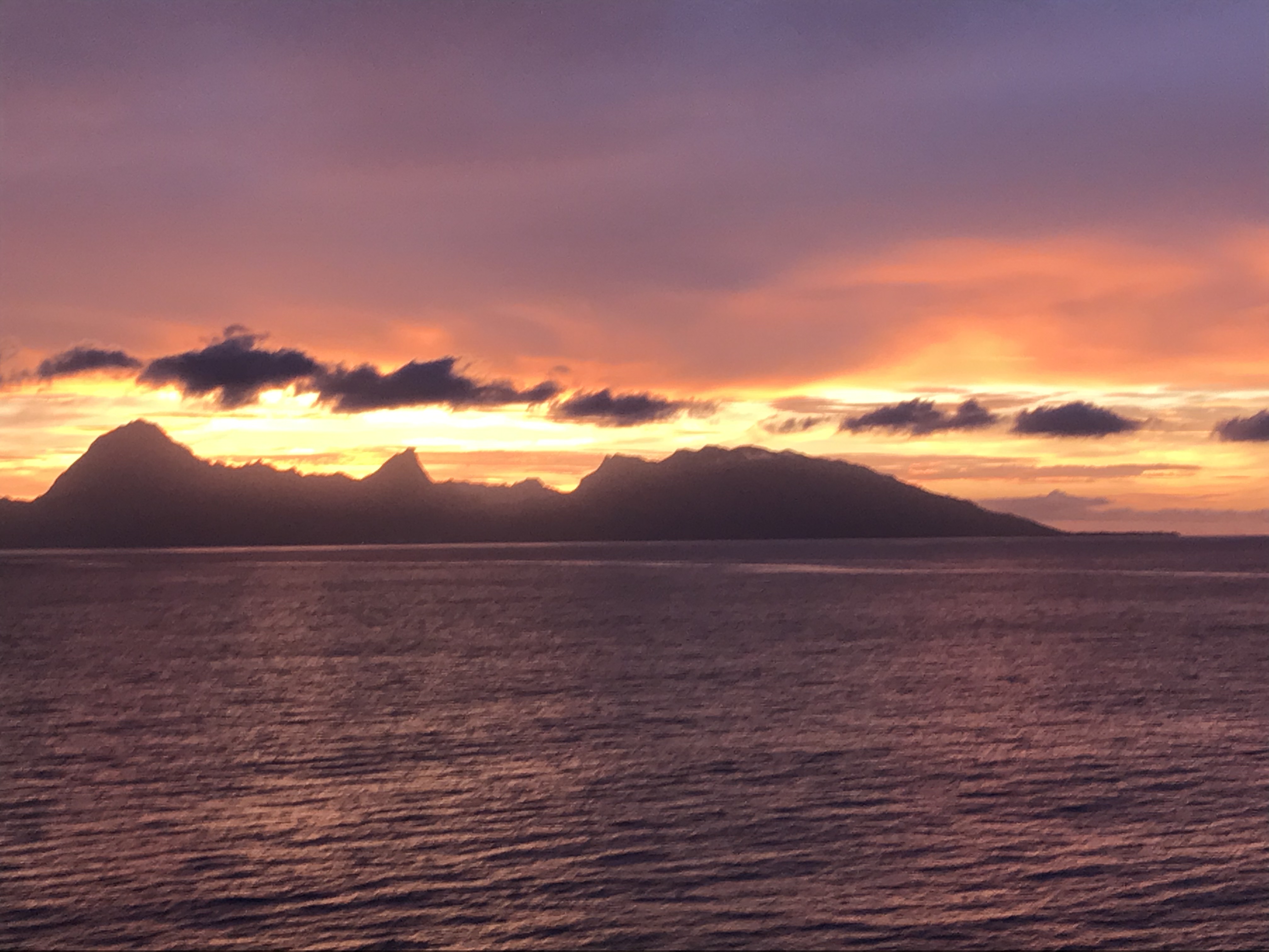
The sail
out in the early evening produced a beautiful sunset and many photos, and we’re
on our way to Bora Bora!
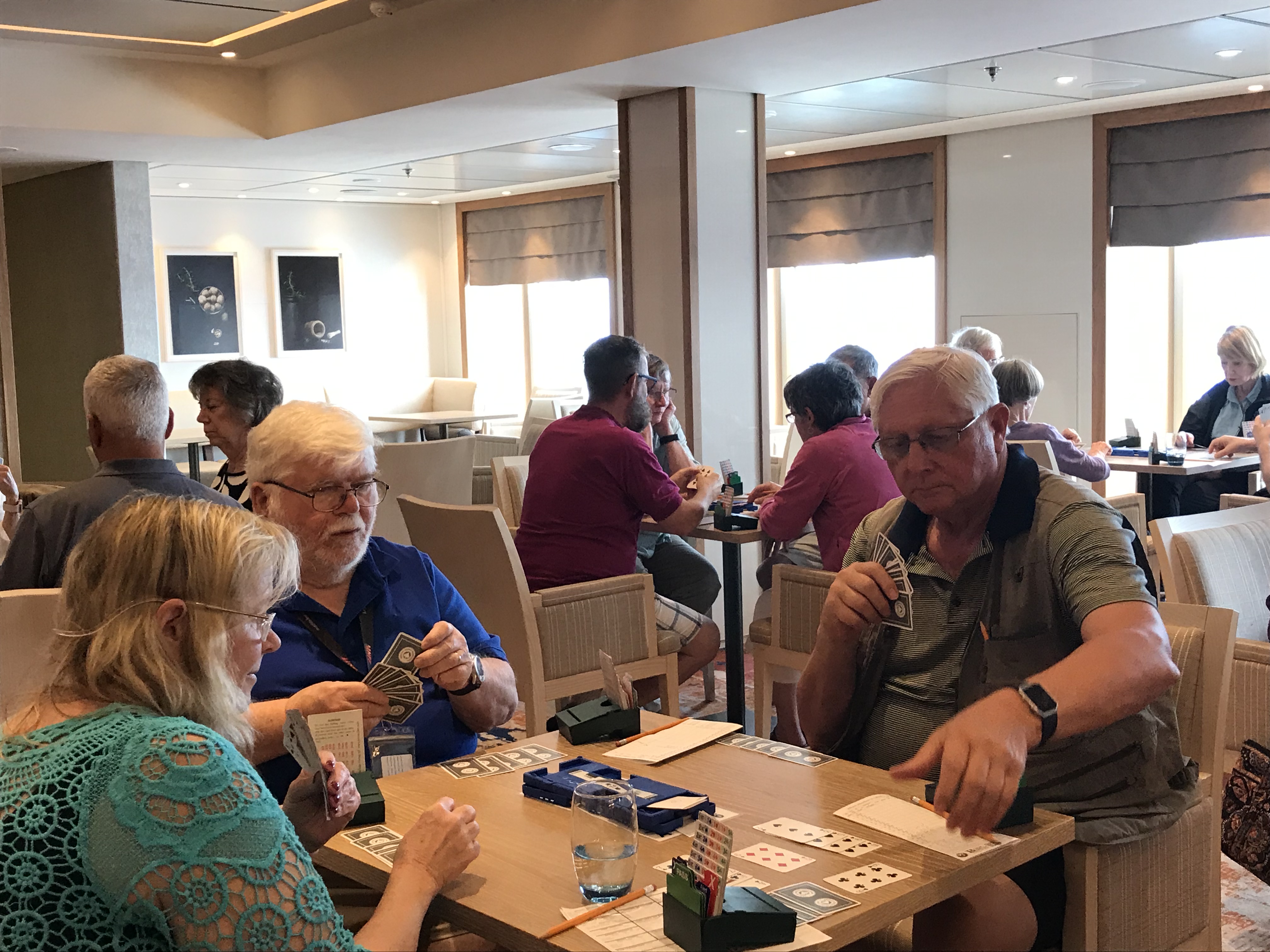
Easter Island is said to be the most isolated human community on earth–that is, the farthest from any other human community. I can certainly believe it from the time it took us to travel there from Robinson Crusoe Island (hardly a large community) and the several days we have spent travelling from there to French Polynesia. We have had several beautiful days on the beautiful ocean with temperatures in the high 70sand low 80s. Lots of bridge playing as well as other activities.
Time changes: early in the trip we moved our clocks two hours ahead; I still have difficulty accepting that even Chile is east of the eastern part of the U.S… Now we are heading west and setting our clocks back an hour almost every night. We have gained an hour 7 times putting us in Honolulu time or 2 hours behind Pacific time. This gaining an hour of sleep will, of course, continue, although not so quickly, since we are almost circumnavigating the world. To make up for it we must cross the International Dateline and lose a whole day. We will have no March 2 this year. Since that’s not my birthday, I’m not mourning its loss—I much prefer gaining hours of sleep. So far, I’ve enjoyed and made use of every one of them!
Friday
morning I saw there was an aqua aerobics session scheduled for 7:30 and I
figured that even I should be able to get up in time to make it given all the
sleep I’ve had. It was great fun. The pool is quite small—especially with 17
people in it so the exercises definitely had to be in place. In addition, the swell caused the water to go
energetically from end to end–and over the end and return as a waterfall. I figured the pool just wanted to join in the
fun!
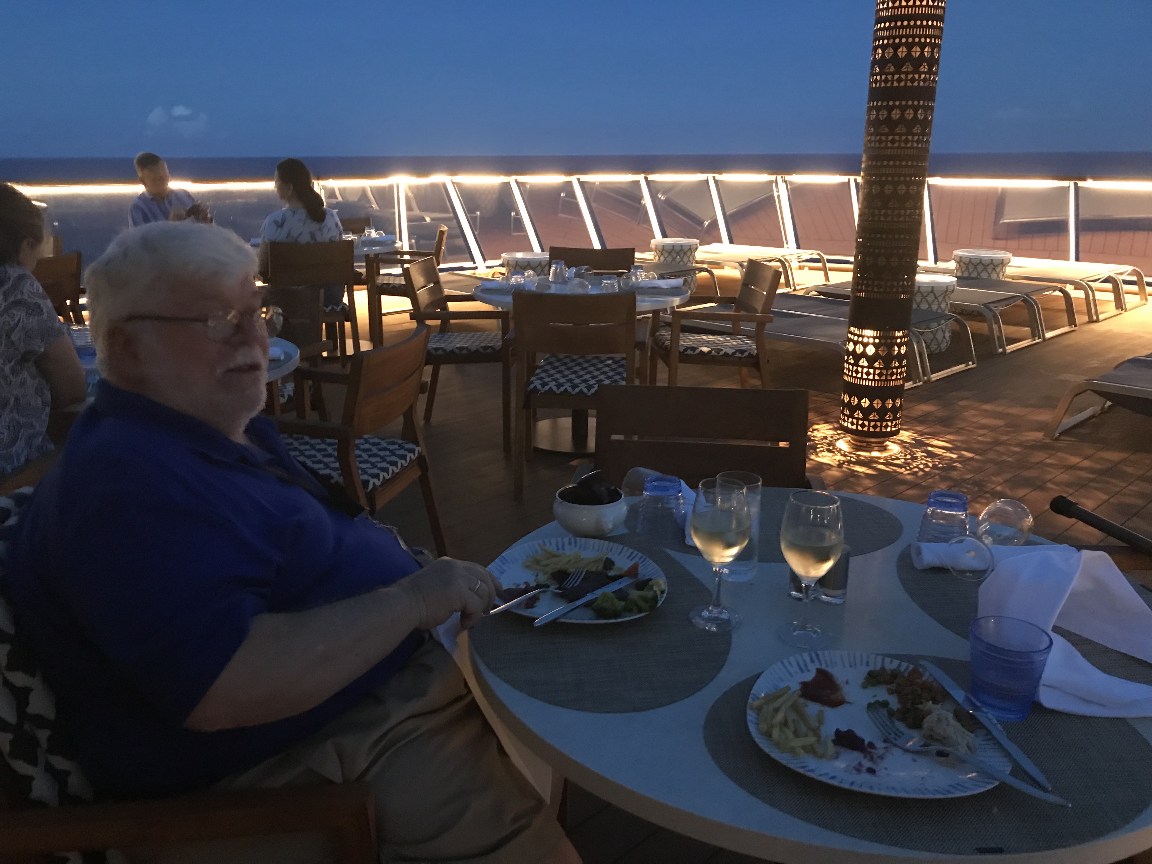
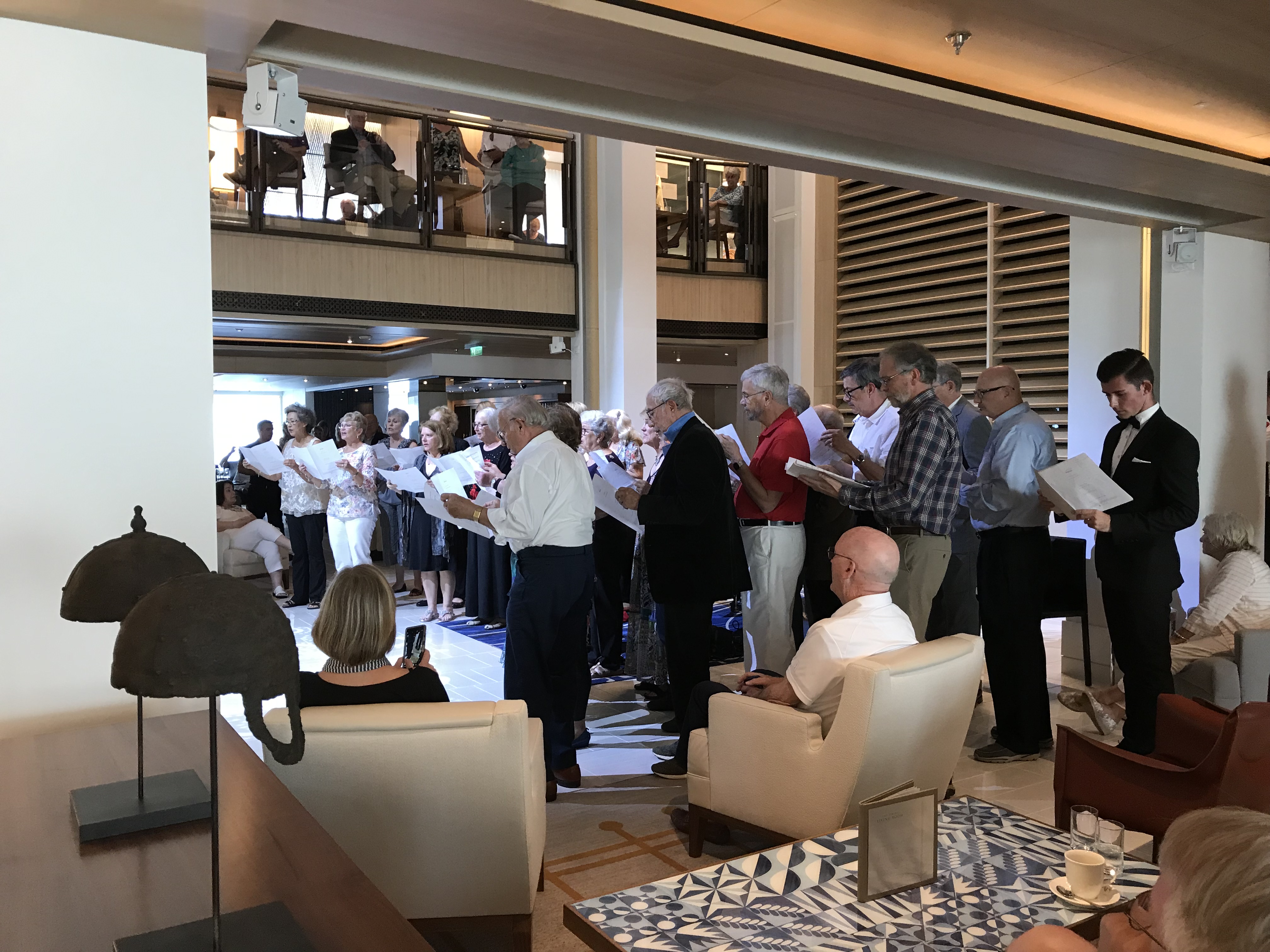
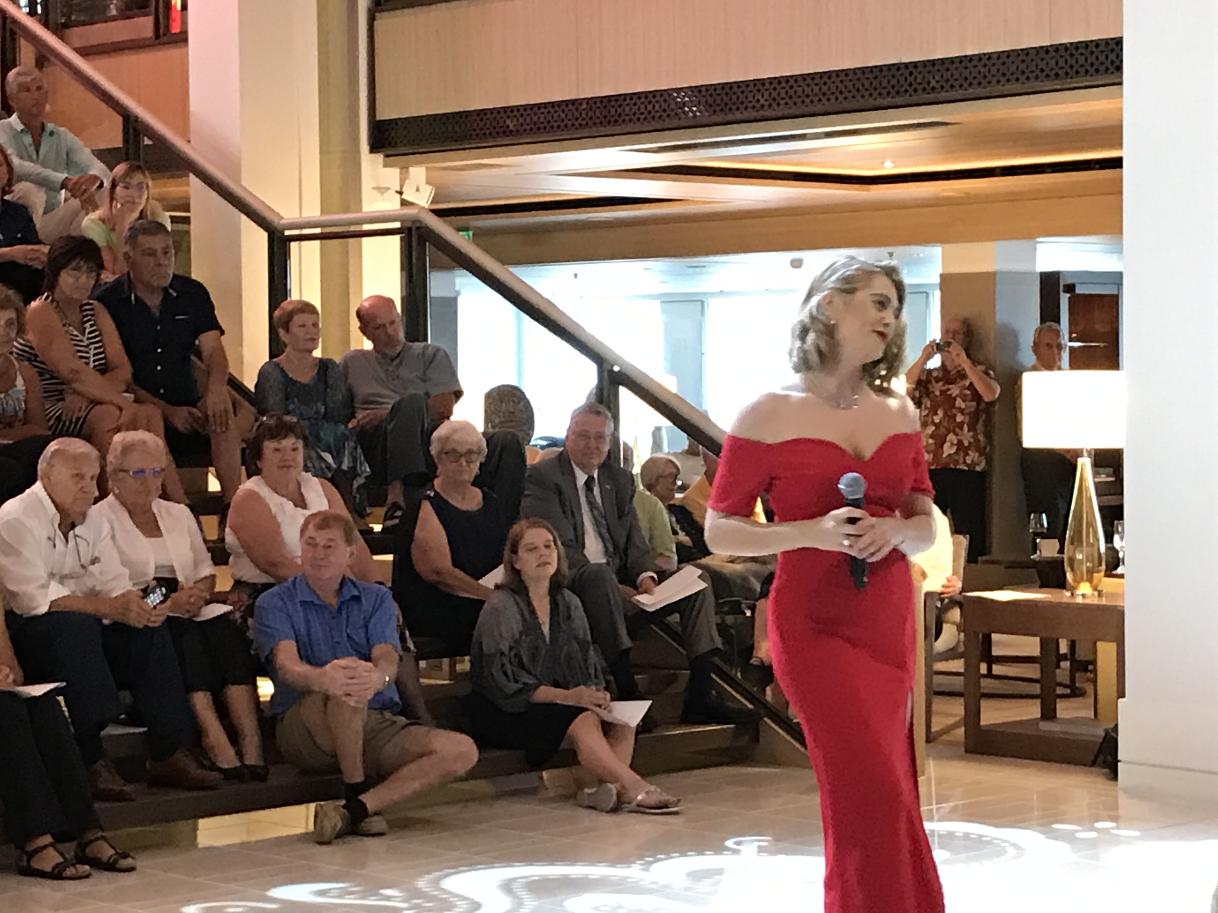
There have been a few shows at 5:30, which suits our ‘retirement’ time better than 9:15. One was a concert by the ship’s instrumentalists and vocalists. I could tell they were really good, and other people were exceedingly enthusiastic, but the sort of music—all I can think of to call it is night club music—isn’t really to my taste. They and the Cruise Chorus did a second concert I enjoyed much more of songs that had won Oscars over the years. Then, of course, they showed the Oscars Sunday afternoon. The concerts were held in the Atrium where the grand staircase miraculously becomes stadium seating (as you can see in the photo)
I was really impressed by the magician of card tricks; it was absolutely amazing what he could so with cards! He was on stage with a few volunteers and they also projected the table where he was doing the tricks onto the big screen. At the low end of the scale, as someone who shuffles a lot of decks of cards while playing bridge, I was impressed that he could shuffle a deck ‘perfectly’—that is interlacing one card at a time from each hand—in less time than I can shuffle a deck very imperfectly.–Cynthia
Pacific Ocean Swells. For several days we have been moving west across the Pacific
from Robinson Crusoe Island towards Easter Island and the group of islands historically
called “Oceania” and politically, Polynesia… and the Pacific has not been
placid; certainly not pacific! Not, mind
you, has the sea been rough; it hasn’t been, but the absence of wind-blown,
white-capped waves that signifies roughness for those used to the Atlantic belies
the underlying presence and effect of ocean “swells”.
When viewed from above, swells are not so
evident, but from windows along the lower decks, their height can be more
evident. Every noon during his verbal
snapshot, the Captain provides the sea (or swell) height in meters, which usually
range from 1 to 4 meters (3 to 13 feet). Swells are less evident than waves because their high and low points are much
further apart than their white-capped, wind-tossed relatives: large swells are
said to have long “periods” (or lengths between successive highs). These less evident ocean wave forms may have
had their origins as far away as Java or other parts of SE Asia; so they have
had time and space to “swell” as they move towards South America. (More subtly, of course, their behavior like
the tide is also affected by the pull of the moon.)
As far the the Viking Sun is concerned,
swells produce a side-to-side rocking motion when the ship is traveling across their
direction of movement, and the ship seems to move like a large porpoise when it
meets the swells head on. Mostly, swells
seem to strike the ship obliquely, and the ship responds with more of a
cork-screw motion. Whatever the motion,
the ship’s behavior seems very comfortable at night when one is abed and
sleeping and is very destabilizing during the day when one is trying to move
about. The ship’s behavior seems to have
little effect on the crew, fortunately, and I marvel, for example, at the
ability of café staff to carry large trays of dishes amidst staggering diners
or the Cruise Director to move graciously along in her 3-inch heels whatever
the motion. Under similar conditions I
mostly feel as if I have had a drink too many, and I usually require assistance
while attempting to carry a single meal plate in the World Café.
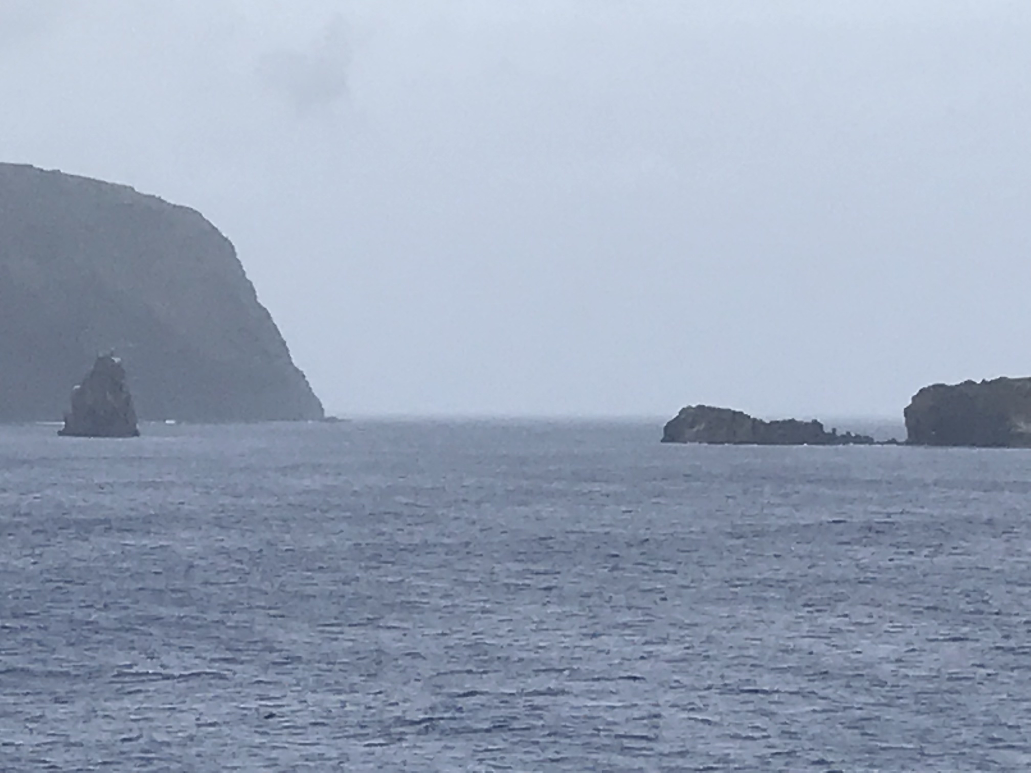
Several days ago, the sea around Easter
Island seemed calm, almost placid. No
sign of waves or swells… until one glanced at the rocky shoreline and saw (and ship’s
tender was awash and tender and platform bounced drastically out of synch with
one other. The captain judged the sea
too rough and hazardous for landing passengers, so instead we circled the
island and viewed a few Moa (large, carved megaliths) from off-shore (see
picture above Cynthia’s comments). Disappointing, but the ocean is what it is!
About 15 years ago I recall visiting the Smithsonian Institute in Washington, DC when a traveling exhibit of Polynesian “maps” or stick charts were featured. At first glance these resembled fragments of badly woven pieces of floor mats or baskets. The exhibit narrative convincingly explained, as I recall, the strands of these pieces represented Pacific swells and the nexus of two crossing strands represented a major change in the direction of swells. SometImes Cowrie shells were included to indicate the location of islands. In other words, these were navigational charts. When combined with stellar constellations, Polynesians used navigational charts to explore and colonize the numerous but often widely scattered islands of the southern Pacific, including Easter Island, sometimes crossing distances of a thousand miles or more. Check Google for an introduction—http://thenonist.com/index.php/thenonist/permalink/stick_charts/. —Chris
What they don’t tell you when you sign up for a cruise that includes Easter Island (but the veteran travelers know) is that chances are at best 50-50 as to whether you will actually reach land. Our cruise director said she’d been to Easter Island twice but attempted it 5 times. It is a tender port and that requires more cooperation from the sea than a port where you park at a pier. Getting 800-900 landlubbers from a ship to a tender and from a tender to a dock is…not easy.
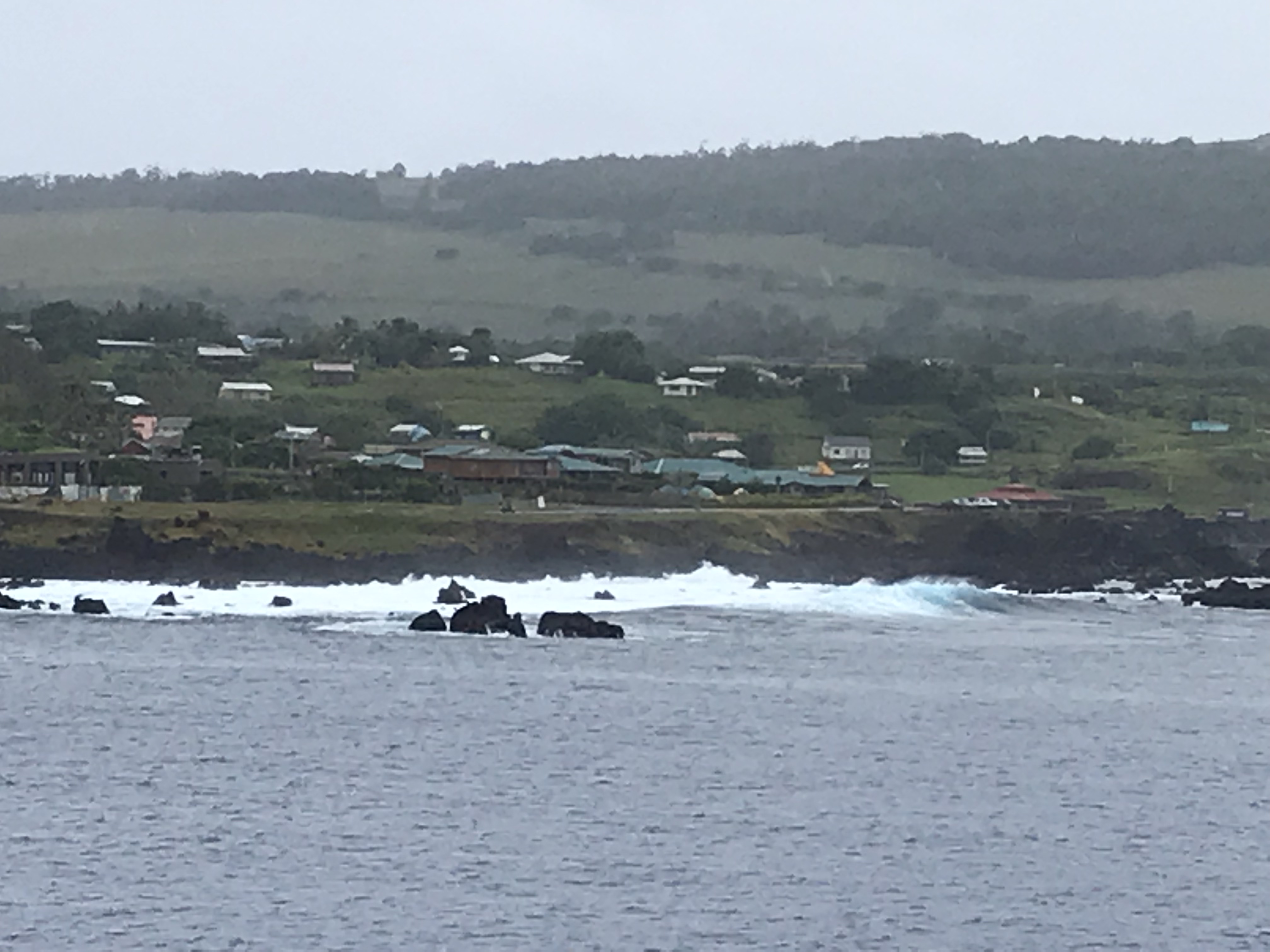
Rain was predicted but only some showers materialized. The port authorities boarded and cleared the ship to go ashore. The sea looked reasonably calm to me, but apparently there was a significant swell, and it was too much to risk sending passengers ashore. You can see from the first photo there were significant waves crashing against the shore.
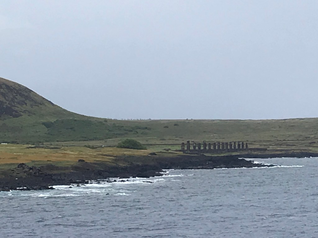
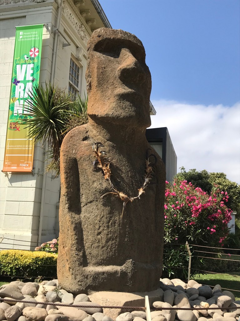
So, instead we circumnavigated the island. An islander stayed aboard and narrated (over the speaker system) a bit of the history and what we were seeing. (I gather he managed to disembark and return to land before we headed for the open sea.) It was disappointing but… We saw the most commonly photographed row of moai from the deck but they were too far away to really see—or to get a good picture of with a phone camera though my attempt is shown above. The photo shows a bit of the volcano nearby from whose lava rock all the moai were carved. I was definitely glad I had seen the one at the Fonck Museum in Valpariso (and photographed it).
Our
local guide also talked about the former Birdman competition (this was well
after the creation of the lava stone moai.)
The island was populated by several tribes and which tribe provided the
overall leader was determined by the competition. A bird laid eggs every spring on one of the
islets offshore and each tribe provided a competitor to dive from the cliffs,
swim to the islet, collect an egg and return with it (unbroken) to the top of
the cliff. The tribe of the first to
arrive successfully provided the ruler for the coming year.
To be
honest, to learn about Easter Island and the moai statues (and to see good
photos), you’re better off using the internet than my trying to summarize
it. Or maybe I’m just bummed I didn’t
get to see them first hand.
Since we couldn’t go ashore on Easter Island, instead of having 3 sea days, 1 land day, then 5 sea days, we have 9 sea days before Tahiti. I believe that’s more in a row than scheduled any time on this cruise. Lots of bridge!
I continue to be impressed by the excellent Sunday services conducted by our cruise director Heather. They are jewels! I even found myself signing up for the bible study held once during each sequence of sea days and led by one of the passengers, and I attended Monday morning. It’s not actually bible study per se but rather reading and discussing a book centered on the Bible. We are going to begin Because he loves me by Elyse Fitzpatrick, which I do not know and have not yet tried to download to my kindle given the erratic wifi. We shall see…
Darwin and Insomnia. While cruising from the Falkland Islands to Valparaiso, Chile,
we traversed the Beagle Channel and much of the Magellan Strait; and saw majestic
fiords as Cynthia has already described.
During the passage, I’ve been (re)reading Charles Darwin’s account of
his voyage on HMS Beagle (1832-1836), which covered more or less the same route. As the Beagle’s naturalist, at age 23 and
fresh from studies at Cambridge University, his account and collections of geological
samples and examples of extant and fossil animals and plants from Patagonia
form the bases for his seminal work on the origin of species. The collections are now housed at Cambridge
and the British Museum.
Of course, these days Patagonia is warmer,
more populated and much less pristine and exotic than it was more than 180
years ago, and I find it difficult to imagine Darwin’s travels from his rich
and colorful 19th century prose.
And his descriptions do go on and on and on. As several biographers (most recently, his
great grandson R. D(arwin) Keynes) have noted, Charles Darwin from childhood
onwards compiled lists of things he had seen or collected….and descriptions of
his Beagle collections are very detailed.
Often during the cruise when I am having
trouble sleeping, I get up and read a section of his travel account and I find
the “tangled bank” (one of his favorite metaphors) of his detailed prose, well,
soporific. For Darwin, however, what he
saw was new and exciting, and his travel notes form the inductive foundation
for his speculations and experiments during the 20 years following the end of
the Beagle’s voyage. During those
decades he reworked his Beagle notes, discussed them and his nascent ideas with
his friends, enlarging and synthesizing his data and revising his thoughts. Moreover, he initiated studies at his home,
which included barnacles, earthworms, pigeons, and dogs. What an incredibly rich life!
For me, the details are not so new, and
the South American locations and creatures have changed too much. I do, however, enjoy following his footsteps
and I welcome the drowsiness the tangled details induce! —Chris
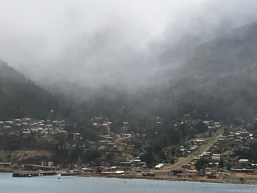
For less than perfectly clear reasons, a Scotsman named Alexander Sinclair was marooned on this island in the 1800s. His experience prompted author Daniel Defoe to write the novel Robinson Crusoe, though Defoe moved the island to the Caribbean and made the man’s sojourn more than 28 years rather than 4.
West of
Valpariso (a 3-hour flight) the island is volcanic, part of a far-flung ‘group’
of small islands, with very steep hills, which reminds me of Dominica, in the
Caribbean, but much more isolated. It
belongs to Chile and has a population of about 800 mostly in the village, in
whose harbor our ship moored. I have no
idea where they get their groceries or other necessities—I saw a very small
shop with canned goods, etc., but no real grocery store. Their economy is based on rock lobster and
fishing with a little tourism. In 2010 the island was hit by a tsunami following a magnitude
8.8 hurricane. The tsunami was about 10 feet high
when it reached the island. Sixteen people lost their lives, and most of
the coastal village was washed away. The
only warning came from a 12-year-old girl, who noticed the sudden
drawback of the sea that presages the arrival of a
tsunami wave and saved many of her neighbors from harm.
We
tendered ashore, and some scaled steep hills for a lookout that always seemed
to be just a little higher… I abandoned
the enterprise partly because I was afraid I would slide much of the way
down. Besides there were plenty of hills
on paved streets in the village to conquer.
I tried to reach the public library but, after walking uphill much
farther than I expected, I found the road blocked off because they were paving.
Rather a
way down the shore, the ship and locals had set up a venue with music and
special drinks. I didn’t make it that
far partly because the music was very loud but mostly because I was already
tired from my hill walking. Indeed, once
on board, I slept for two hours and still managed to sleep 10 hours that
night…
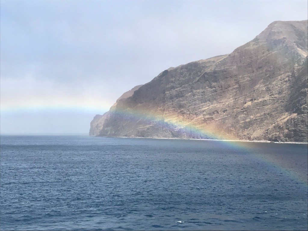
As we
prepared to leave, the island because shrouded in mist as if retreating into
fiction and a rainbow emerged to say goodbye.
Goodbye was, however, delayed because a large rock and the anchor had
become too intimate and it took awhile to separate them so we could
depart. (Our cruise director Heather
said in the announcement that it was not exactly what she anticipated when the
Captain said he had a large rock for her…)
This post and the following two posts were delayed by absence of internet. Sometimes it said we were connected, but it didn’t function or gave up in the middle of loading photos. I attributed the problems to being out in the middle of nowhere; Chris pointed out it’s a satellite dish; so I don’t know. But as of February 19 it’s finally up again.
We have new players at bridge from the contingent who embarked at Valpariso; most of these will disembark in Sydney, Australia. Michael discontinued the ‘advanced beginner’ class and promoted them to ‘intermediate’ as he does a ‘rank beginner’ class for new arrivals. Many of the folk who were attending the ‘advanced beginner’ and ‘intermediate’ classes moved also from playing ‘social’ bridge to duplicate. We, therefore, have more players in duplicate—back to 6-8 tables rather than 4-5. It means 2 boards to a round rather than 3 and the game is slower, both because people move more and because the new players are more tentative and slower. But the newly promoted seem to be enjoying duplicate and feeling less intimidated by the whole idea.
Train station tower, Customs tower, and between them the Navy headquarters & square
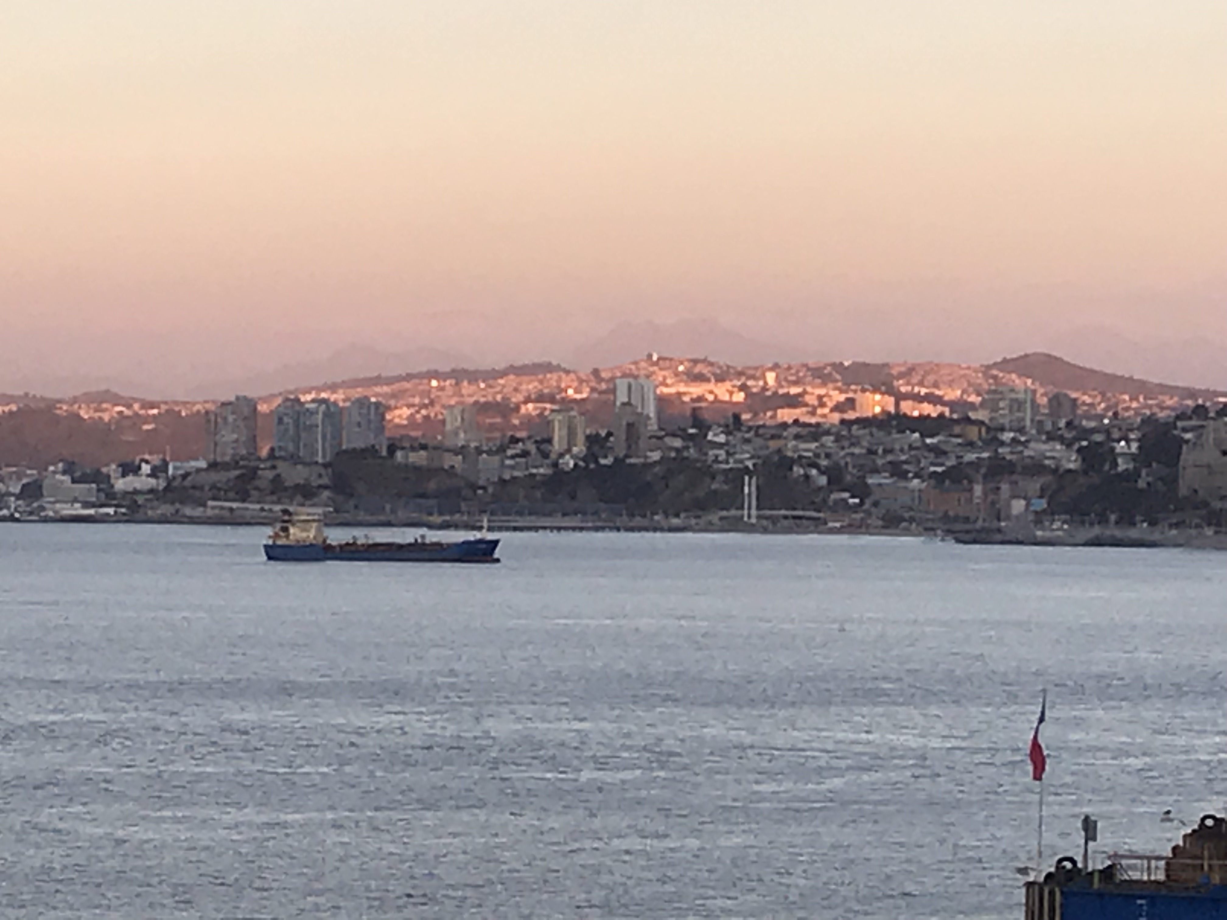
Valpariso from the ship
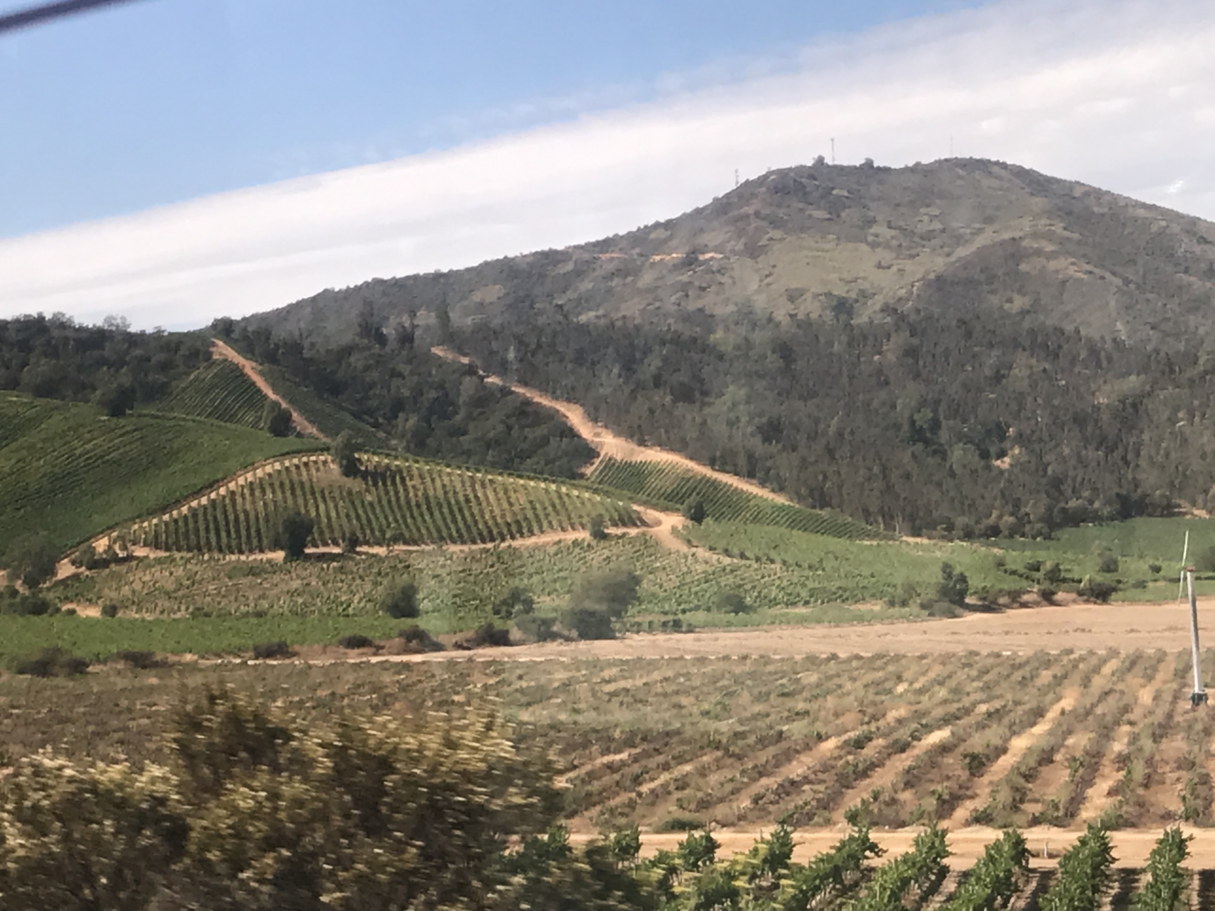
Wine country
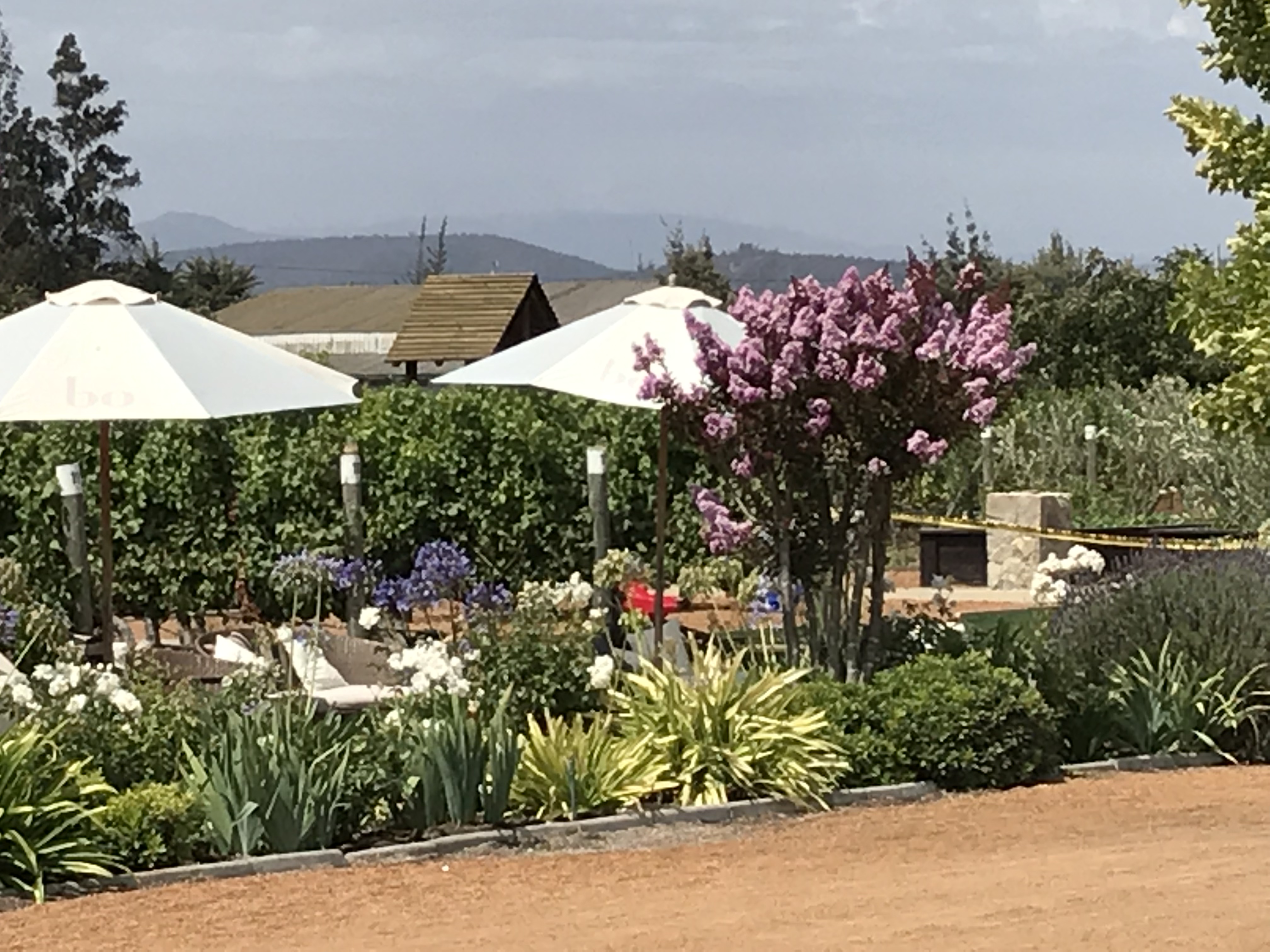
Arriving at the winery
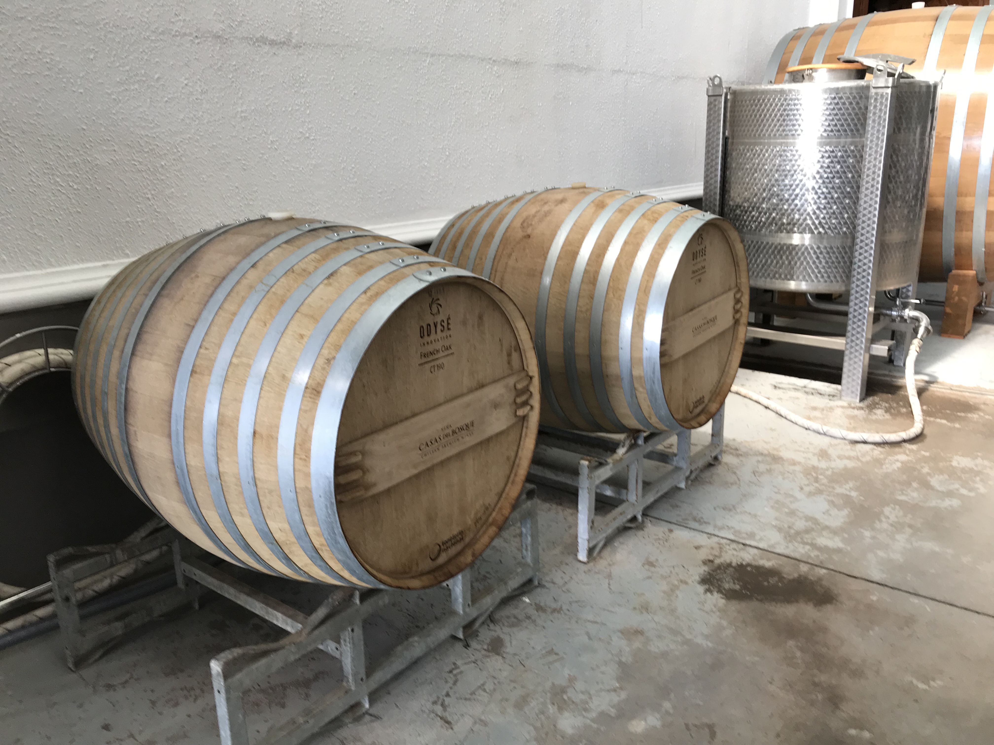
Wine barrels
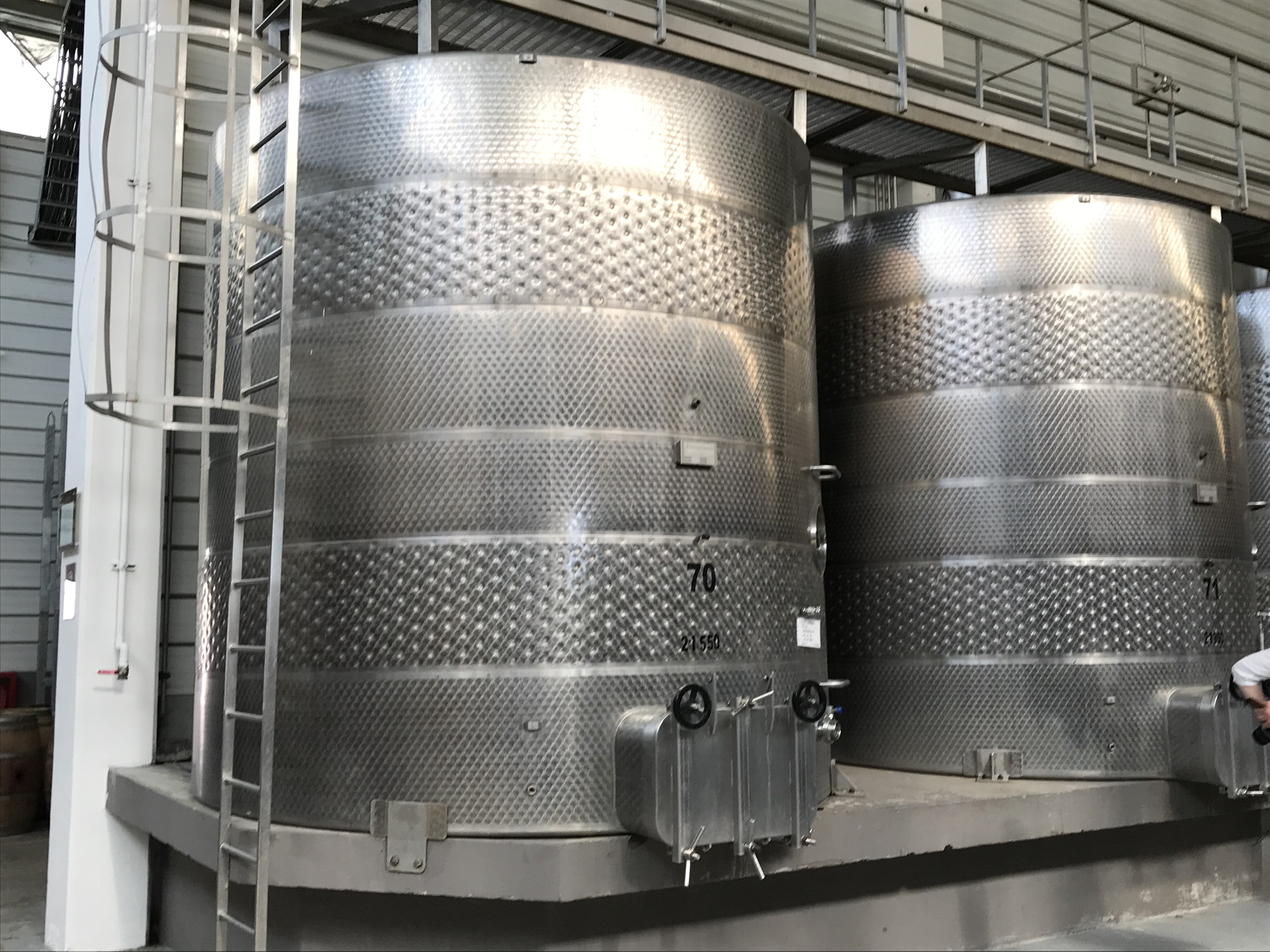
Wine storage units
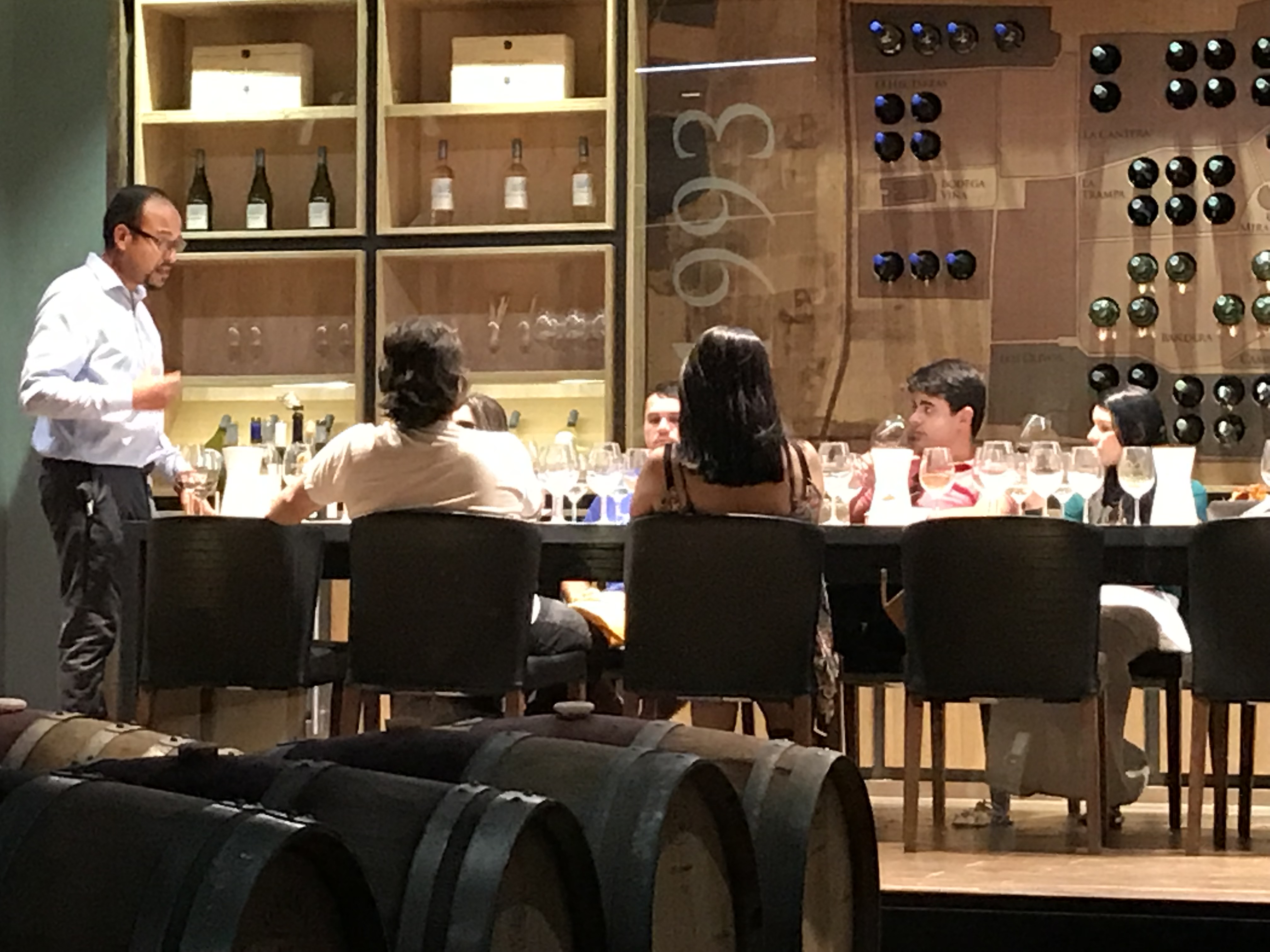
A wine lecture
Valpariso in the evening
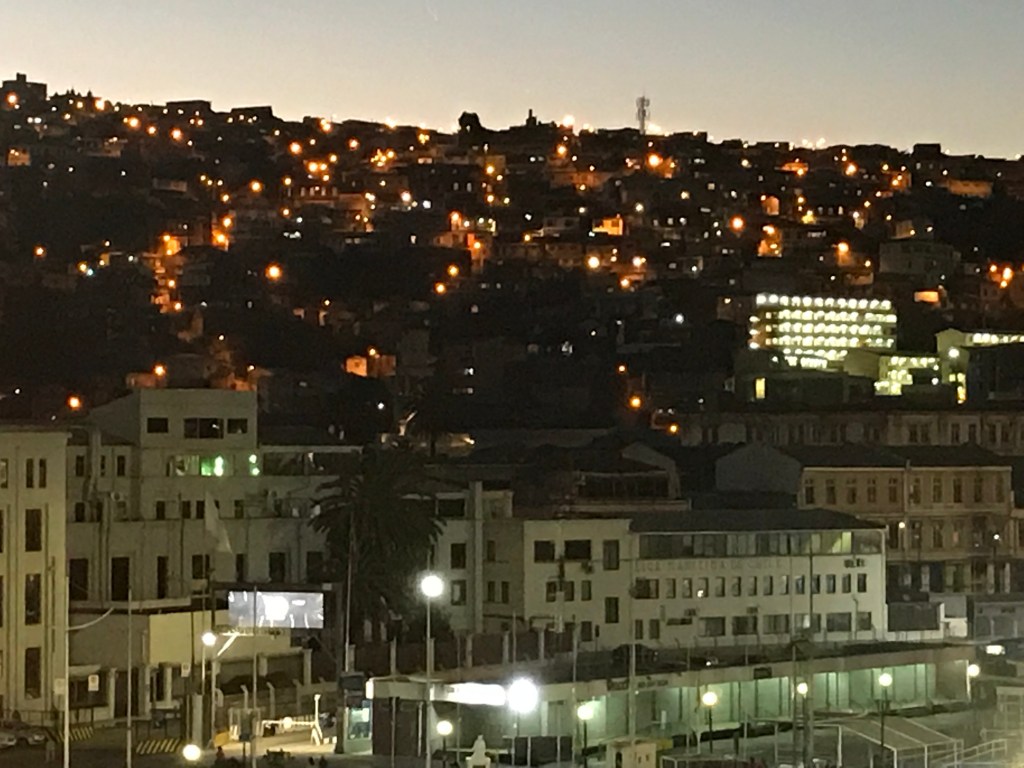
Valpariso at night
Moai outside the Fonck museum
Back to
the bustle of the big city for a two-day stay!
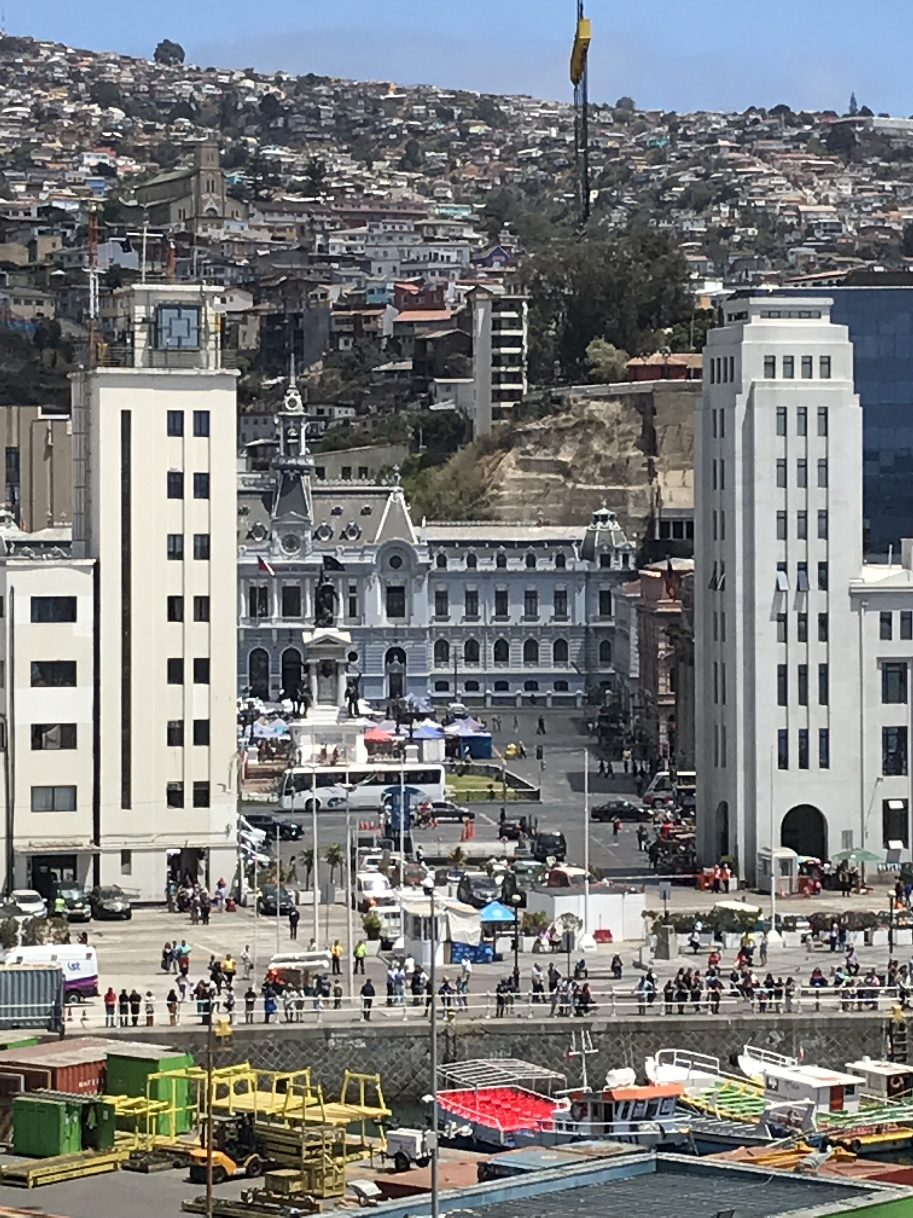
The pier is in the center of town, but you can’t walk there. A shuttle bus takes you from the ship to the
port terminal—quite a distance—and then you could walk. The port area looks like a construction zone;
there were plans for building a mall and whatever else, but the 6.9 mw
earthquake of the coast in 2017 and its ensuing tsunami—a first for Chile, they
say—caused them to rethink. Apparently
they haven’t yet finished rethinking.
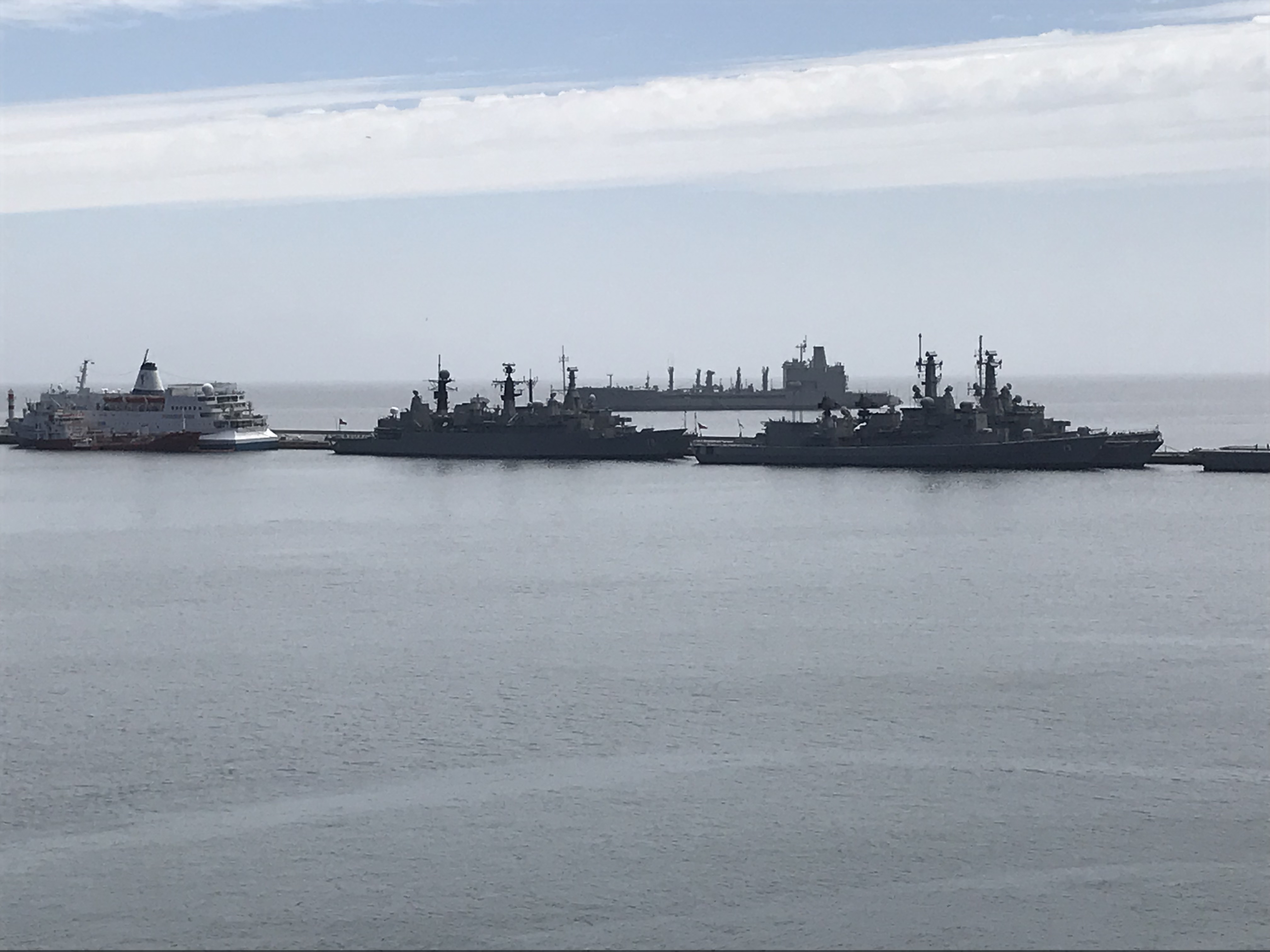
And look who our neighbors in port are! Valpariso is the birthplace and headquarters of the Chilean Navy and the Navy is much in evidence as you can see from the photos. It is a major port for Chile but was a major port for the world until the construction of the Panama Canal. Realizing the country needed a Navy, Chile brought in the British to develop it. Thus, they say, the Navy is still modeled on Britain in uniforms and organization while the Army is German in design.
We
visited the Casas del Bosque vineyard and winery about a 45 minute drive away and
had an interesting tour and some good wine as well as a look at the
countryside. The end of the excursion as
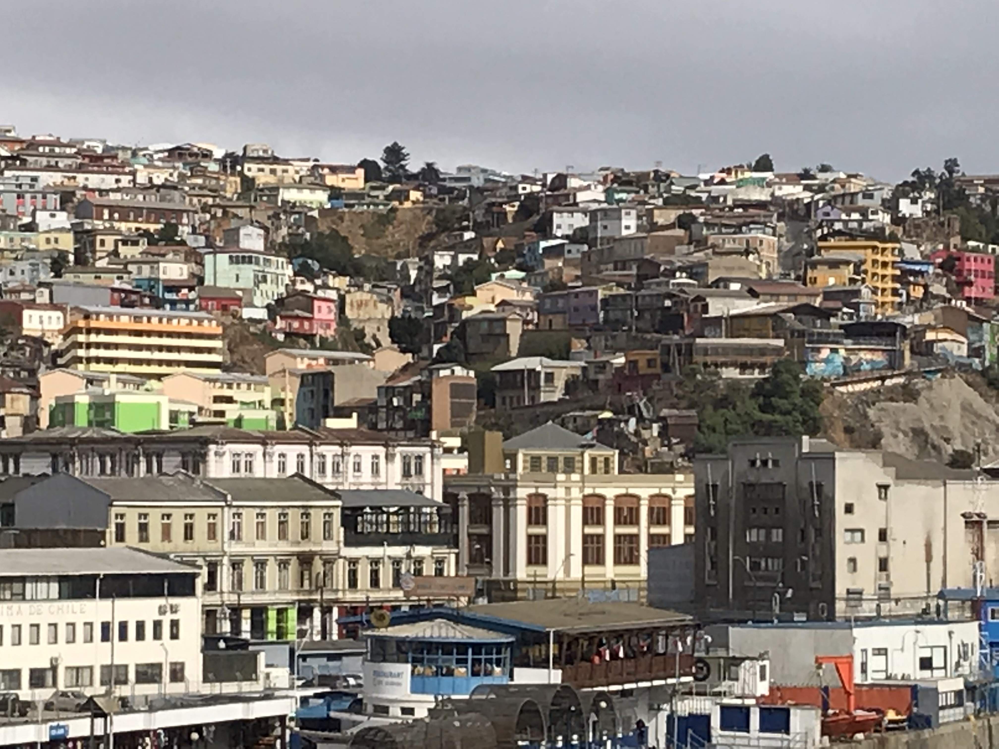
well as much of the following day’s excursion was bus tour around Valpariso and
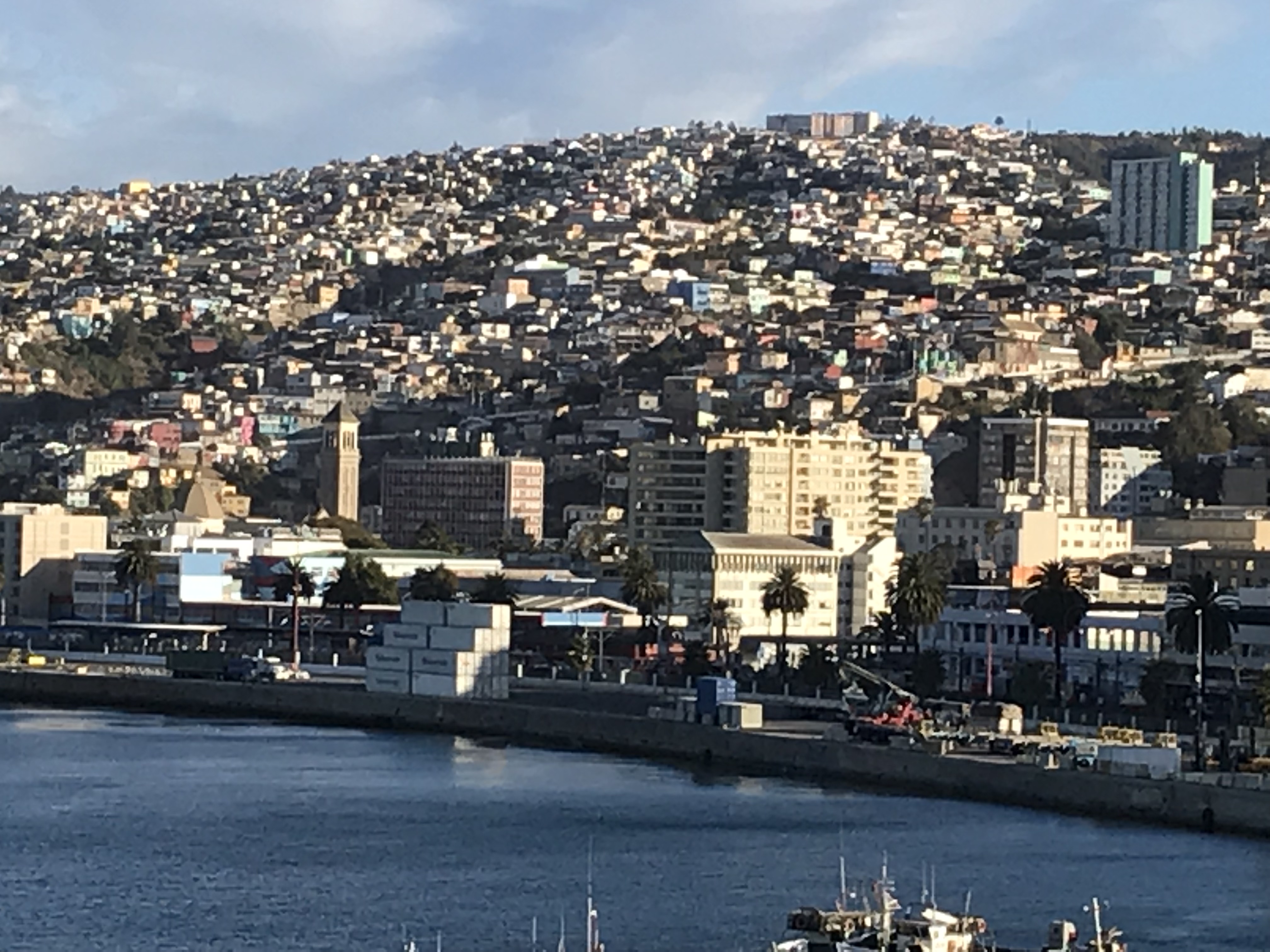
the adjacent Vina del Mar. Both are
built on several steep hills and the city has innumerable (well, I’m sure
someone has counted them) funiculars to aid in ascending and descending. The older houses were built close together
higglety-pigglety (that’s a technical term…) on the hills and their ravines
and, in some cases, are not accessible by roads. We wandered around the narrow roads on the
hills in the care of an amazing bus driver and had some lovely views of the
lower city and ocean.
The
second day’s excursion also included a visit to the Fonck Museum with exhibits
on the local Mapuche Indians and Easter Island—in preparation for our visit in
a few days, which was very useful.
Valpariso was an important world port until the Panama Canal was completed. Now, though still an important Chilean port, the economy has suffered. In the mid 1800s lots of people were migrating from Europe to the Americas. Almost all of my ancestors arrived around 1850 (except the Scotsman who came 75 years earlier to fight in the British army and on discharge was granted land in Nova Scotia.) Most of Chile’s immigrants were from Britain and Germany. Their hero, who led the fight for independence from Spain (achieved in 1810), was Bernardo O’Higgins; his Irish father arrived in the 1700s and married a Chilean woman. It’s initially startling to see streets, squares, etc. named ‘O’Higgins.’
In Valpariso the second leg of our world cruise ends; most of the folk who boarded in Buenos Aires disembark along with many of the people we’ve known since Miami. Two of five ‘legs’ finished but only a third of the cruise. The later ‘legs’ are longer–probably a similar number of ports but more sea days.
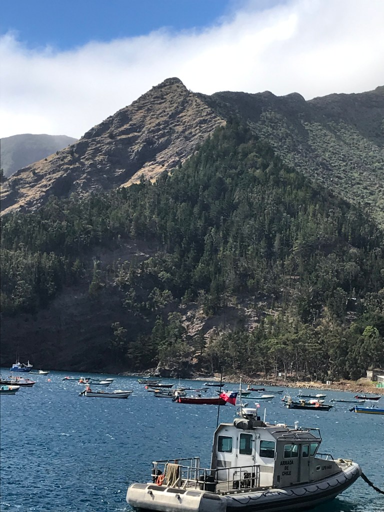
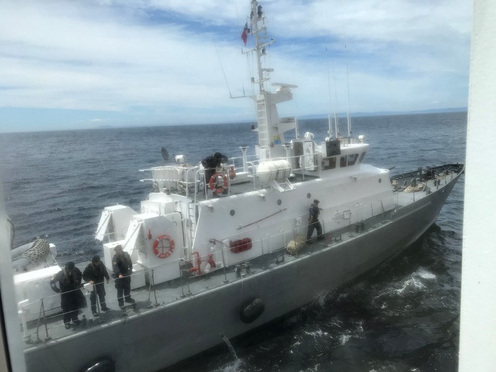
We had our first introduction to the Chilean Navy when a Navy ship approached us and was met by one of our tenders. Watching from the bridge room, we found it a little startling and speculated about what it meant. We’ve heard since that someone fell, hit their head, and was transported by the Navy ship to the hospital. We have had our share of medical problems on board—so much so that the doctor said he hadn’t worked such hours since he was a resident. Someone left the ship in an ambulance a few days ago when we were in Chacobuco (a heart attack I believe) and several people are down with flu—we blame the folk who boarded in Buenos Aires. There is even more stress on washing hands. The doctor ends his stint in Valpariso so then we get a ‘fresh’ doctor. So far we are healthy and many with flu have recovered.
Puerto
Mott and the surrounding area were settled in the 1860s by German immigrants,
who were actively solicited by the Chilean government. They were, our guide said, selected from
applicants and were required to have a background in agriculture, be married,
and be Catholic. One story is some
Lutheran families snuck in by pretending to be Catholics; another is the man
sent to recruit families couldn’t find enough Catholics interested in moving so
he included Lutherans and was promptly sacked on his return. Either way, there is a Lutheran population
and churches. The government gave in and
let them stay but required all Lutheran church services to be in German in
order that they not be attractive to any members of the native Catholic
population. The area is the major
farming area of the country and known as the lake region.
We had
an excellent guide, an elementary school teacher who gave us much historical
and cultural information on our bus ride to a nearby town of Puerto Varas on
the shores of a huge glacial lake,—we were told it took 5 hours to drive
around. Across the lake are snow-covered
volcanic peaks that were beautiful in the photos displayed during our port
talk. However, it was raining and you
couldn’t see them at all in the rain.
Our guide said the weather is either raining or planning to rain most of
the time. We did visit a local craft
shop (a lot of woolens including alpaca) and jewelry store (lapis lazuli is the
big local stone.)
Others
made more adventurous excursions to other lakes and waterfalls (including a
boat ride in one), to a traditional German heritage ranch, and to a volcano to
hike partway up. Still others went
horseback riding or river rafting.
Puerto
Mott brings us close to the northern end of the Chilean fjords.
As we sailed out about 6 pm, the sun appeared. We sailed between islands but rather than mountain sides disappearing seamlessly into
the ocean, they were low lying, possibly with fields and farmlands, but raised
from the sea by low cliffs.
We had dinner at Manfredi’s, the specialty Italian restaurant, a bittersweet experience because Andri, the waiter we have become very fond of (and, seemingly, he of us leaves the ship in three days to return home to Bali to his wife and three sons (until he returns to the Viking Sun in August for the 250 day world cruise!!) Andri is in Manfredi’s at dinner and always takes care of us even when we are not seated in his area. Breakfast and lunch he is in the World Café, always sees Chris enter and helps him get food and take it to our table. He continues to keep an eye out and appears at our table to tend to our every need. We will miss him!
Another staff member who has been helpful on excursions and is disembarking in three days at Valpariso is our assistant cruise director Brian Rodriguez. He is also a tenor and had a farewell show tonight so we went—one of the very few evening shows we’ve been to. Turns out he has a fantastic voice with a wide range. Although there seen to be a lot of people with the same name doing music, you can find some clips on Youtube if you search Brian Rodriguez Viking music. He is very short and slight—he told us during the performance that he is actually 5’ 3 1/2” and that ½ inch is important to get him into some rides at Disney World—and comes from a city in northern Cuba known as Miami, Florida. Cruise directors have to have a sense of humor…