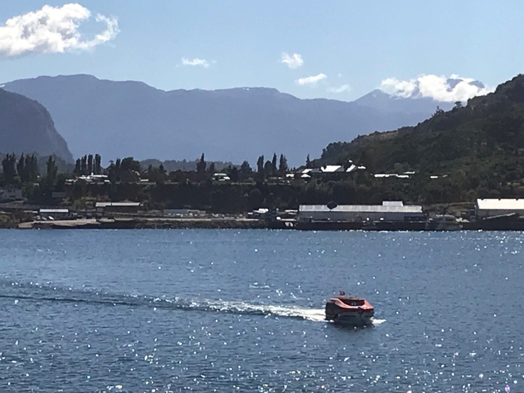
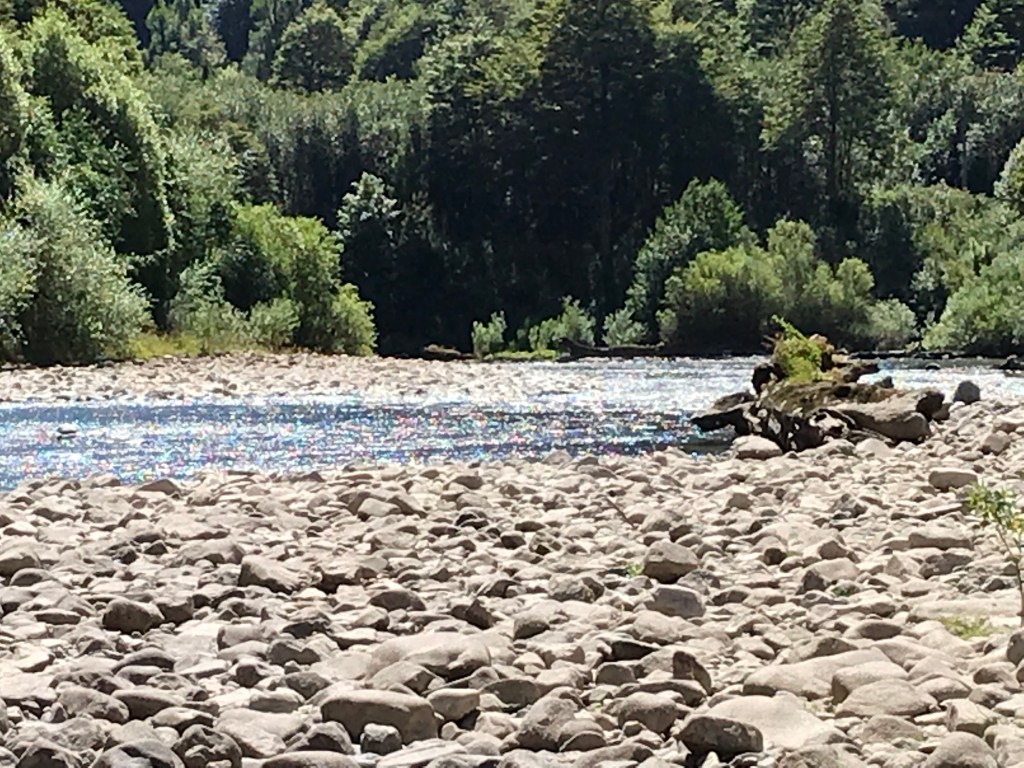
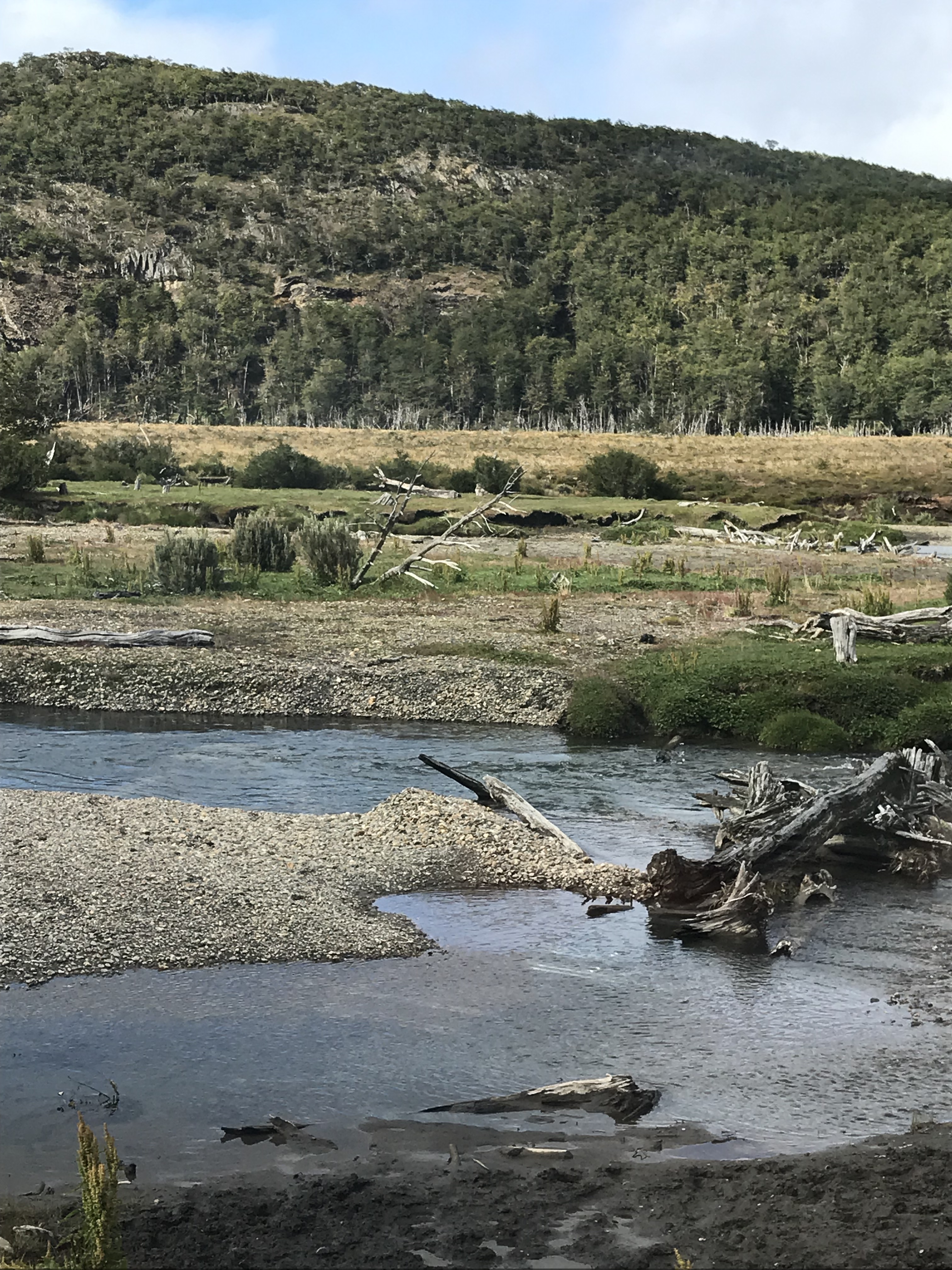
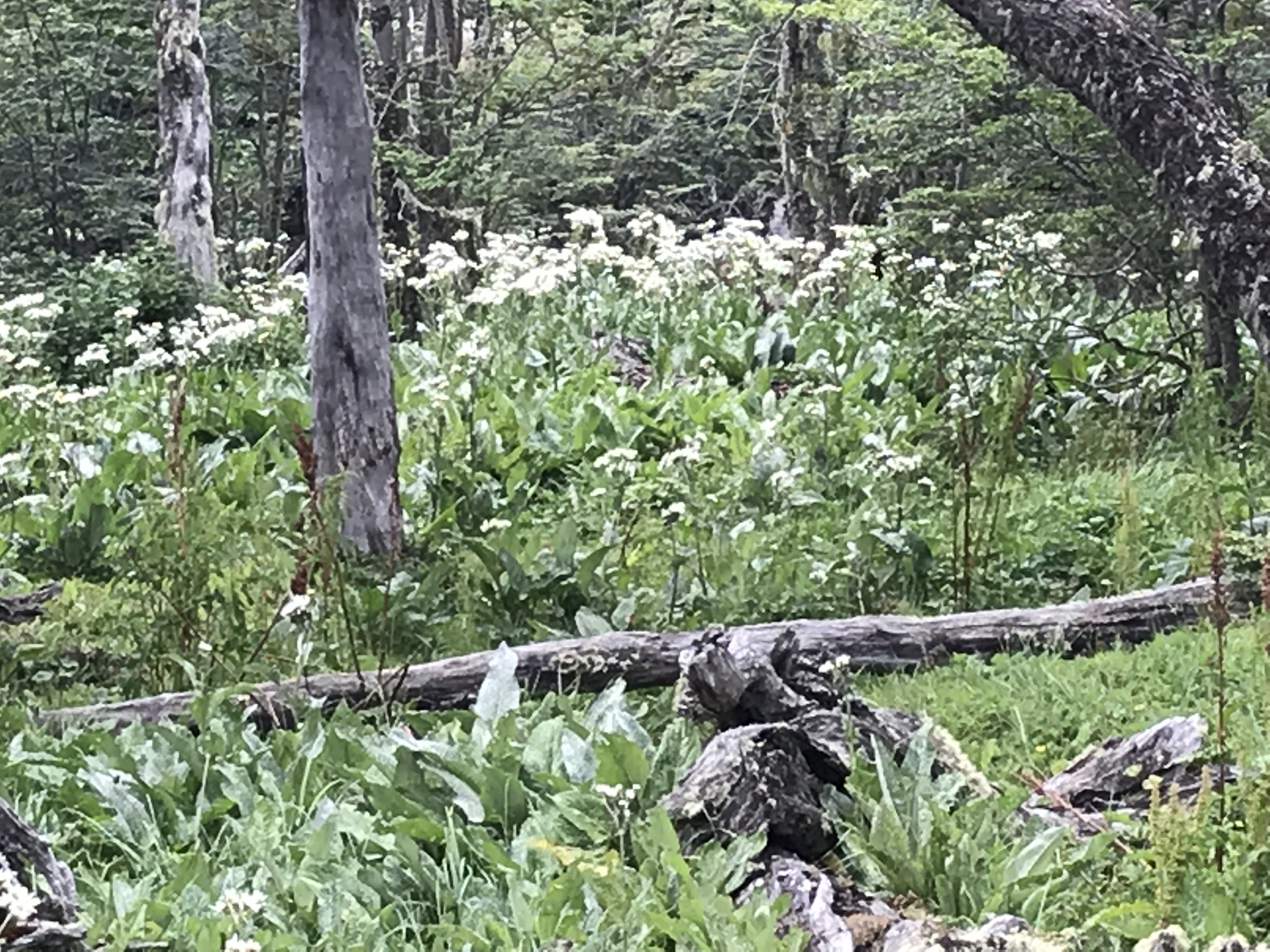
Puerto Chacabuco is a small town of @2000 residents whose main occupation is salmon farming so there are several salmon farms relatively close by. At the top of a fjord, it has a stunning setting and involved tendering ashore. Excursions included fly fishing, horseback riding, and kayaking; we took a bus tour through the broad valley where cattle and sheep grazed to a natural preserve with a small museum where we walked along the Simpson River where some of our fellow guests fished. –Cynthia
The Captain’s Noontime Report. “Good Af..ter…noon, L..a…dies and Gentlemen!” begins the
Captain every noon we’re at sea, speaking with a gravelly Scandinavian (Norwegian?)
accent. “This is the…Captain speaking from the…navigational bridge.” What follows then is his litany of maritime
data: our latitude and longitude, in degrees and minutes; the barometric
pressure in millibars; the air and sea (and swimming pool) temperatures, first
in Centigrade and then in Fahrenheit degrees; the distance we’ve traveled since
leaving our last port, in both nautical and statute miles; the distance to our
next port, again in the same distance units, and our estimated time of arrival;
our current speed in knots, usually 17 or if the seas are rough or visibility
is reduced, 12 or lower. I may have left
out some of the details, but the script never varies; the blanks just get
filled in. Cut and Dried!
What is neither expected nor cut and dried,
even after six weeks at sea, is the Captain’s final sentence in every noon time
talk. “Take good care of each
other!”
And you know, I think we do; and certainly try to! The passengers seem remarkably pleasant, courteous and helpful…an Australian and fellow bridge player never fails to appear at my elbow, or so it seems, with the steadfastness of a tank, as I teeter down a passageway trying my best to gauge the swells and rolls. —Chris
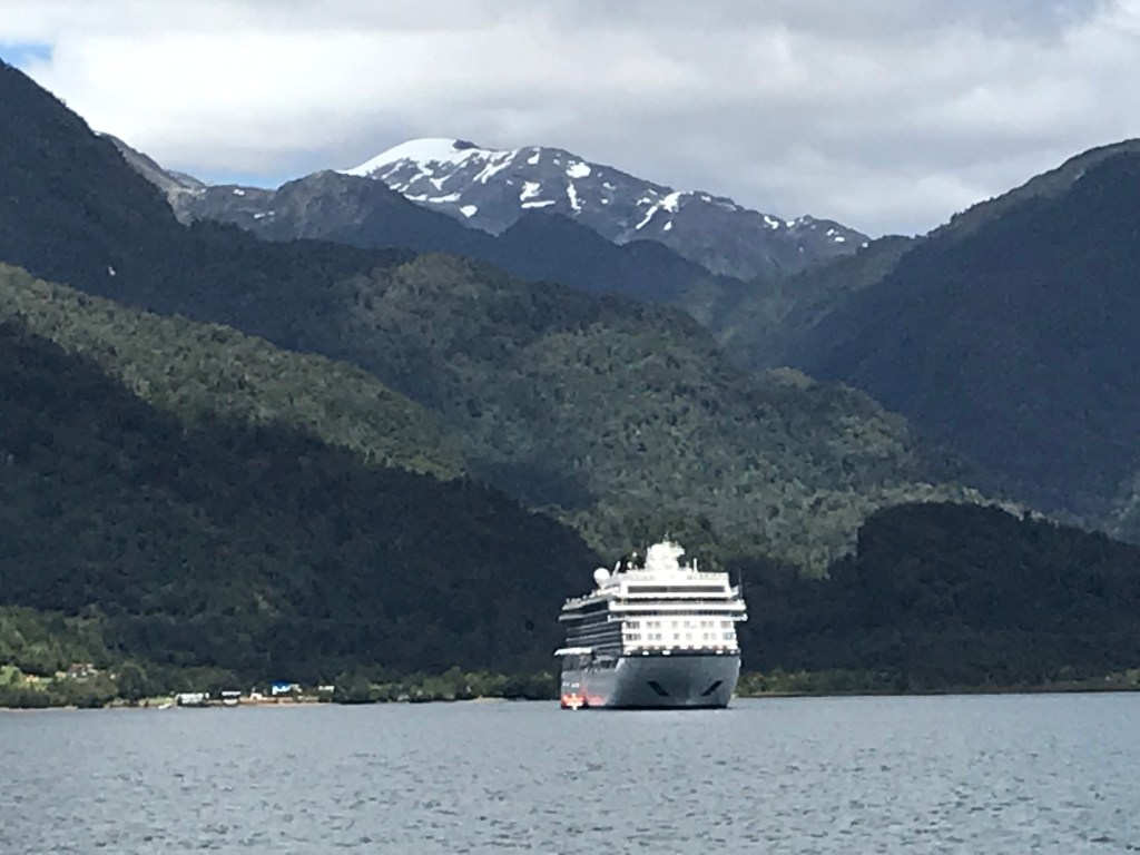
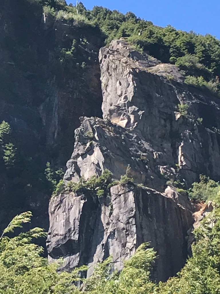
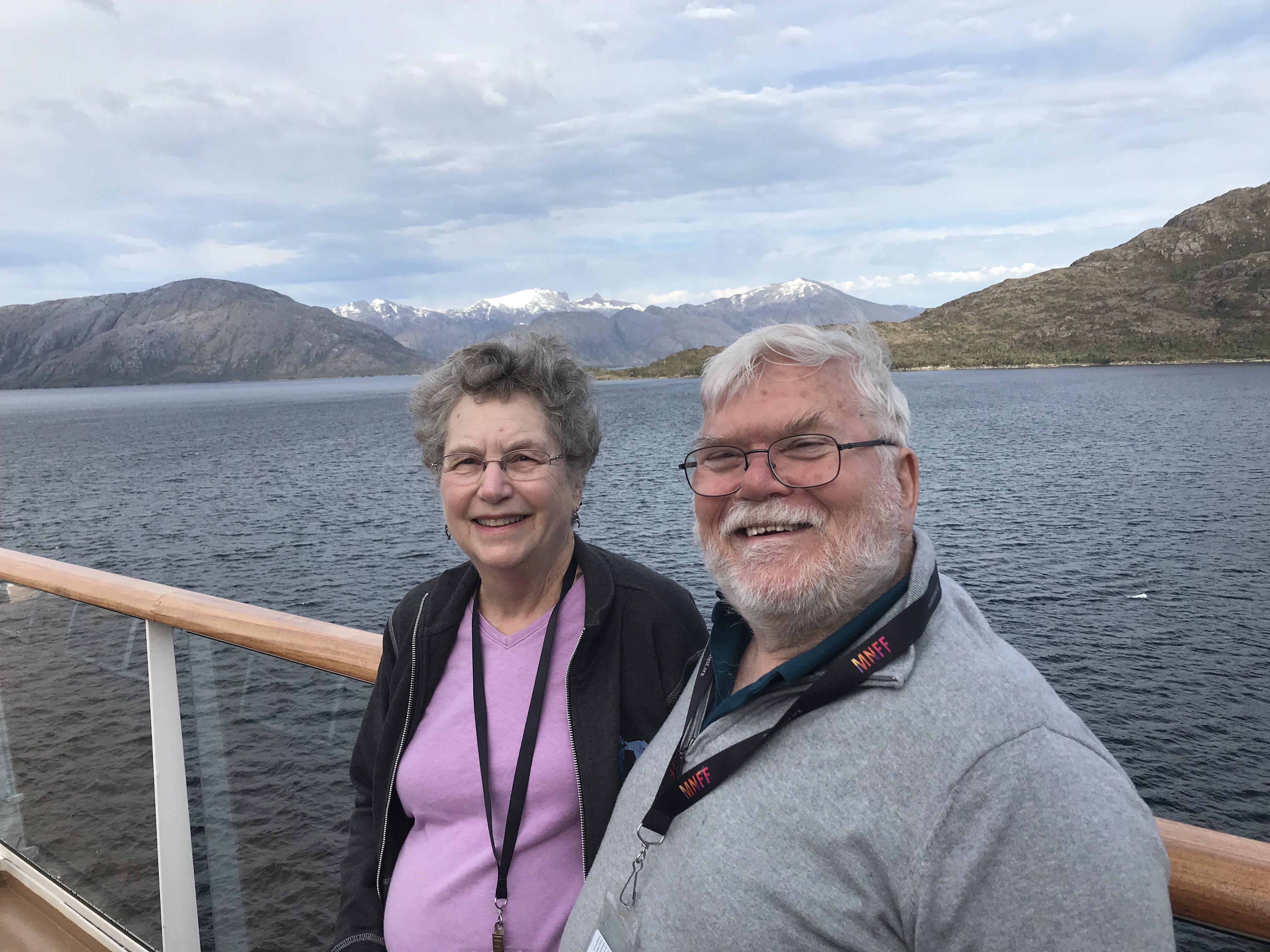
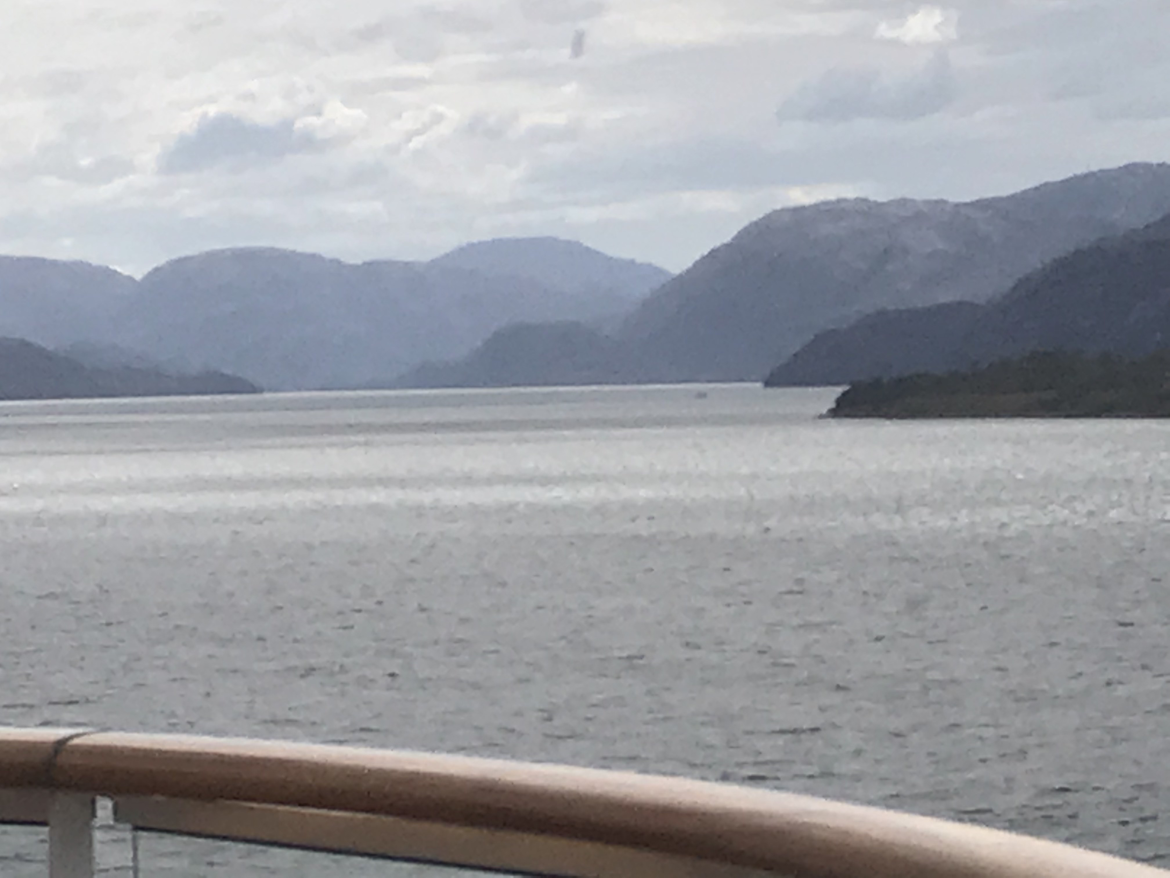
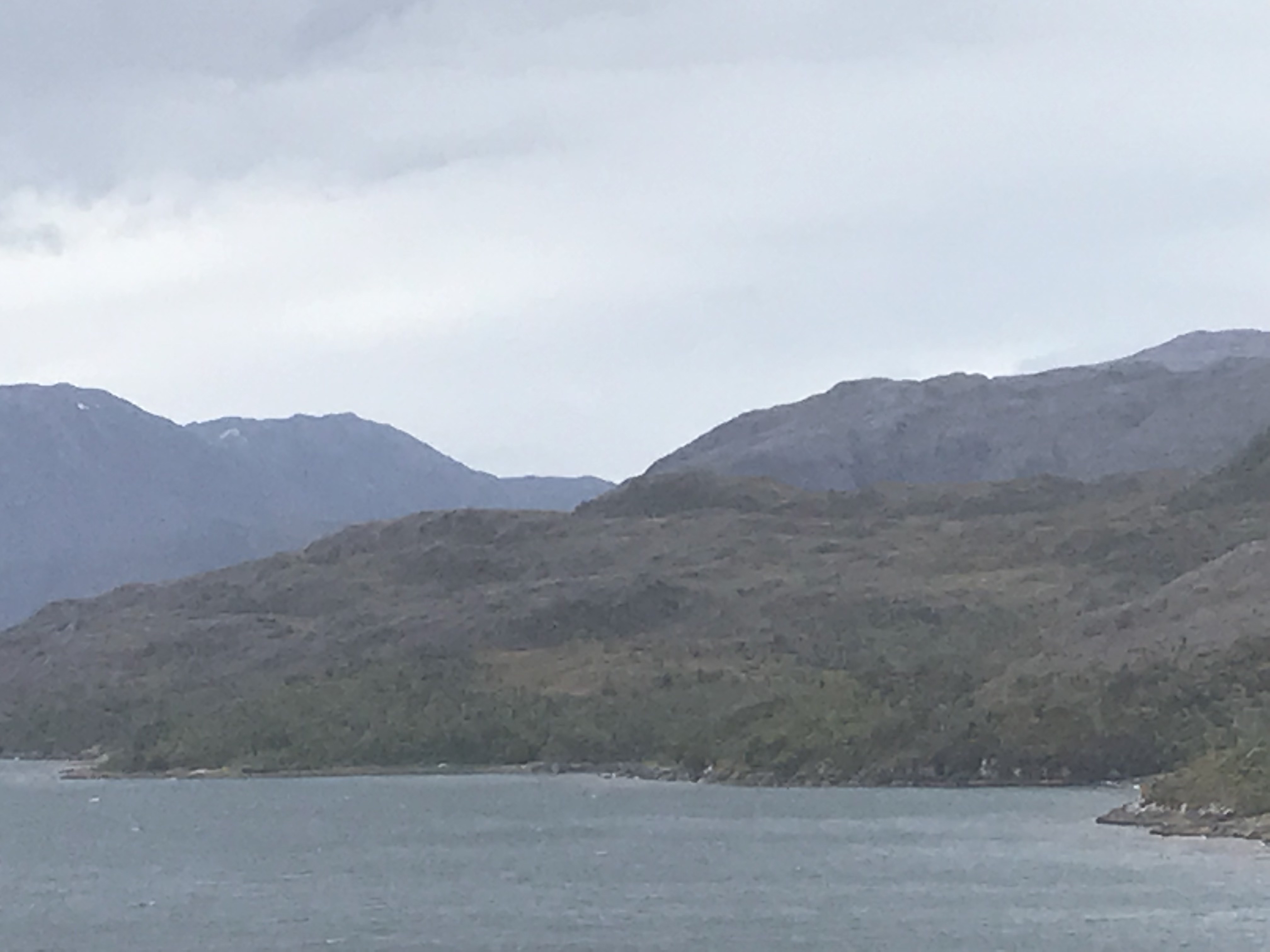
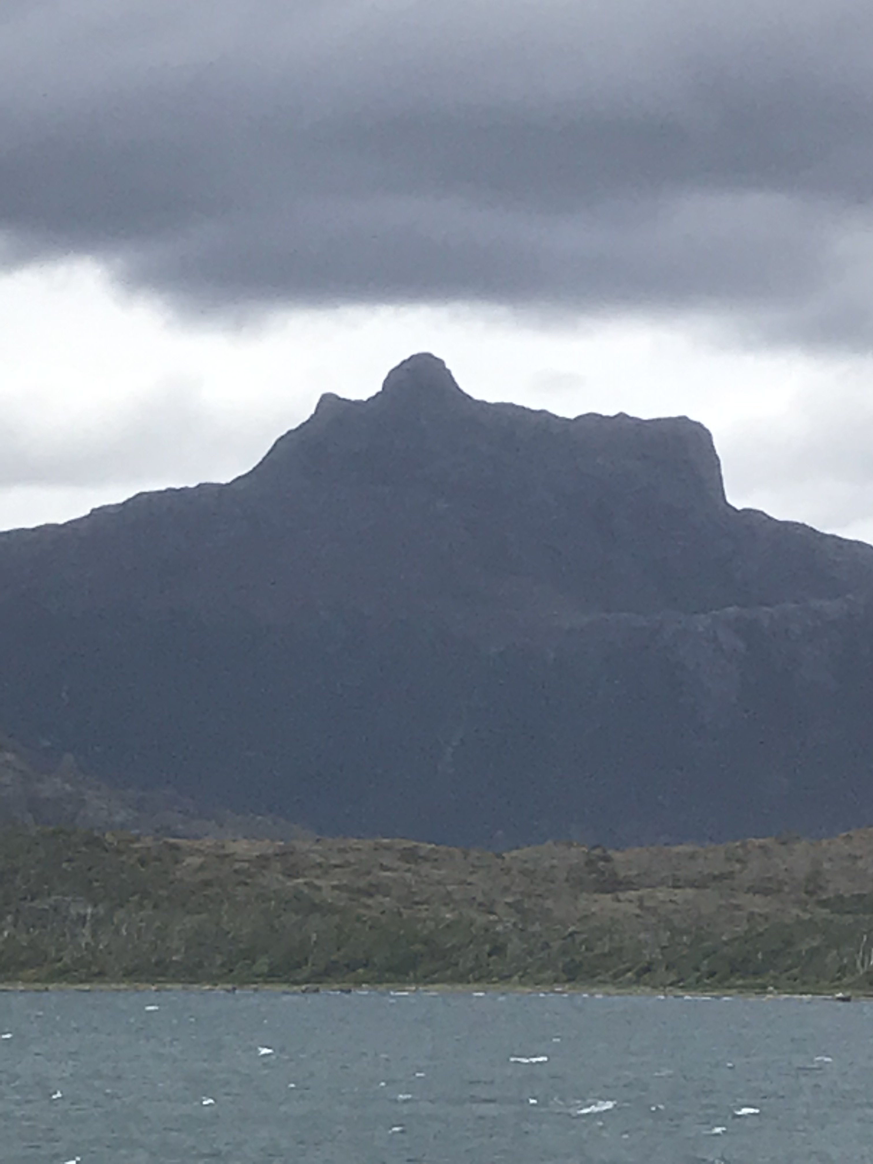
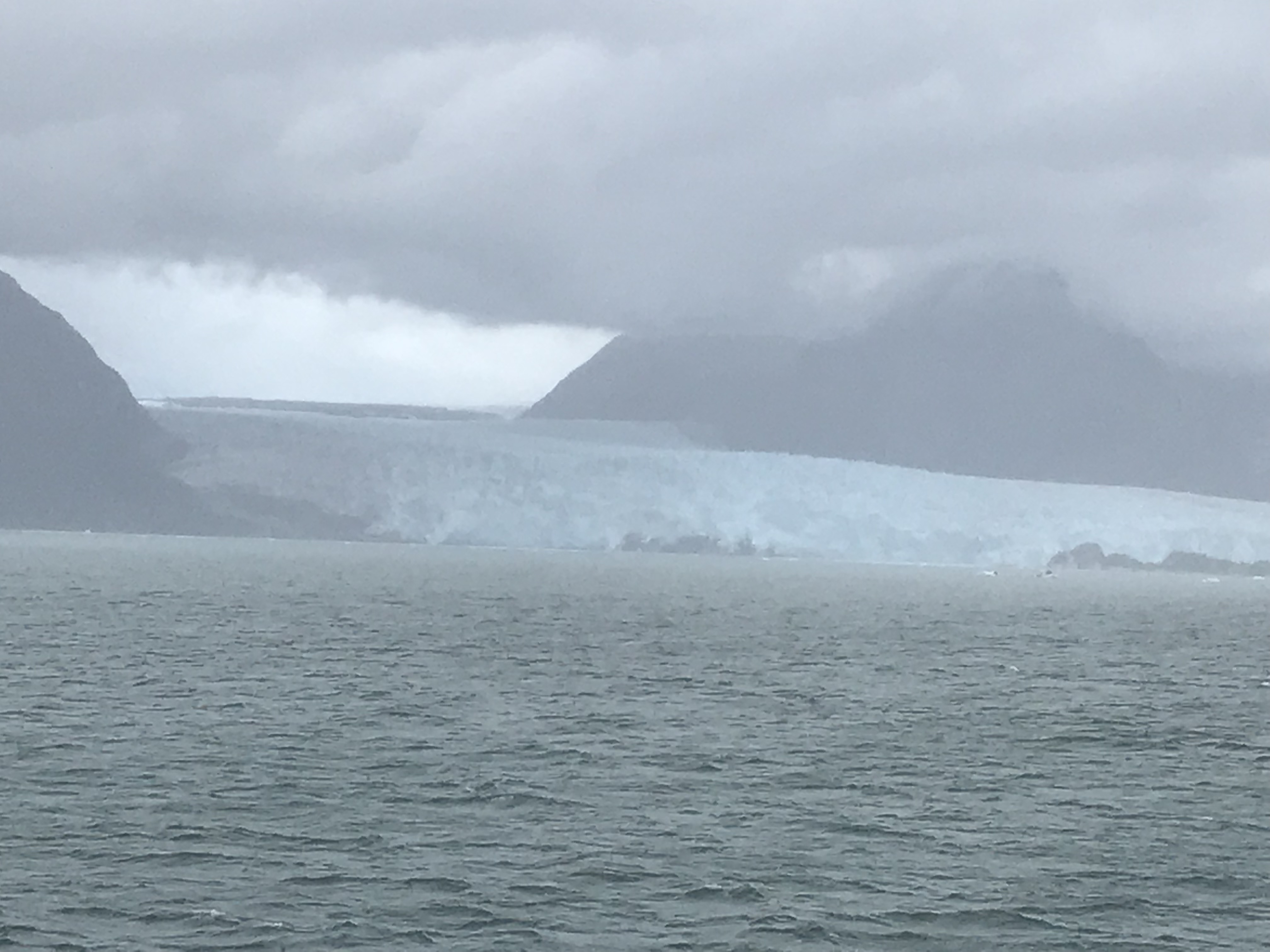
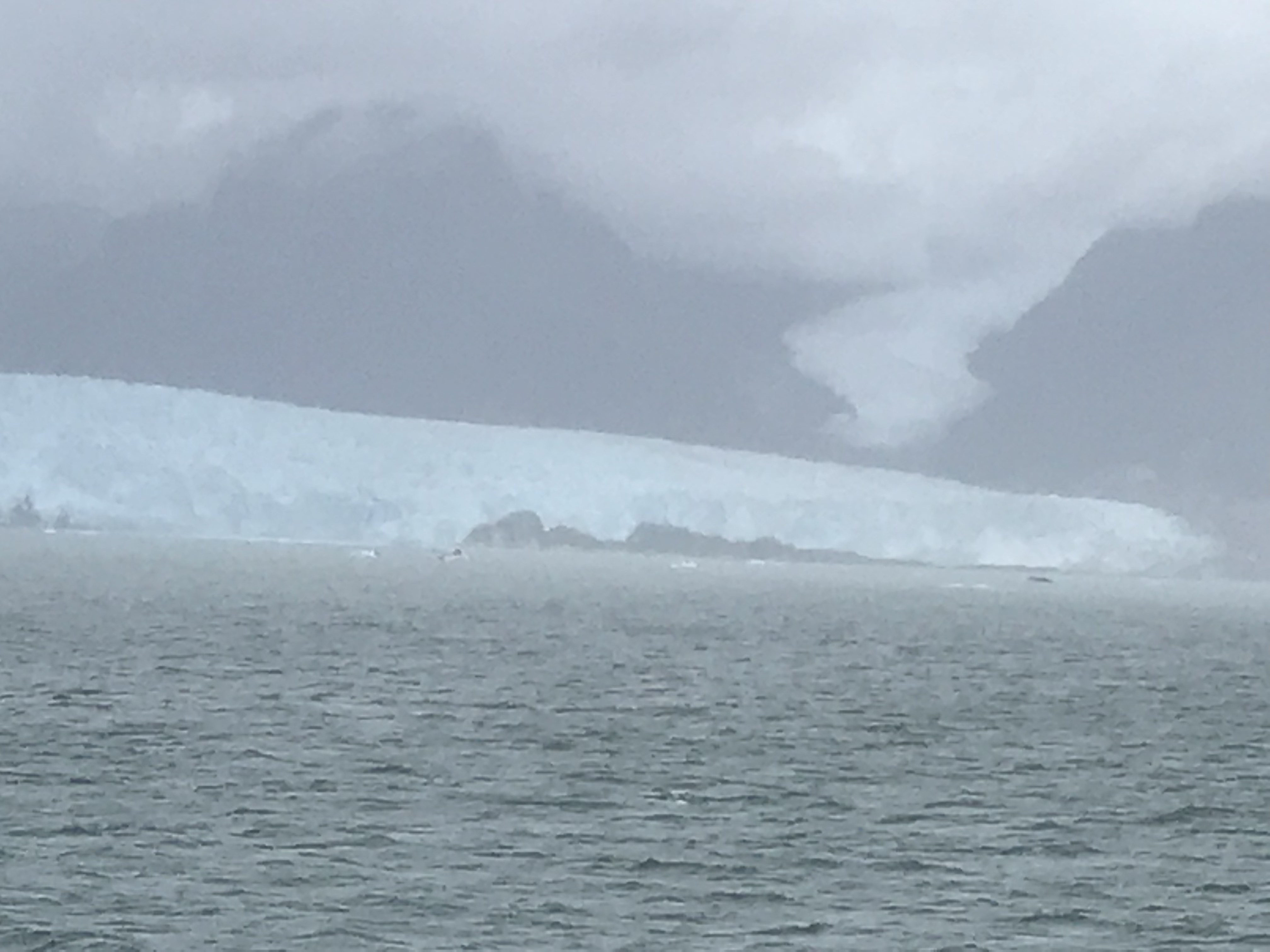
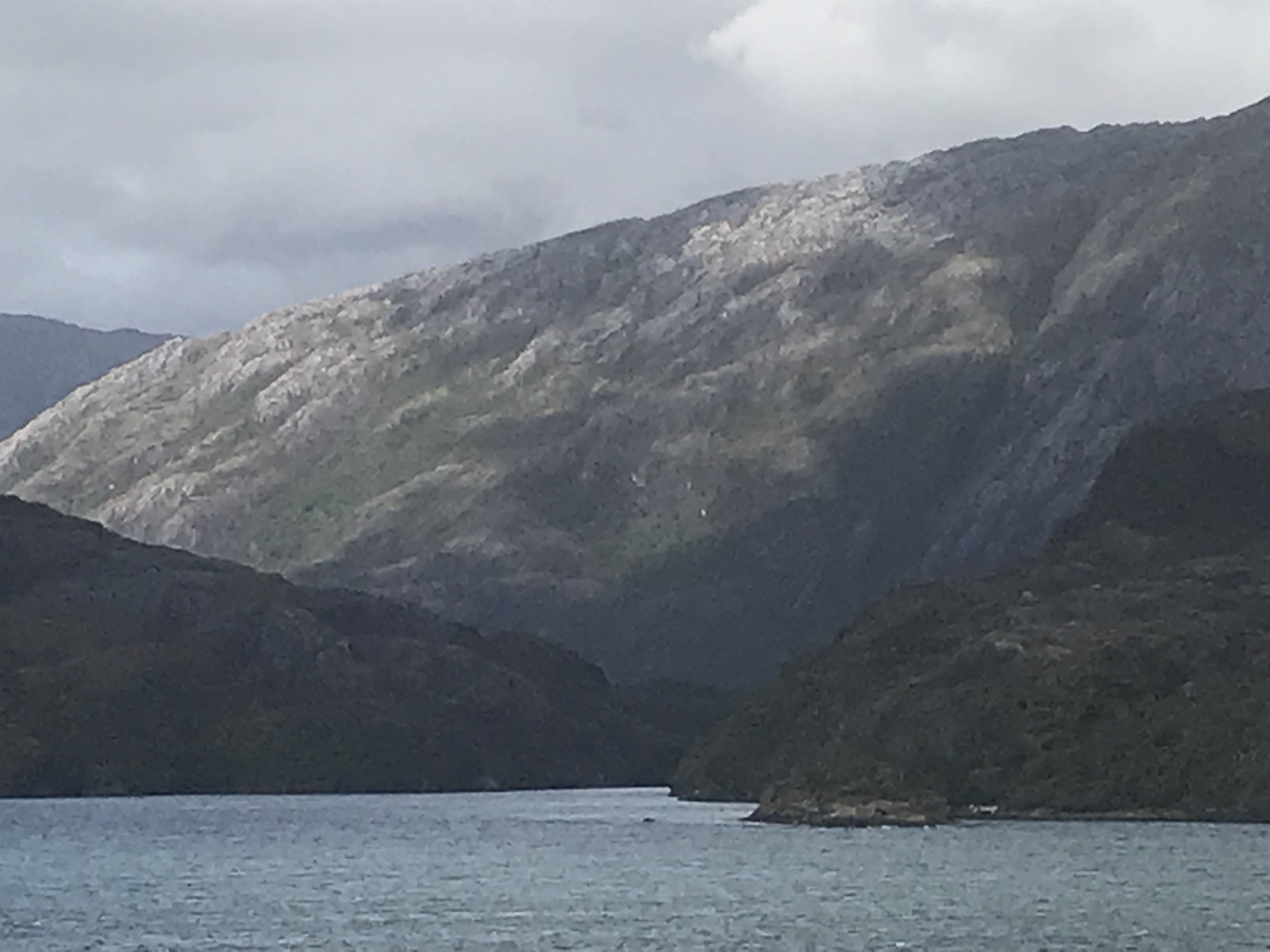
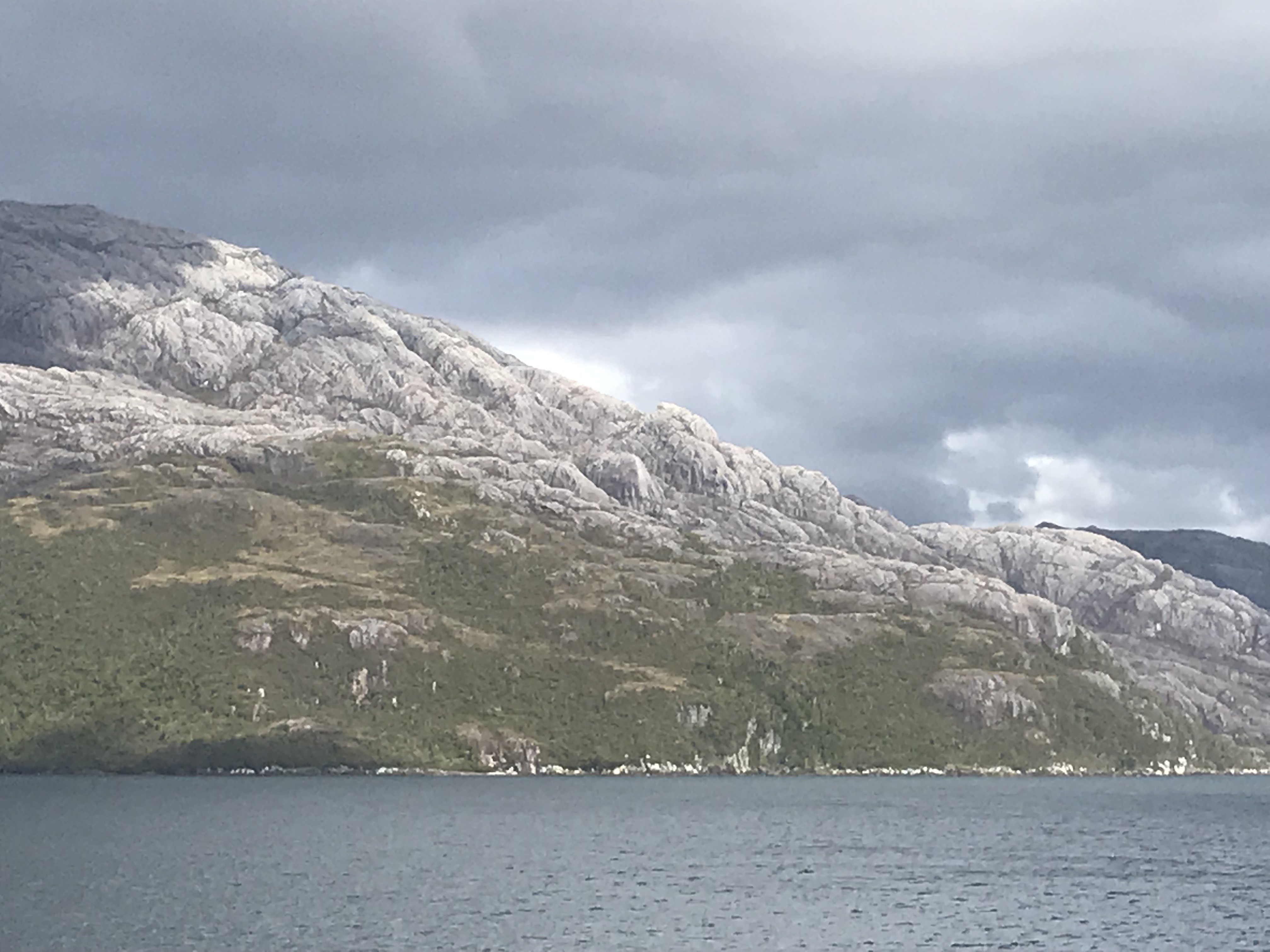
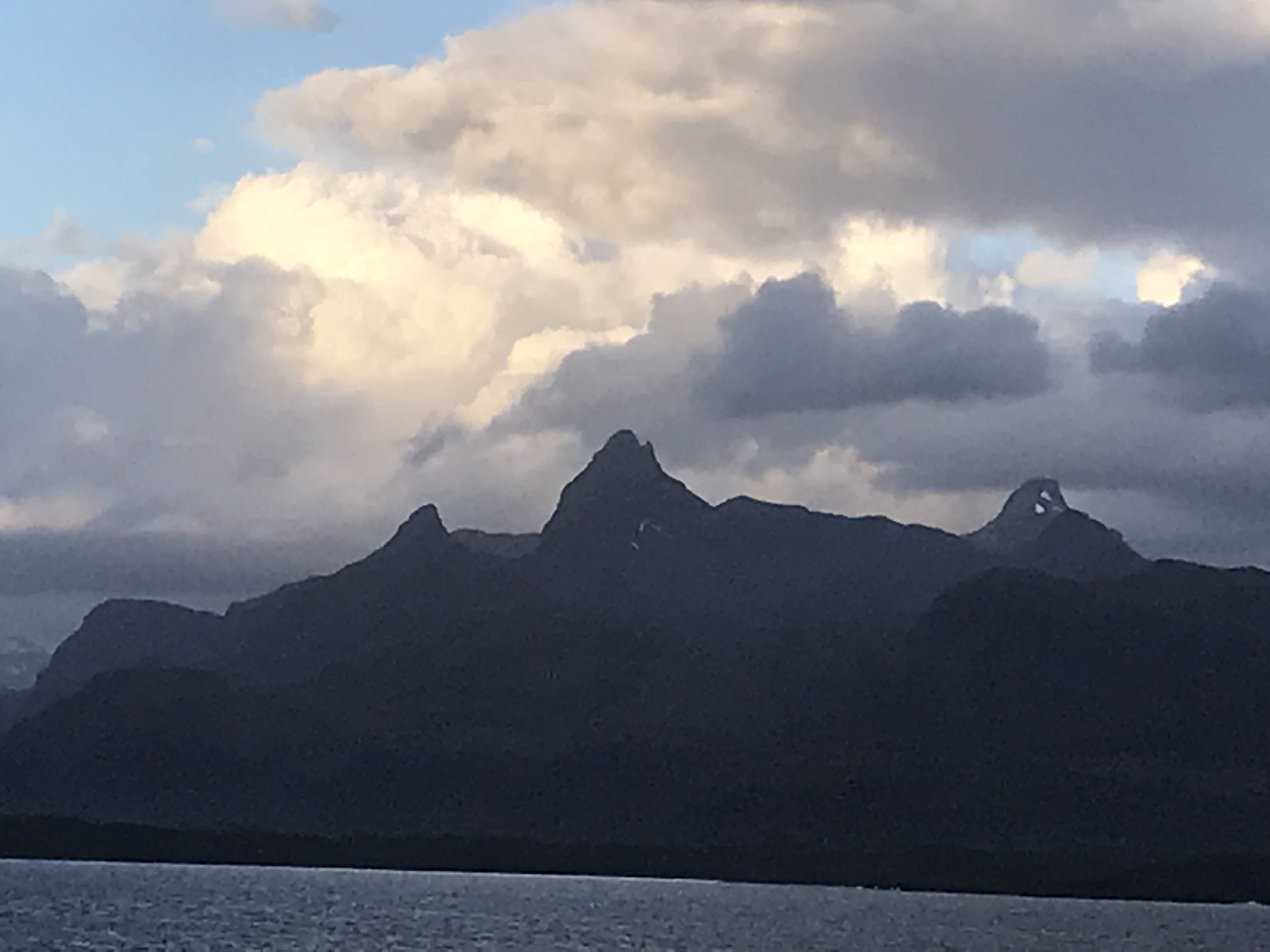
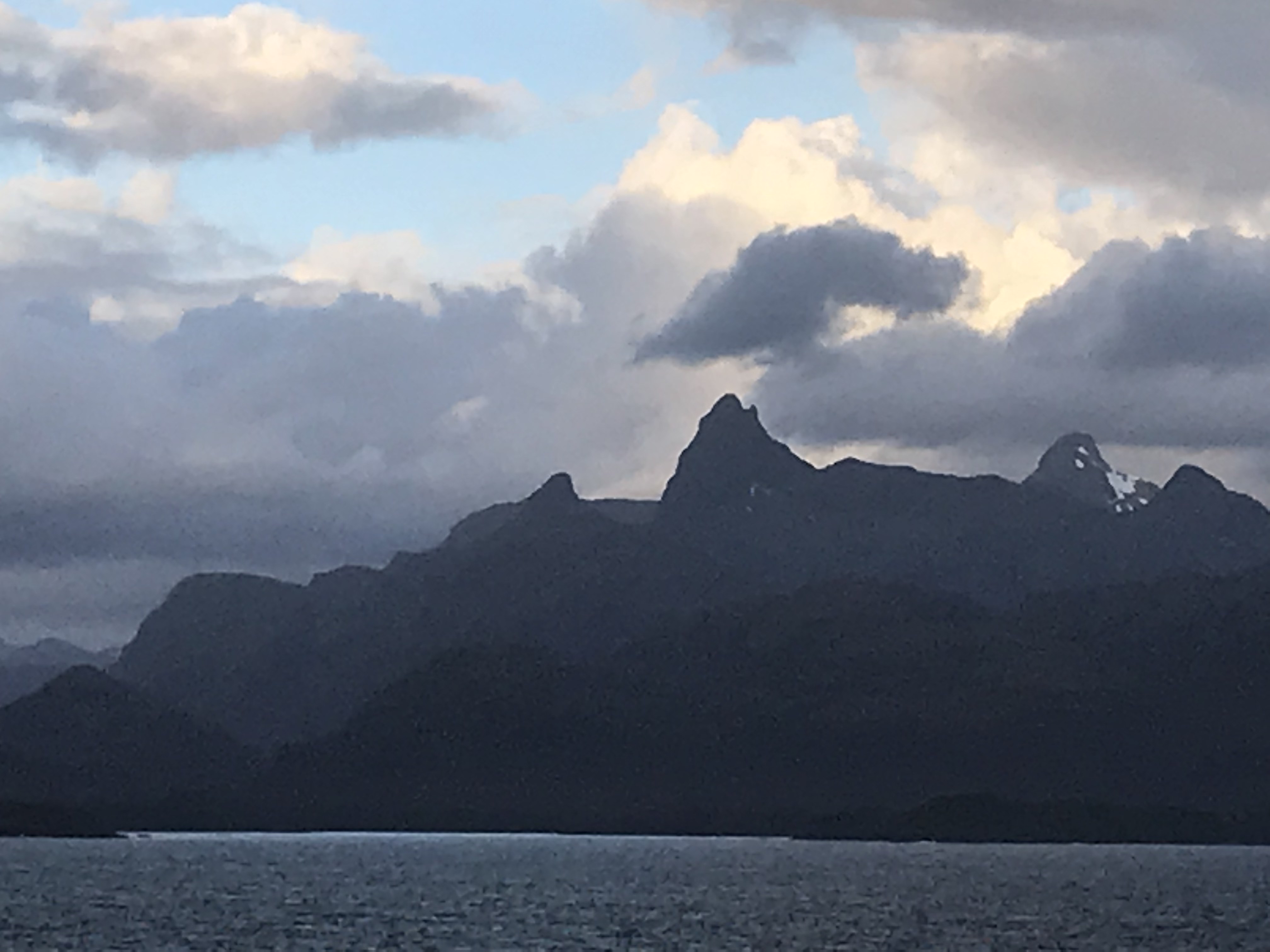
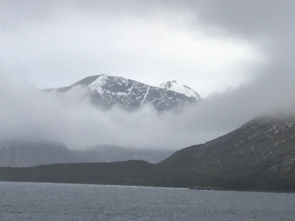
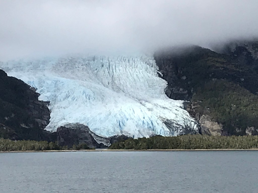
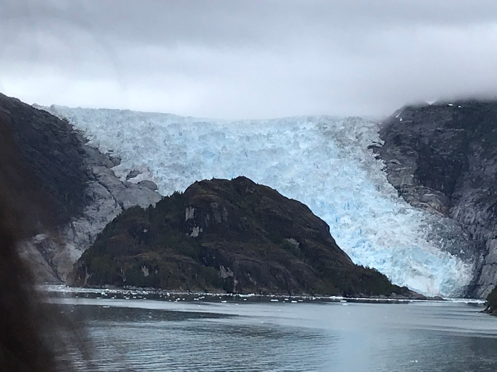
I am attaching a whole bunch of photos of mountain and glaciers as seen from the ship… I could spend an entire cruise sailing these fjords! They are gorgeous. It is a joke many places to say ‘If you don’t like the weather, wait an hour,’ but here it is literally true. We have gone from brilliant sunlight to socked-in fog and back a dizzying number of times in a day. We suspended bridge this afternoon because we were approaching a ‘gynormous’ glacier and rushed outside to take pictures. Unfortunately, we transitioned quickly while passing the glacier from mostly cloudy to socked-in fog so photos don’t do it justice, but I will post some anyway. Actually none of my pictures do the scenery justice, but I still take them. We spent our days sitting and the window reading and looking at the scenery along with some bridge (by a window) and eating (outside or by a window).
At night on the 5th we were back in the Pacific—more waves to rock us to sleep—and back in the fjords in the morning. By noon again back in the Pacific—of necessity–we’ll return to the fjords later tonight. The sea is much rougher; the Captain says 8-12 foot waves (‘rough sea’) so we’re rolling around a bit as we walk, grabbing for railings along the corridors. The port talk on Puerto Chacobucca, where we will spend tomorrow, promised more gorgeous scenery. –Cynthia
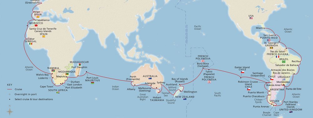
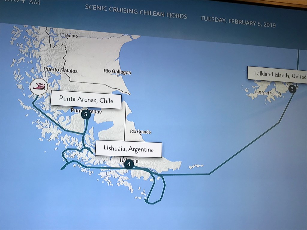
The beautiful but circuitous route since the Falklands
The Patagonian Archipelago. There are 3 basic ways around the southern part of South
America: the northernmost route follows a somewhat erratic path along the
Magellan Strait; a shorter, more direct passage along the Beagle Channel; and
finally, more simply “rounding the Horn”!
Given the manner in which the continent is broken up especially along
its western and southern regions, the northern two routes have numerous variants.
Leaving Port Stanley in the Falkland
Islands, the Viking Sun traveled to Ushuaia (“U shu ai a”), Argentina, the
major port in the Beagle Channel and jumping-off point for many scientific and
tourist cruises to Antarctica (1000 km away). The Sun then retraced its steps eastwards
in the Channel and subsequently south to Hornus, which is located in Drakes
Passage. Hornus is the point where the
Pacific and Atlantic oceans meet (and according to most accounts, usually collide
with much turbulence and high waves) and is the basis for the geographical term
“Cape Horn”. The often turbulent seas
were relatively calm for our memorable journey.
Although not evident on the map, the Sun
circled Hornus, allowing passengers to view the Chilean naval station on the
cliff top and the large albatross monument that had been erected in memory of
the thousands of sailors who over the centuries lost their lives “rounding the
Horn” before the opening of the Panama Canal.
The ship then returned north and turned westwards,
winding its way through the Channel and around numerous Chilean islands along
the way. The short SW loop out to sea at
the western edge of the Archipelago allowed the ship to make a relatively
narrow, early morning reach, followed by a dawn pirouette and return between
tall mountains and glaciers on its way northward to a late afternoon arrival in
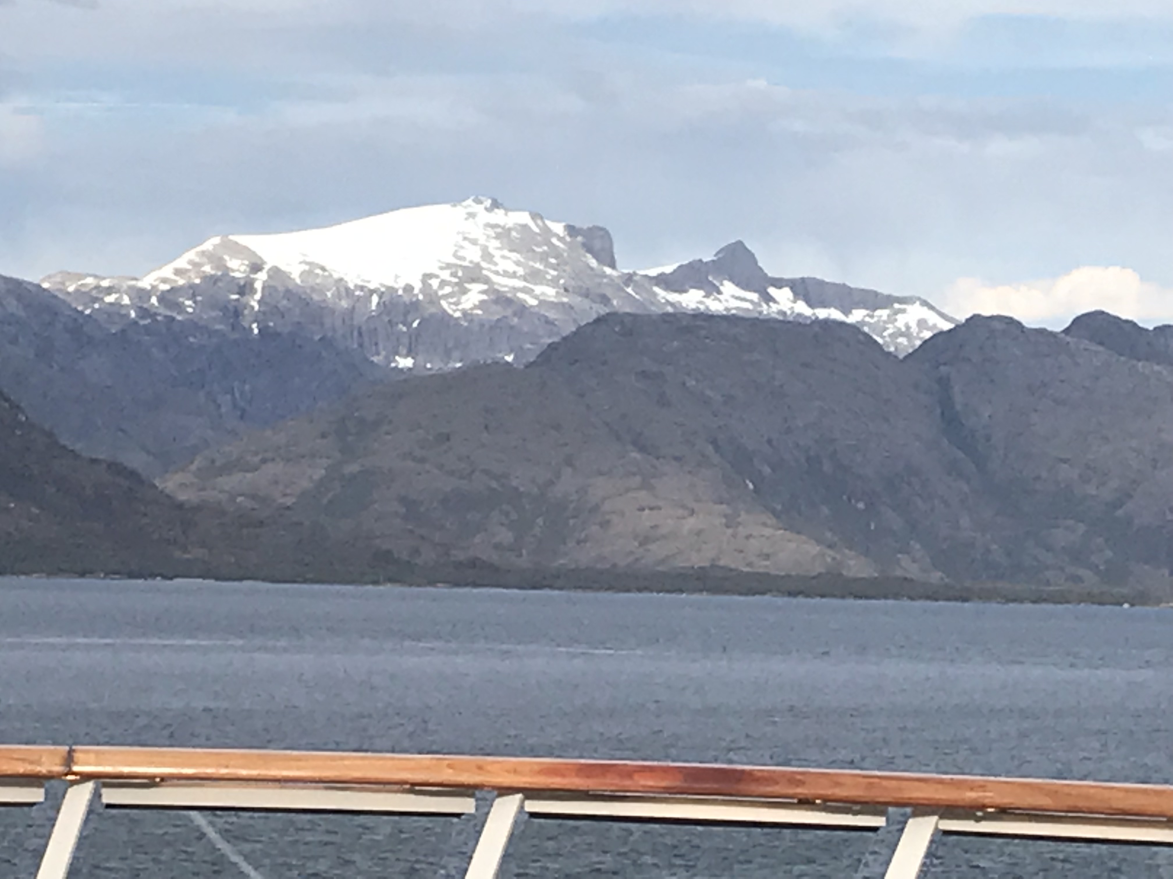
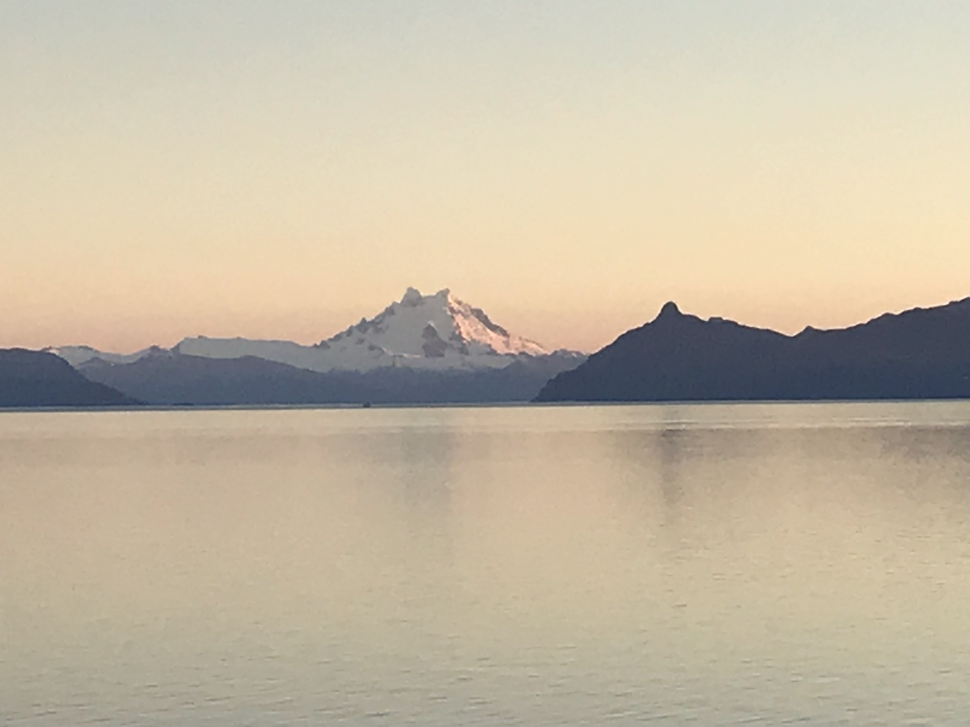
Punta Arenas, Chile, the largest port on the Straits of Magellan. Sunrise brought the peaks and glaciers into
majestic display on both starboard and port sides of the ship, and at some
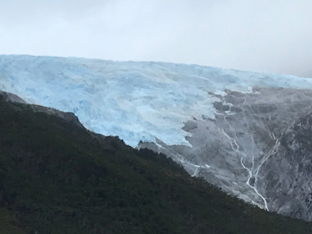
point one of the ship’s tenders captured a large chunk of glacier that had
recently calved into the Strait. When
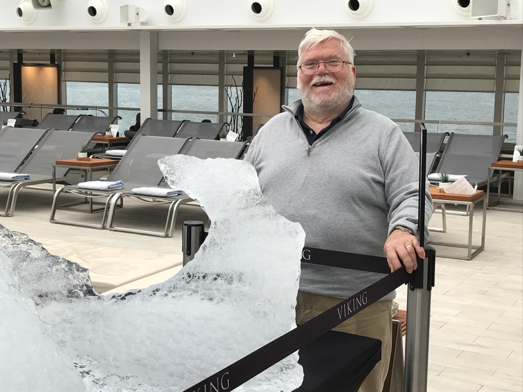
displayed on the pool deck, the irregular bluish piece of ice elicited tentative
touches and frequent photo opportunities (see earlier posting), oohs and aahs
and provided the backdrop for likely equally numerous uTube photos.
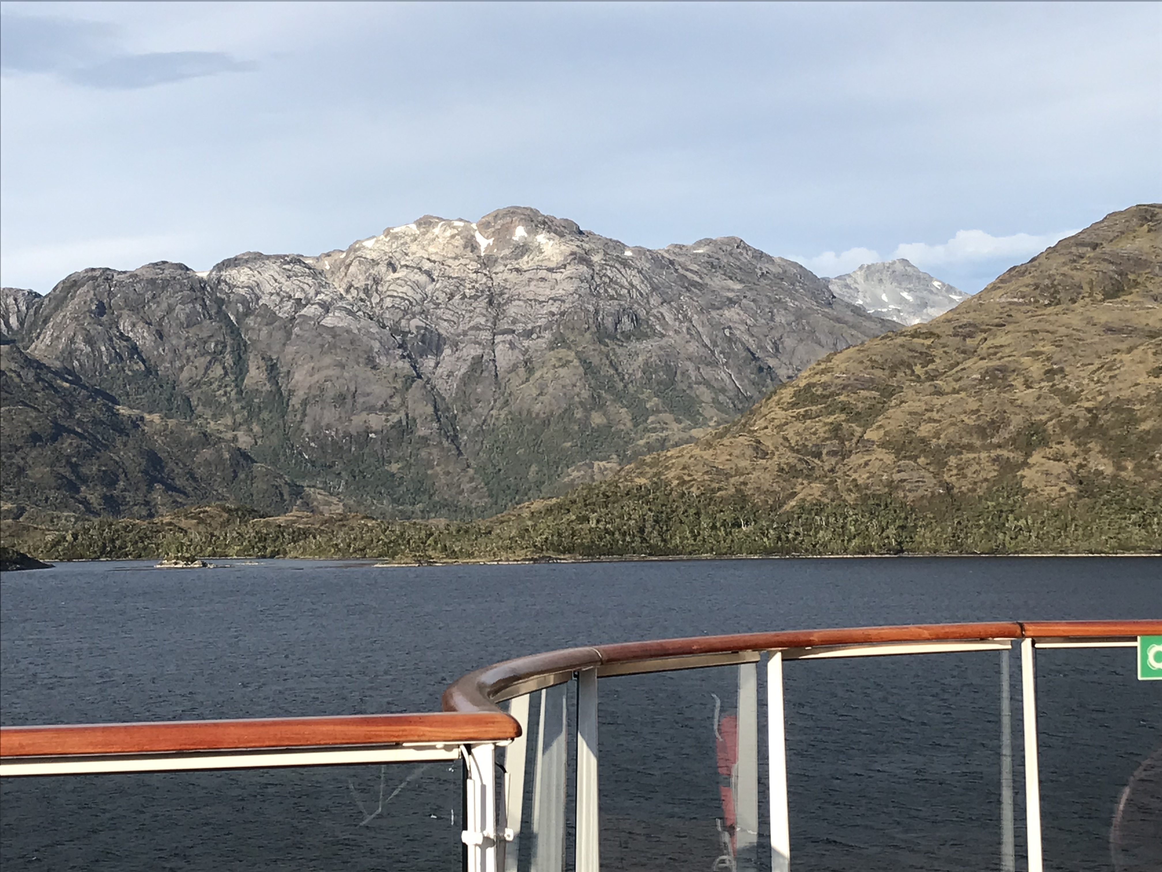
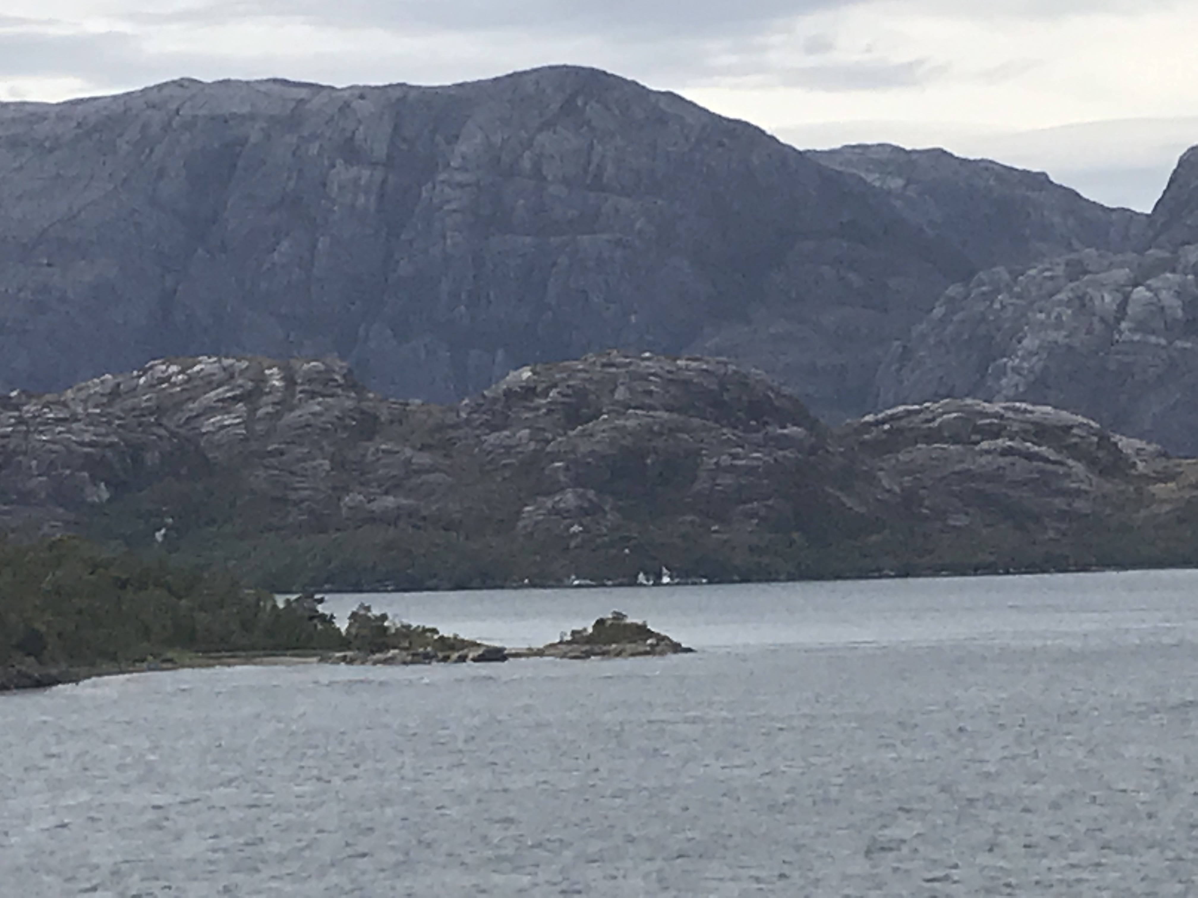
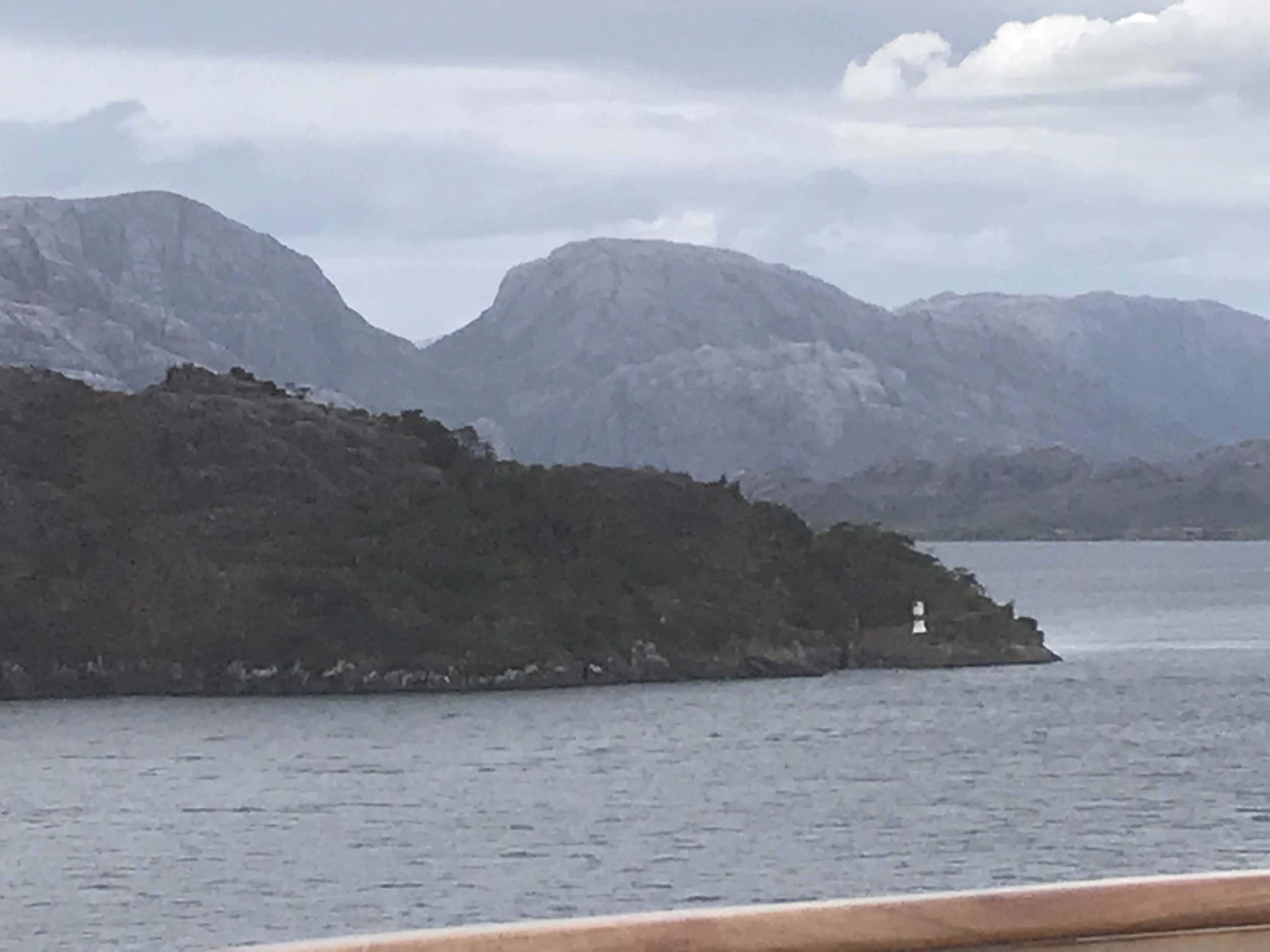
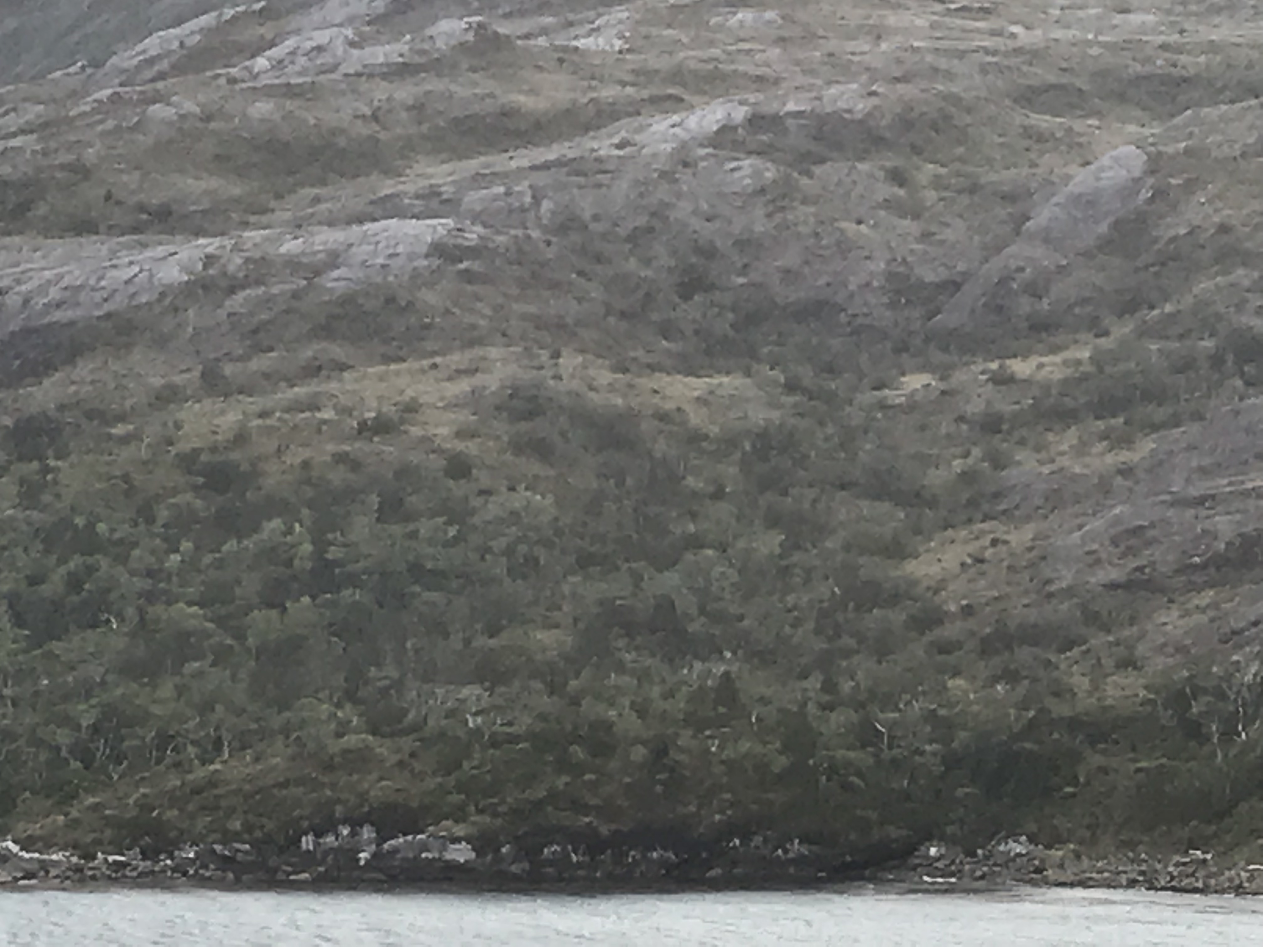
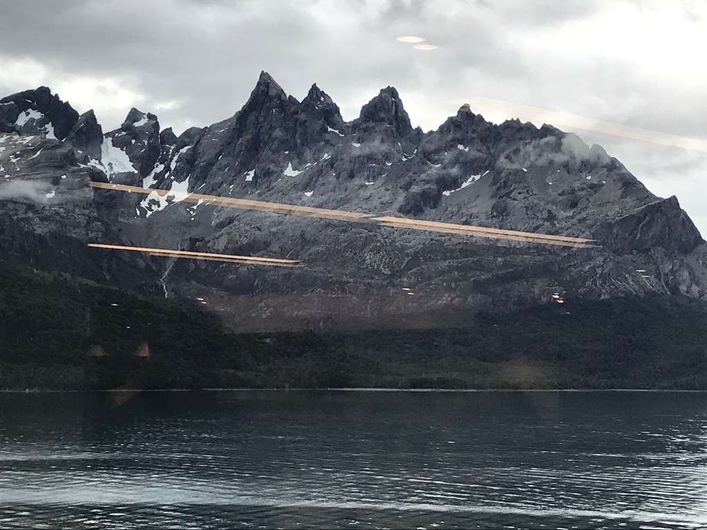
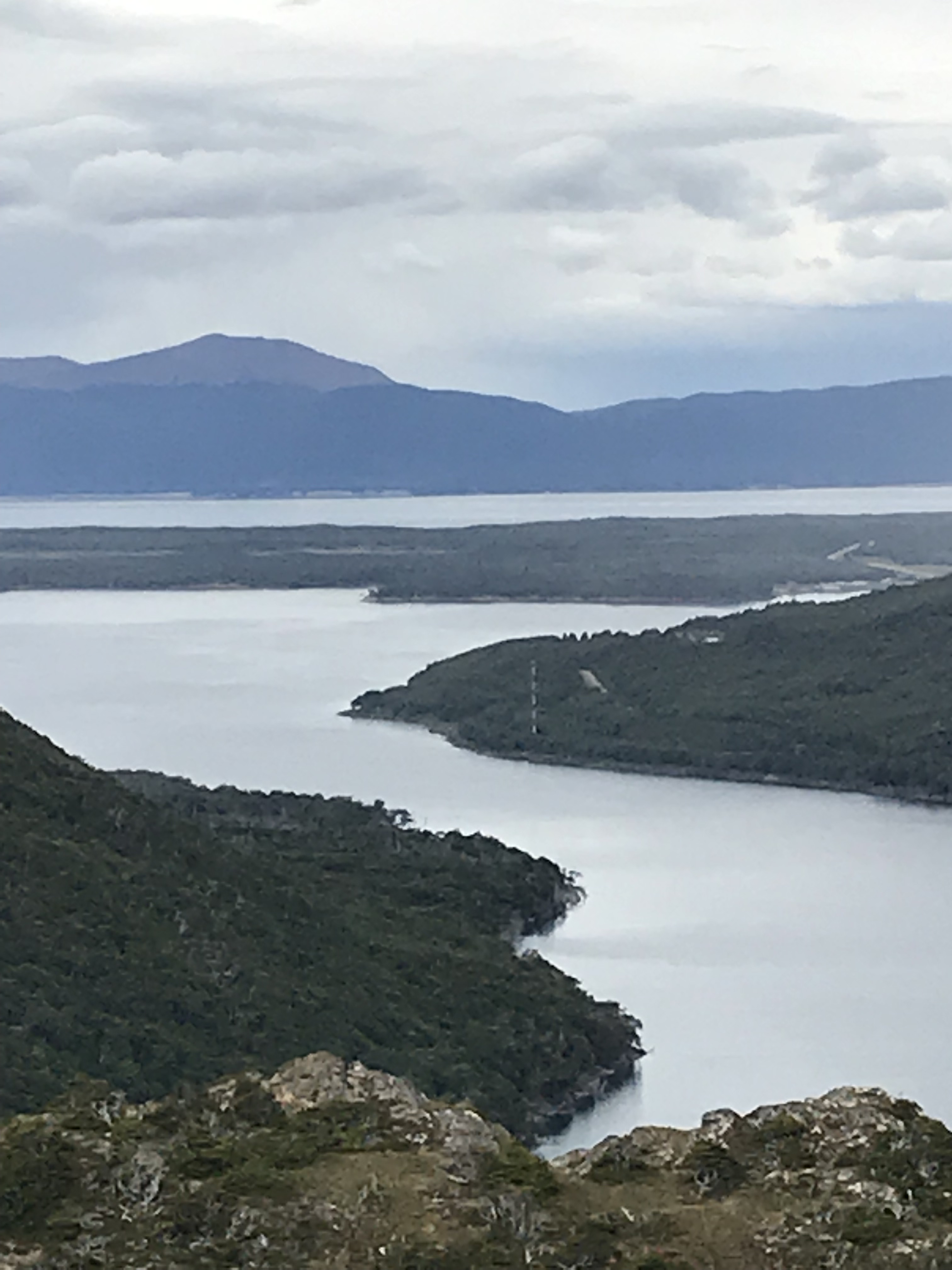
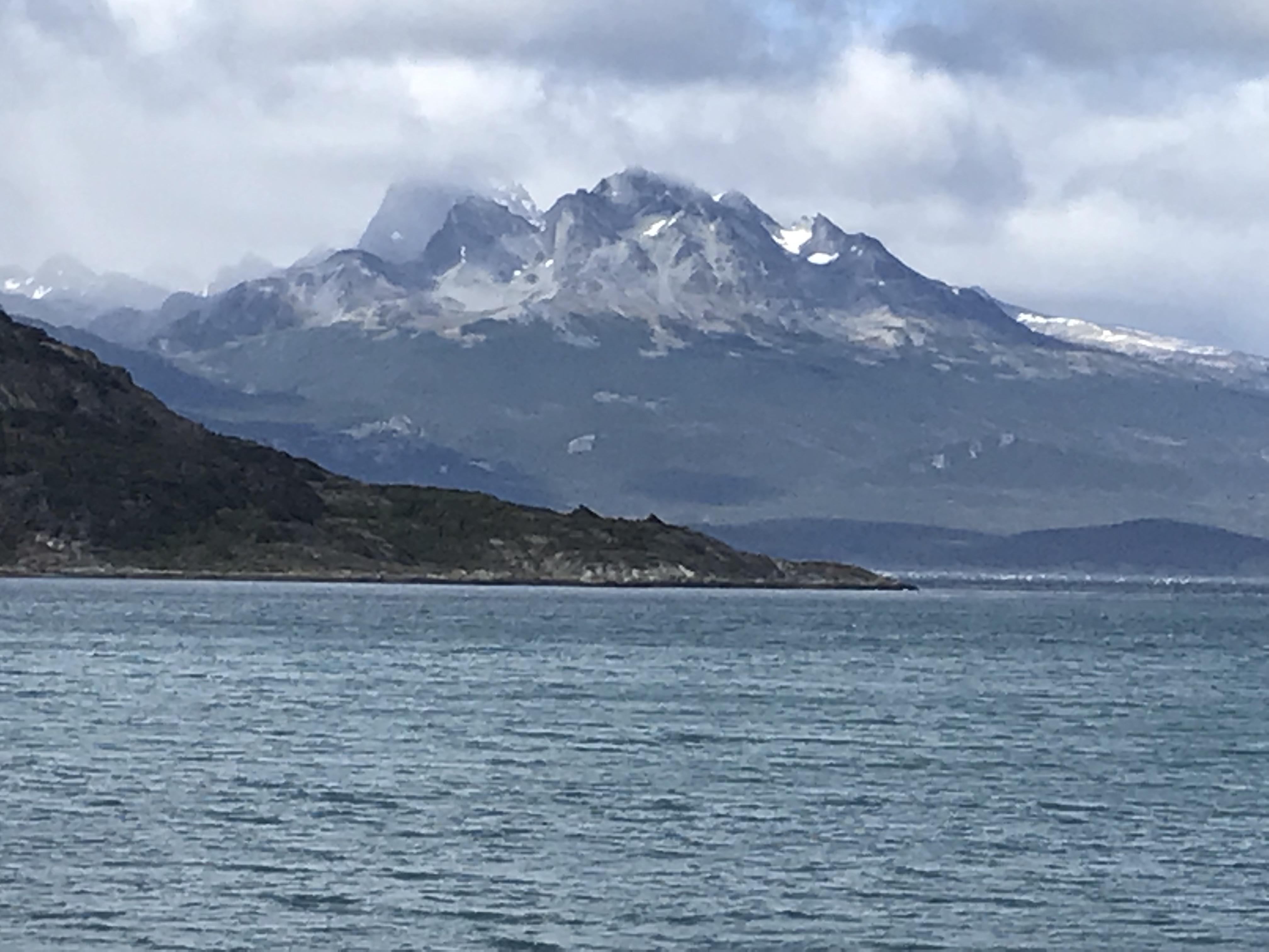
Leaving Punta Arenas, Sun retraced its SE path along the Strait and then turned northwesterly interlacing its way in continuing calm waters amongst numerous islands, many too small to resolve on the map depicted above. With virtually no shoreline, mountains rose abruptly to elevations often surpassing 1500 m, with rugged terrain occasionally broken by cataracts and with rising height covered by stunted trees, then what seemed at a distance like low shrubs finally yielding to naked or snow-covered granite. Glaciers were rare but an impressive one extended down a valley to the edge of the Strait was sighted earlier this afternoon. –Chris
We woke
early (because in the midst of summer this far south sunrise is very early—and
the days are very long).
We are still in Patagonia which comprises the southern portion of South America and, thus contains significant parts of both Chile and Argentina. Chile gets the very bottom bit as it curves east under the bottom of Argentina. Inhabitants of Ushuaia and the rest of Argentine Tierra del Fuego can fly to Buenos Aires or other parts of Argentina, but in order to go by land they must enter Chile, cross a bridge from Tierra del Fuego to the mainland, and cross back into Argentina. They are really isolated by this because the Chilean-Argentinean border crossing requires a passport & visa.
Our
guide for our morning bus tour of the area told us that today and yesterday
were unusual—probably ‘best days of the summer,’ warmer, sunnier, and less
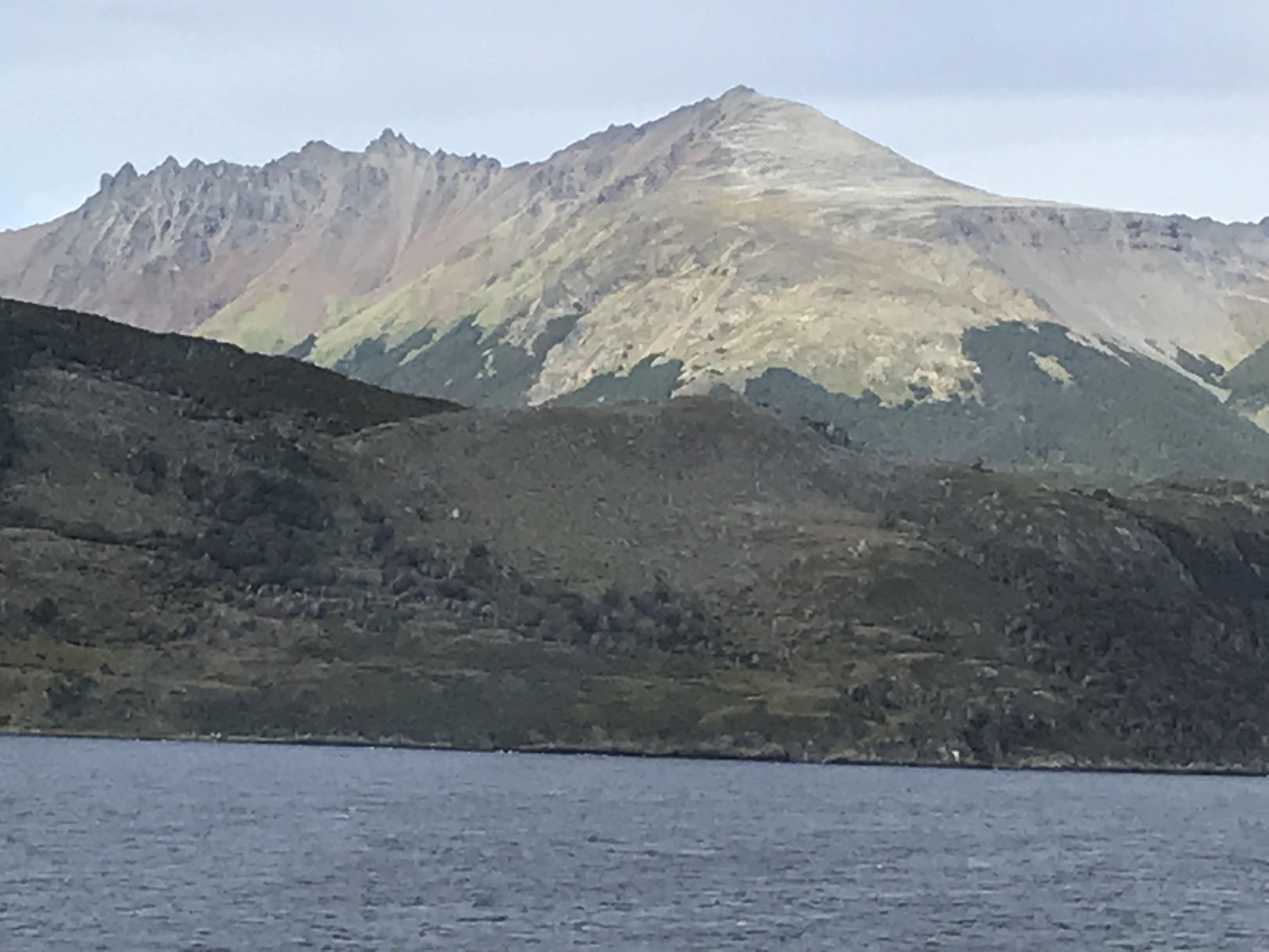
windy than ‘normal.’ We could see Monte
Sarmiento and other snow covered mountains far away across the channel, and
that, we were told, happens only 2-3 days a year! So much for my conviction that, so close to
Ushuaia, Punta Arenas has a much warmer climate.
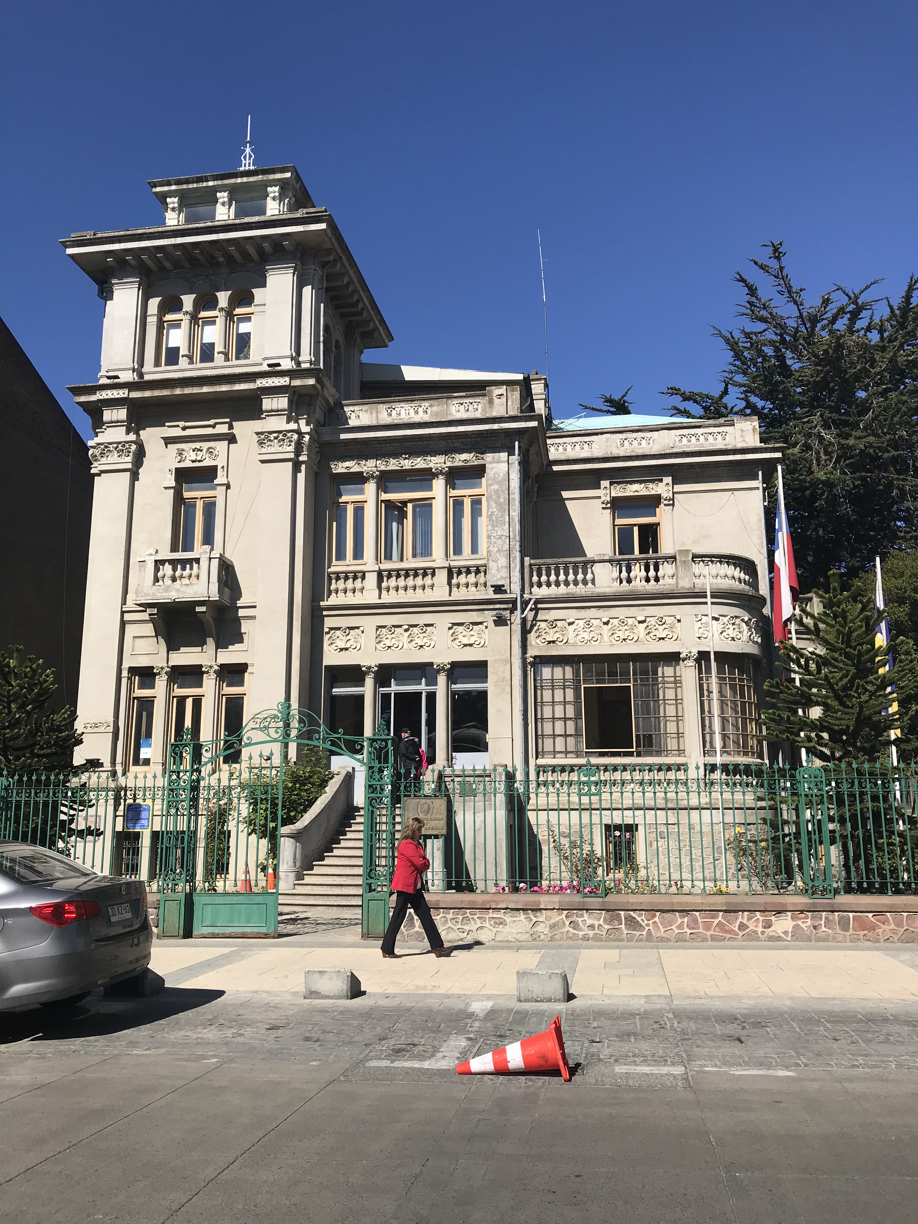
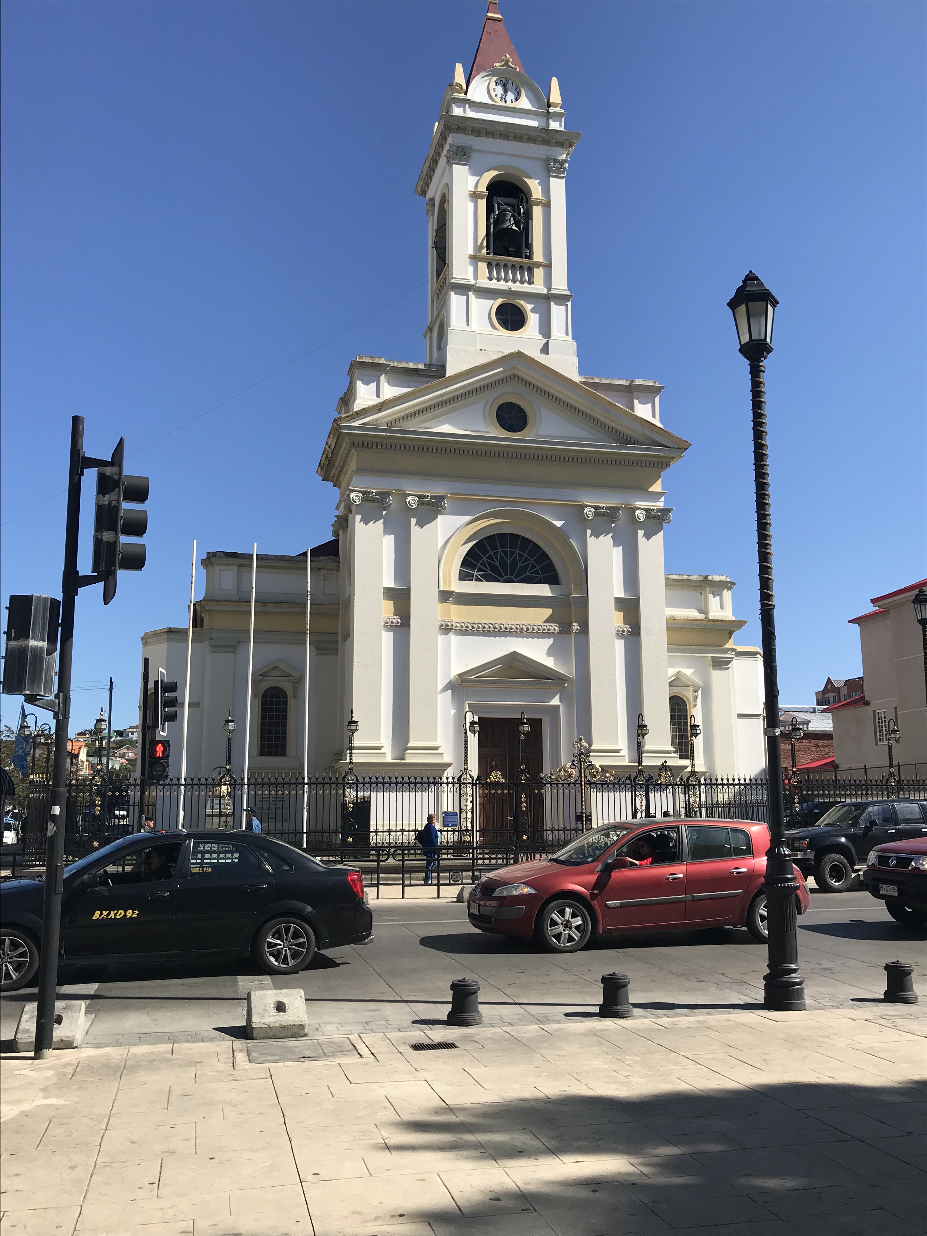
Punta
Arenas has a population of about 132,000 so approximately twice the size of
Ushuaia. It looks more like a city in
large part due to its patron Sarah Braun.
Sarah was a Russian Jew who immigrated in 1874 and married Portuguese
businessman José Nogueira, a pioneer of the sheep industry, which came
to be Patagonia’s major source of wealth.
He and Sarah commissioned an opulent palace in Punta Arenas by a French
architect. When he died young, the
wealthy widow completed the house and commissioned many other European style buildings
in her adopted city especially around the central square. She also imported furnishings for her home
and other buildings to make the area seem like a bit of transported
Europe. The rest of the city is a
contrast—rather furnishings ramshackle buildings ramshackle buildings (each
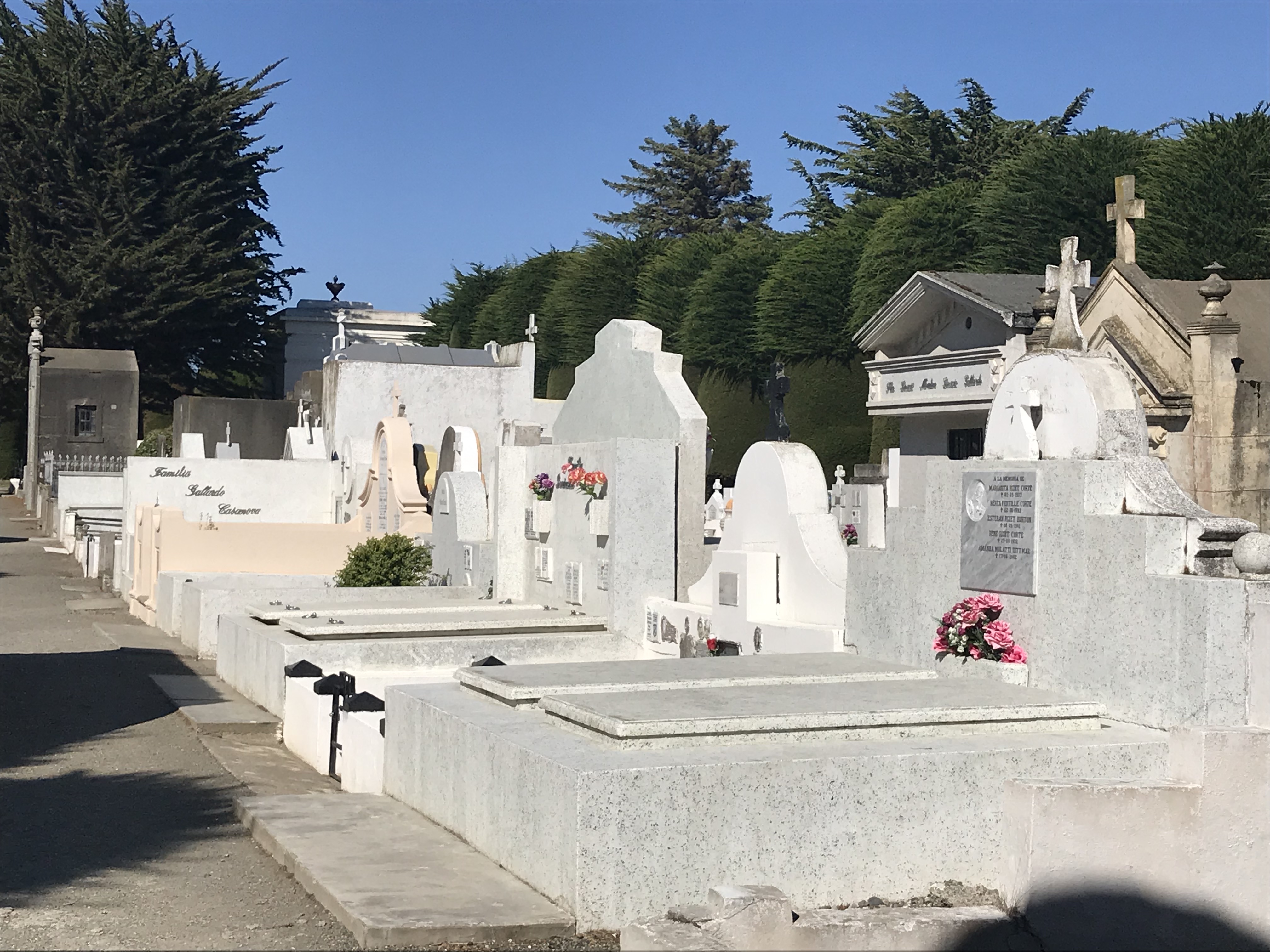
house surrounded by a wall) with corrugated metal roofs—except for the
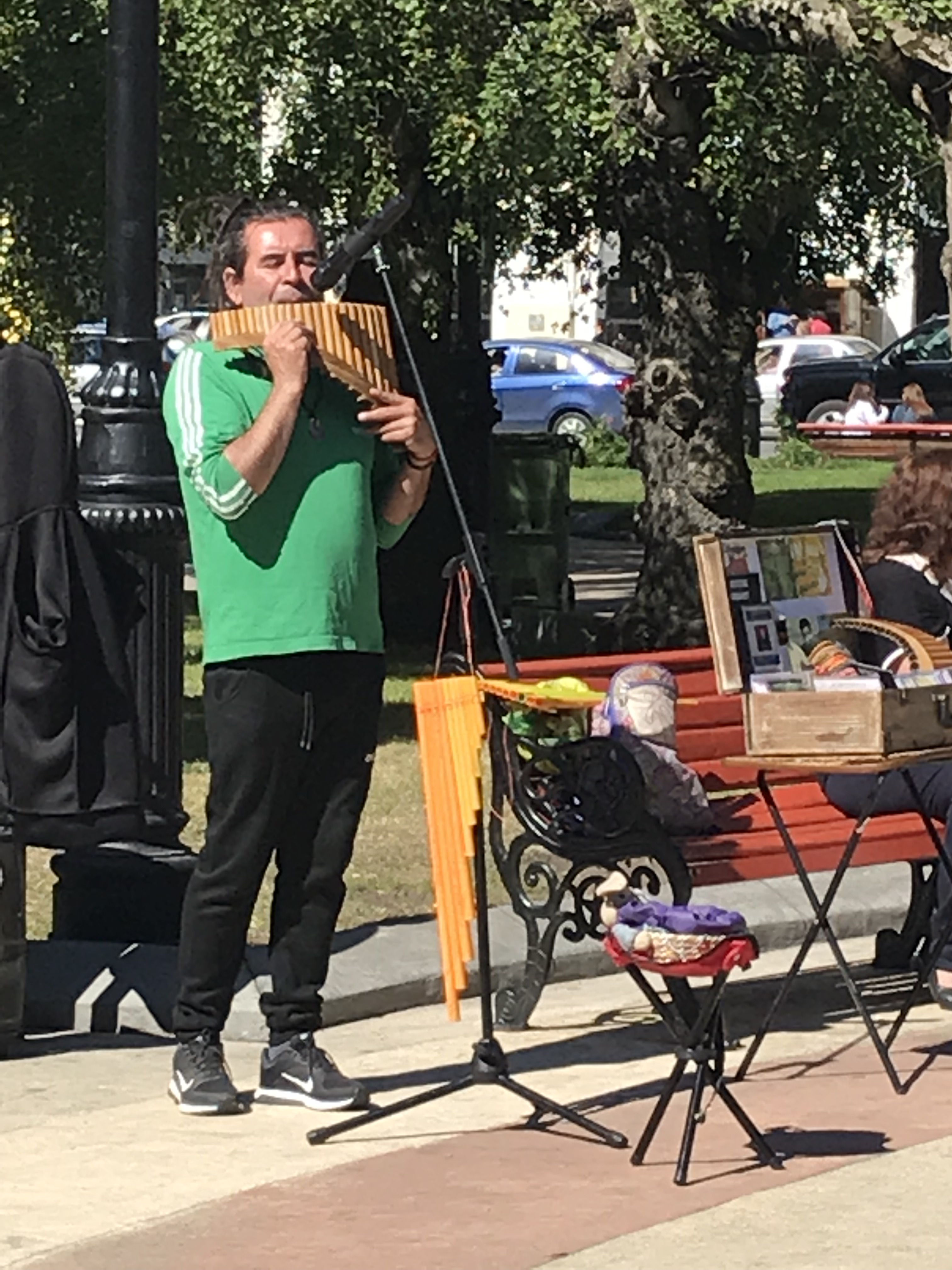
sumptuous above ground cemetery reminiscent of that in Buenos Aires. In the square was a man playing the pan
pipes; the song as we entered was Songs of Silence by Simon & Garfunkel.
Sailing away this evening it was still beautiful and in the high 60s and we were able to eat and then readon the deck until about 9 pm. We also saw several small dolphins leaping fully out of the water. Our resident whale watcher saw sei whales (a baleen whale—‘the third-largest rorqual after the blue whale and the fin whale’) but we only saw their spouting a few times. We are sailing south and east along the Magellan Strait and were excited to learn we will spend tomorrow sailing the Chilean fjords as well. –Cynthia
Keeping Up With The Rodriquez’s, Menendezes,
Brauns, et al. One of the mandatory behaviors
expected of a “Viking Traveler” in South Americais “debarking” the ship and going ashore. Ship-board shops are closed, no lectures and
few other organized activities are scheduled, and there is no casino, so unless
one wants to lie in the sun, go to the spa and/or exercise frenetically, there
is very little else to do (except drink, I suppose!). While ashore, travelers bicycling or
exploring without a guide are relatively free to go where they wish, but those
of us “on tour” in buses or on foot
dutifully go where we’re directed… and In each port we’ve visited
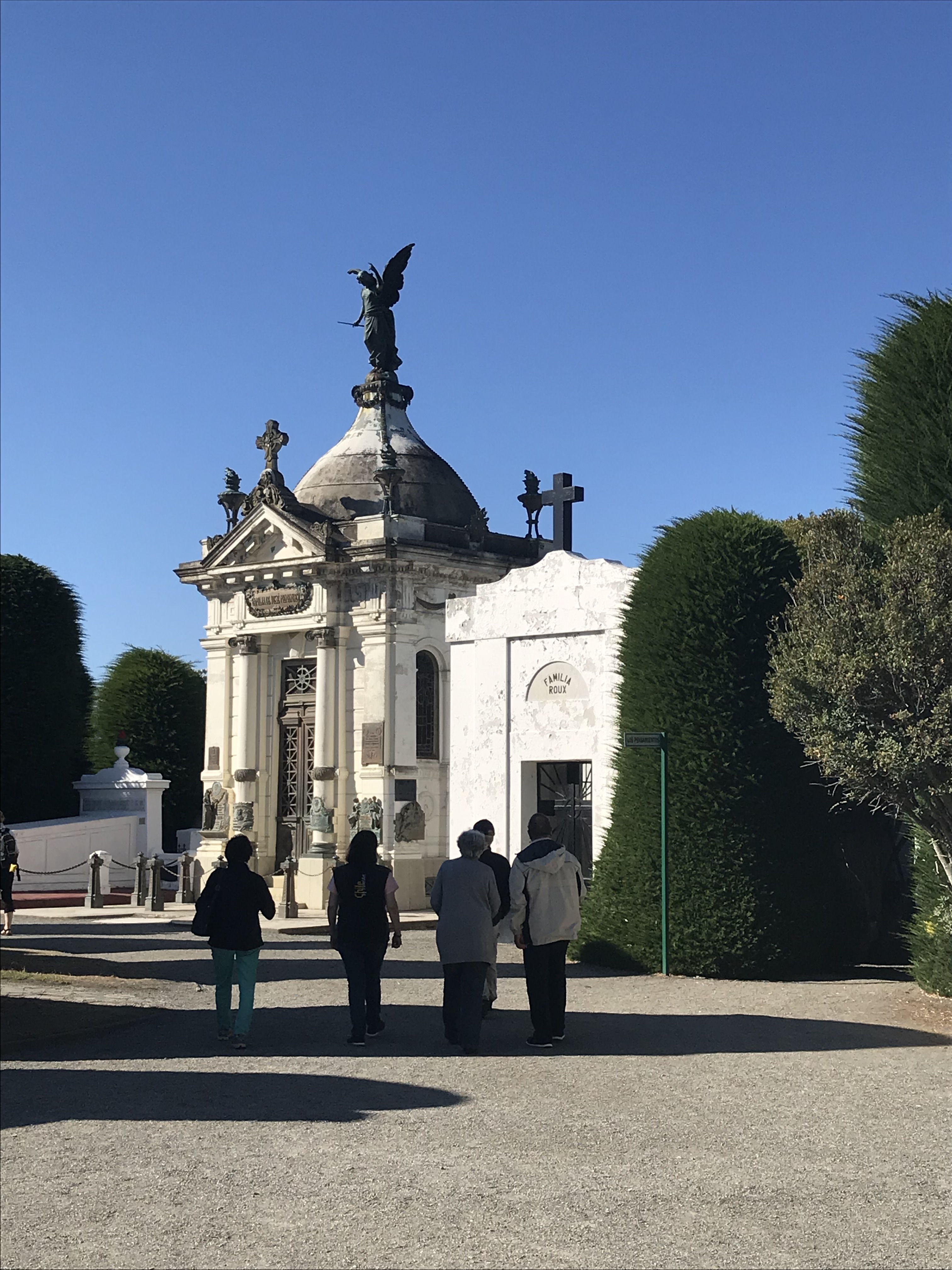
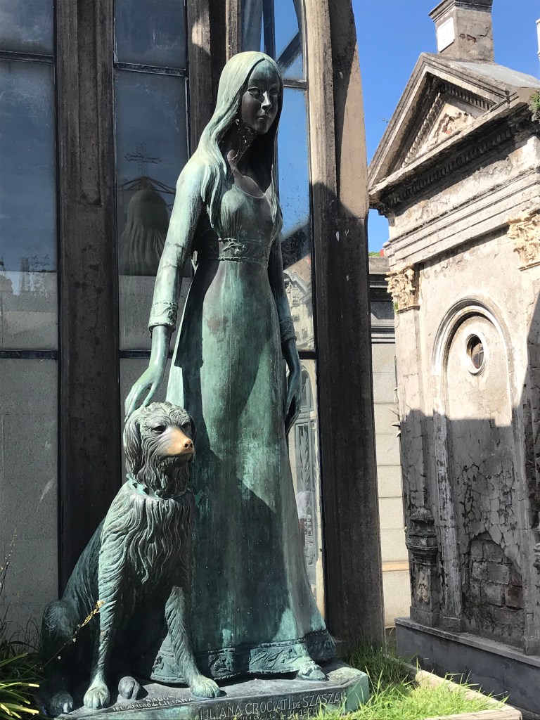
recently, a minimum of 30 min is spent walking around a cemetery!
You’d think a graveyard would be the last
place a savvy company like Viking would include on a tour comprised of elderly
retirees. Why remind us of where we are
all headed? It turns out that in those
South American cemeteries we’ve visited, mausoleums are a major, if not the
sole, feature. (Family members are
interred within, we are told, many feet downwards, layered by generation.) And these houses of the dead are
elaborate! While all have similar
footprints and are constructed of similar stone, they are stylistically
baroque, neo-classical, Italianate or Iberian and various mixtures of these,
along with a potpourri of columns, statues of family and religious personages, and
a variety of crosses, crucifixes, and plaques.
With lots of photographs being taken by the touring traveler, the answer
to the question raised above is these few acre are economical and historical
microcosms of their locales, and visiting them is one way to see the city in
depth (so to speak)!
One wonders where the servants, laborers, fishermen, and shops people are buried… not apparently with the upper middle classes. –Chris
We were awakened
about 8 am by the Captain announcing we were approaching Cape Horn. Cape Horn is on Hornos Island off the
southern tip of Patagonia and south of it is the Drake Channel. We approached from the north and proceeded to
circumnavigate the island going through the Drake Channel itself from west to
east (apparently that’s easier.) We were
fortunate to have a very calm day and so proceeded without incident. Then we returned north to the Beagle Channel
and, sailing portions of it for the third time, proceeded past Ushuaia west
through the Channel. I missed taking
pictures of two fantastic glaciers because I didn’t bring my phone to dinner…
But
there were more great mountains and glaciers the next morning—though, of
course, the glaciers are receding and have been, I believe, since the
1960s. Go soon if you want to go (the
same applies to Alaska, of course.) The
ship’s crew went out in a tender and retrieved a couple of pieces of glacier
ice, now on display on the pool deck (probably not for long but they may last
through lunch…)
It was such gorgeous morning sailing through various fjords that I skipped church… In the afternoon four of us played bridge though bridge was not officially scheduled today and we arrived at Punta Arenas late in the afternoon.
Punta Arenas is the furthest south Chilean port–on the Magellan Strait across from the northern side of Tierra del Fuego. If I’d kept up with the lectures, I’d know more about the geo-political aspects of this jockeying between Chile & Argentina that includes trying to bolster the population at these two southern ports. Climate-wise there seems to be a world of difference! It was in the 70s when we arrived—at least 20 degrees warmer than in Ushuaia—with bright sun and no wind. For the first time in several days we could eat dinner on the back deck comfortably. Not as impressive a backdrop as Ushuaia—the mountains are a little farther away.
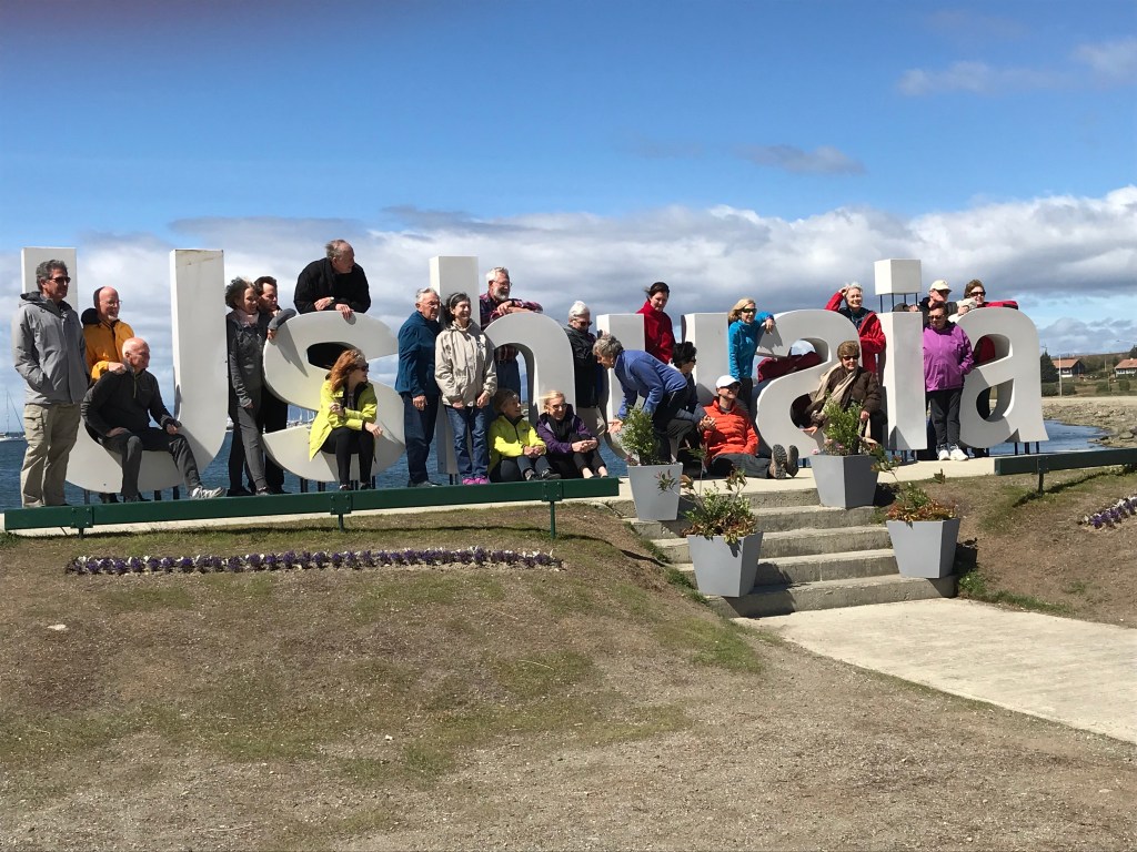
I made
no entry for January 30 because it was a typical ‘at sea’ day and Ushuaia was
much more interesting. First of all, ‘Ushuaia’
is the Yamana Indians name for the area as written by British explorers meaning
‘deep bay.’ That the spelling was
determined by English language speakers is important because, although the
pronunciation that follows the Yamana word is something like ‘oo-shwuy-a’, the
Spanish language doesn’t pronounce an ‘h’ following an ‘s’ so another ‘correct’
pronunciation is ‘oo-swuy-a.’
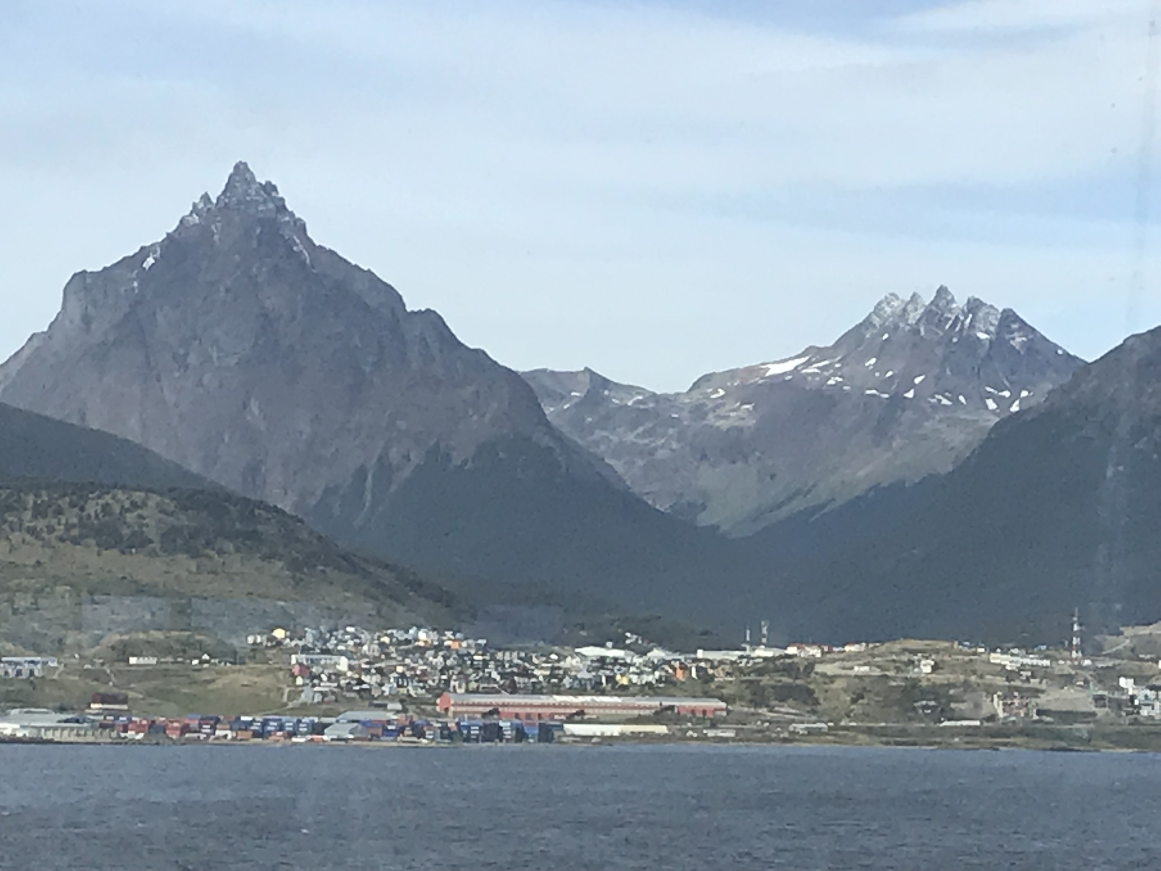
We
sailed in from the east along the Beagle Channel. Ushuaia is a beautiful spot surrounded by snowcapped
mountains on southern end of the island of Tierra del Fuego, which itself is
part of Patagonia. The population is
about 70,000 although as little as 20 years ago it was about 15,000. The Argentinean government wants to boost
population so established much industry and gives financial incentives for
living there. The biggest industry is
electronics, a surprise to all of us. Another
big industry is tourism mostly summer but also winter for downhill and
cross-country skiing and dog-sledding.
Summer tourism is partly related to it being the closest port to
Antarctica and more and more expedition ships as well as pleasure cruisers go
to Antarctica. As many as four other
passenger vessels were in port simultaneously during our time there.
I would
find it difficult to live in a place where the average summer high temperature
is in the low 50s with much wind and, at 55 degrees south of the equator
(equivalent to somewhere in Hudson Bay or Glasgow, Scotland), winter days are
exceedingly short, but people who live there seem happy. One of our guides was
born there but grew up elsewhere and moved back as an adult; another was from
Buenos Aires but prefers the mountains to the city.
Since we
were in port for a day and half—an extra half-day—we managed to fit in three
excursions as well as some tourist shopping.
We took a bus east and north over the Garibaldi Pass to beautiful Lake Fagnano—great
scenery. Since this is the tail end of
the Andes mountains chain (before it goes under the sea and resurfaces in
Antarctica), we were told we can say we conquered the Andes (admittedly at
about 2800 feet or somewhat higher than Appalachian Gap in Vermont)! The trip included a rainbow trout or roast
lamb lunch at a small resort where many sled dogs were boarded.
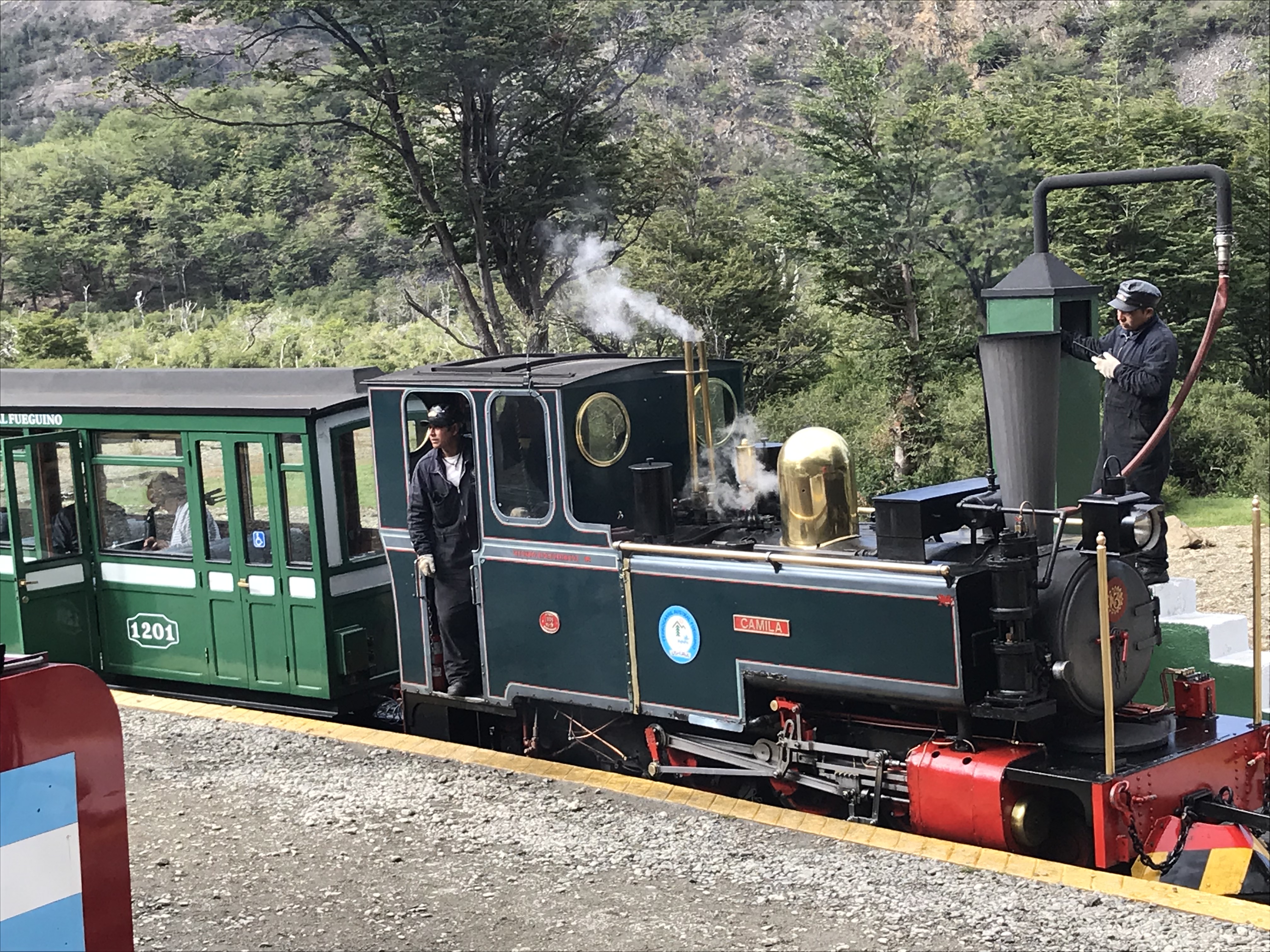
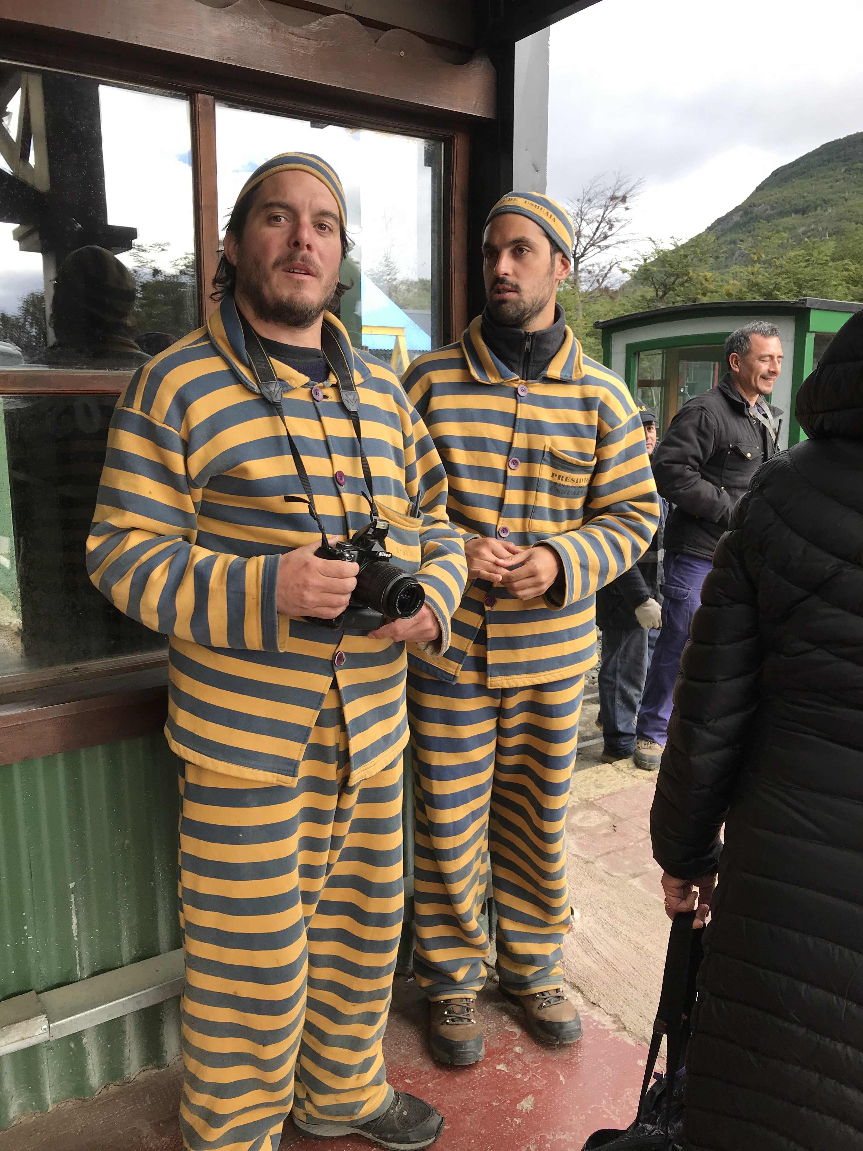
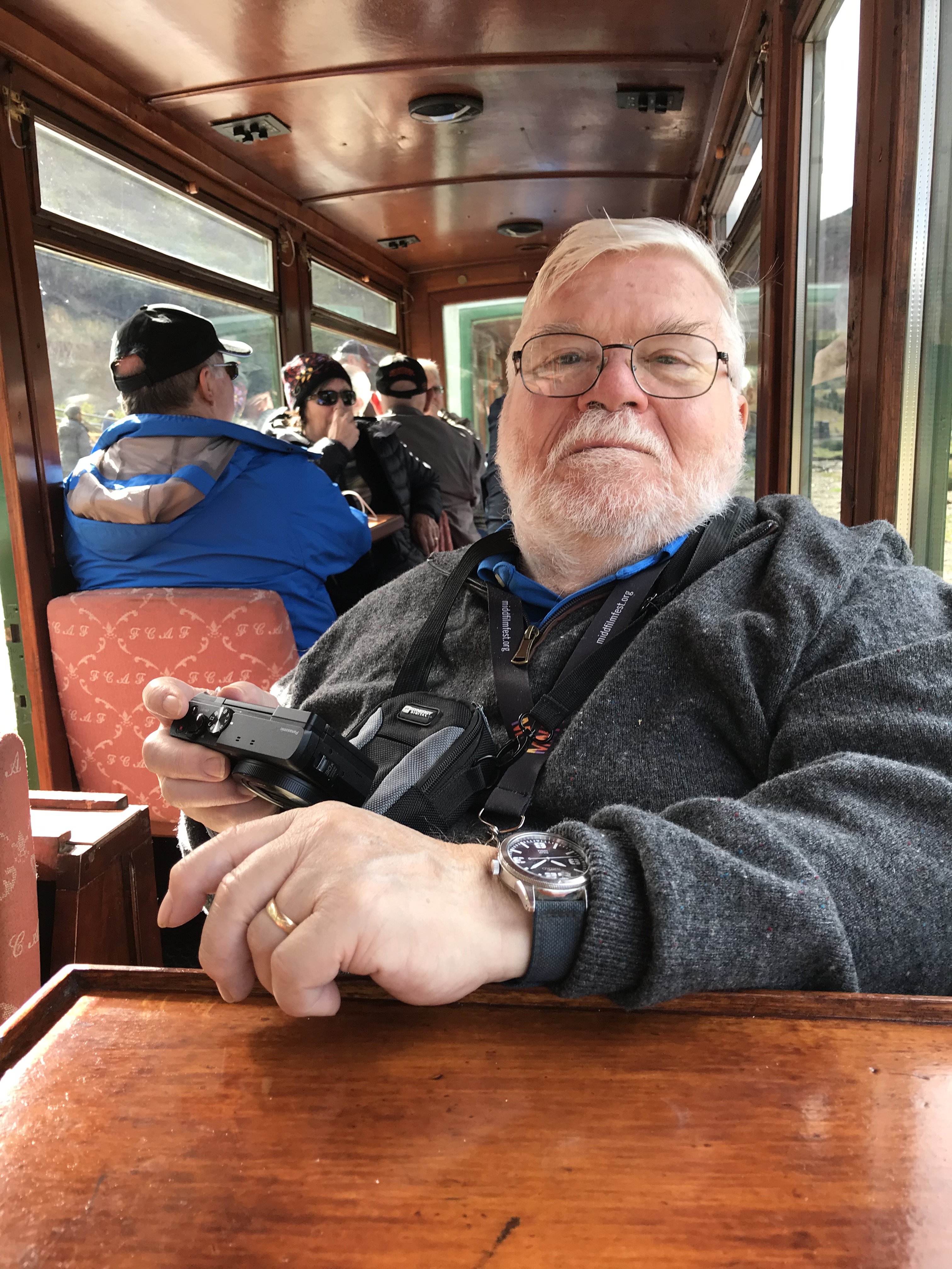
The
following morning, we took a tourist train into the National Park—again
lovely. Ushuaia was originally
established as a penal colony, and the prisoners were transported into the
forest by train for firewood. Our train
was much more comfortable and enclosed where theirs was open. Until the prison closed in the mid-twentieth
century, the town basically consisted of prison employees. After a quick lunch we had a bus tour of the
town.
The sail
out from Ushuaia east on the Beagle Channel was lovely—we basically retraced
part of our route in two days ago and then hung a right toward Cape Horn. I’m afraid I’m overusing the words ‘beautiful’
and ‘lovely’ but the whole landscape really is beautiful and lovely!
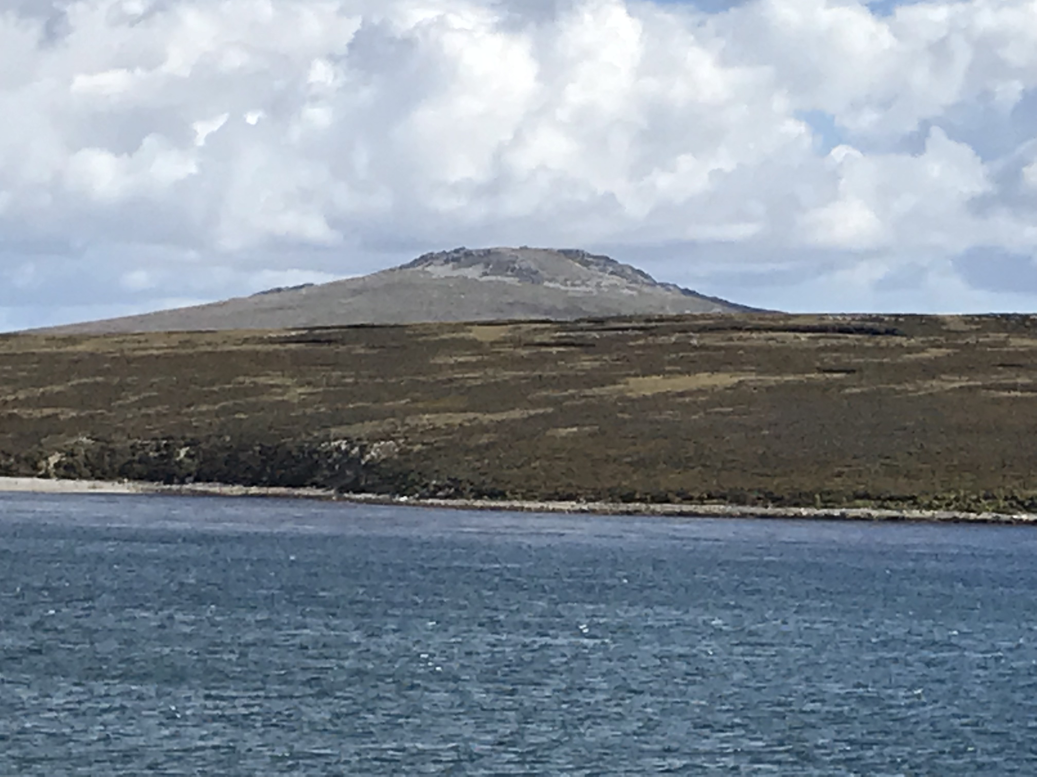
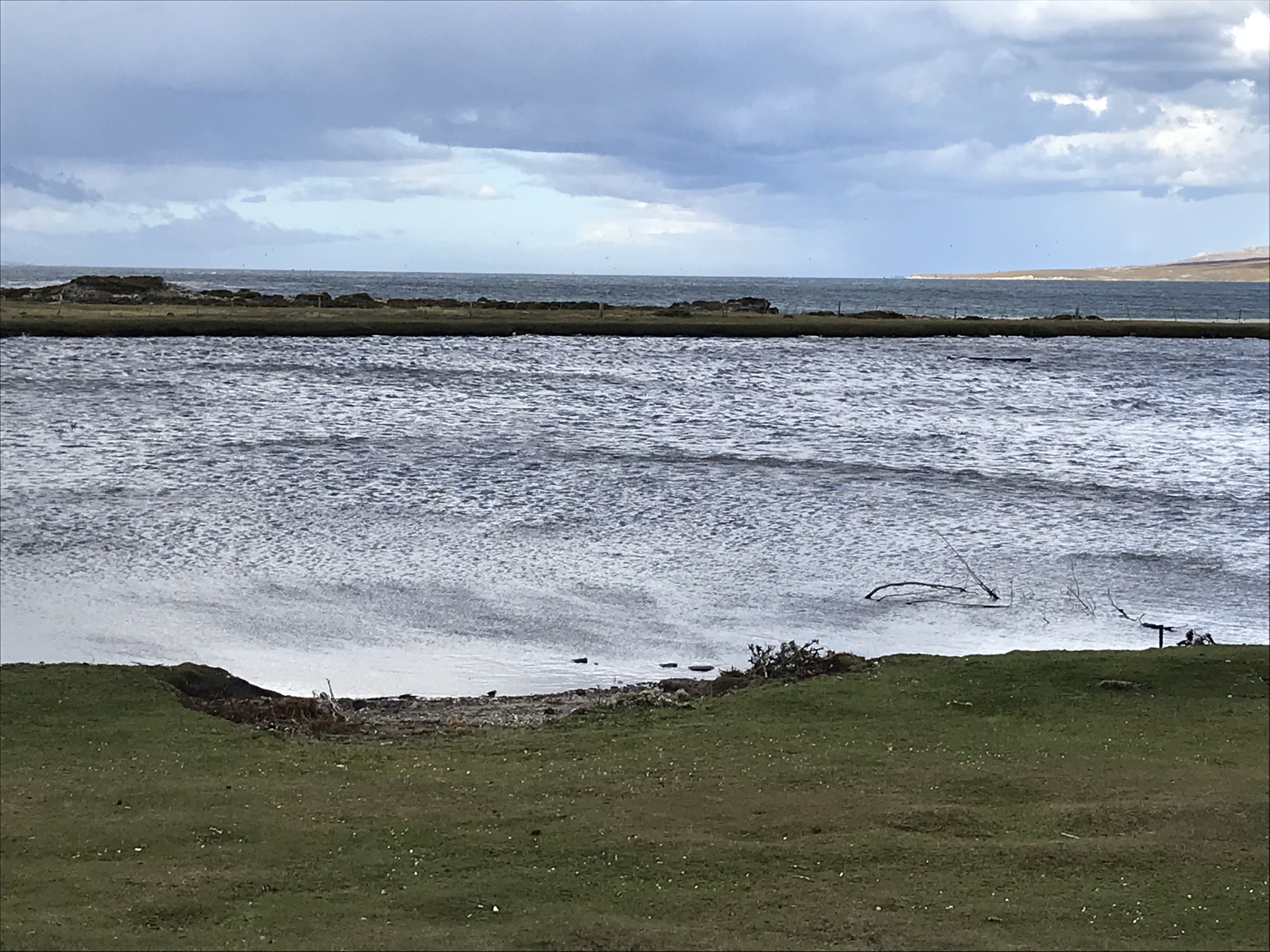
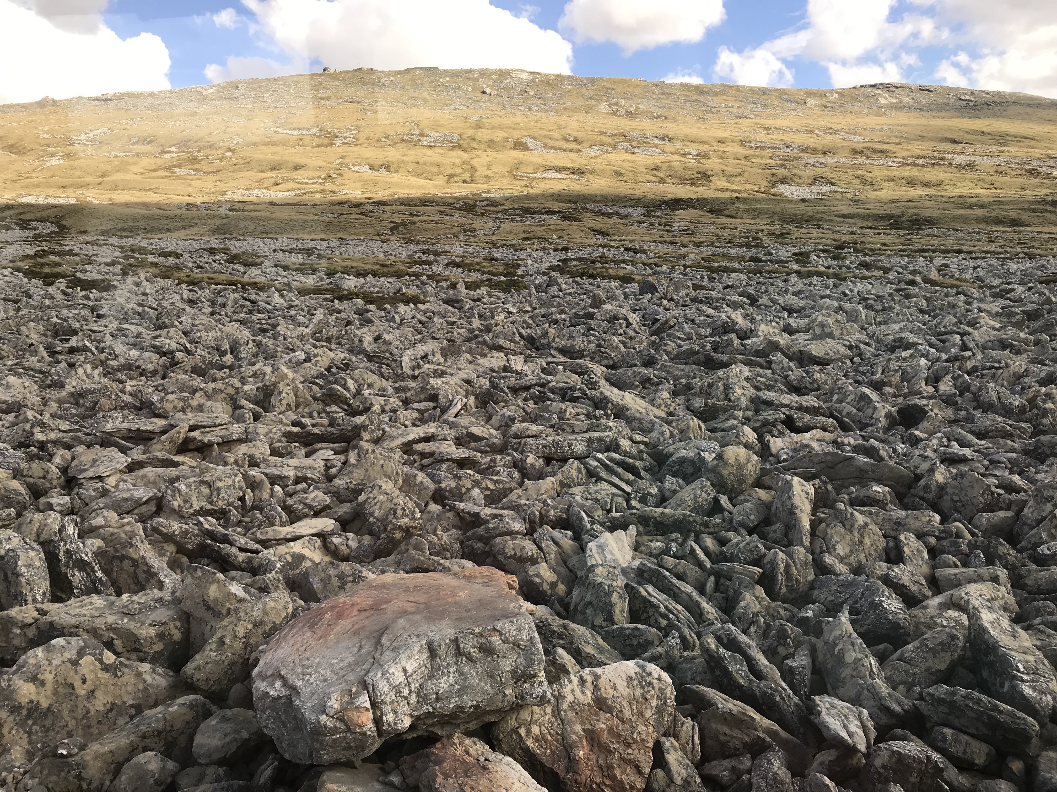
Expecting two days in the Falklands, we waited until after lunch to tender ashore for our afternoon excursion to a sheep farm. Our brief look-around from the pier and bus showed a very English-looking village with typical red phone booths and post boxes and a lovely brick Anglican ‘cathedral.’ I use quotes because the population of the islands (there are two main islands connected by a ferry plus a few hundred smaller islands) is about 2500 people, which seems like rather few for a cathedral. The landscape (seen from the ship and then along the drive) is beautiful (to my mind) rock topped hills, valleys full of boulders, and low scrubby vegetation; it looks much like the Scottish Hebrides.
A bus
took us for a drive (about 45 minutes to an hour depending on traffic and road
construction) to Long Island Farm along mostly gravel roads. The first part is tarmac and they are in the
process of paving the rest from Port Stanley to the airport (about 35 miles I
believe). There are many Landrover type
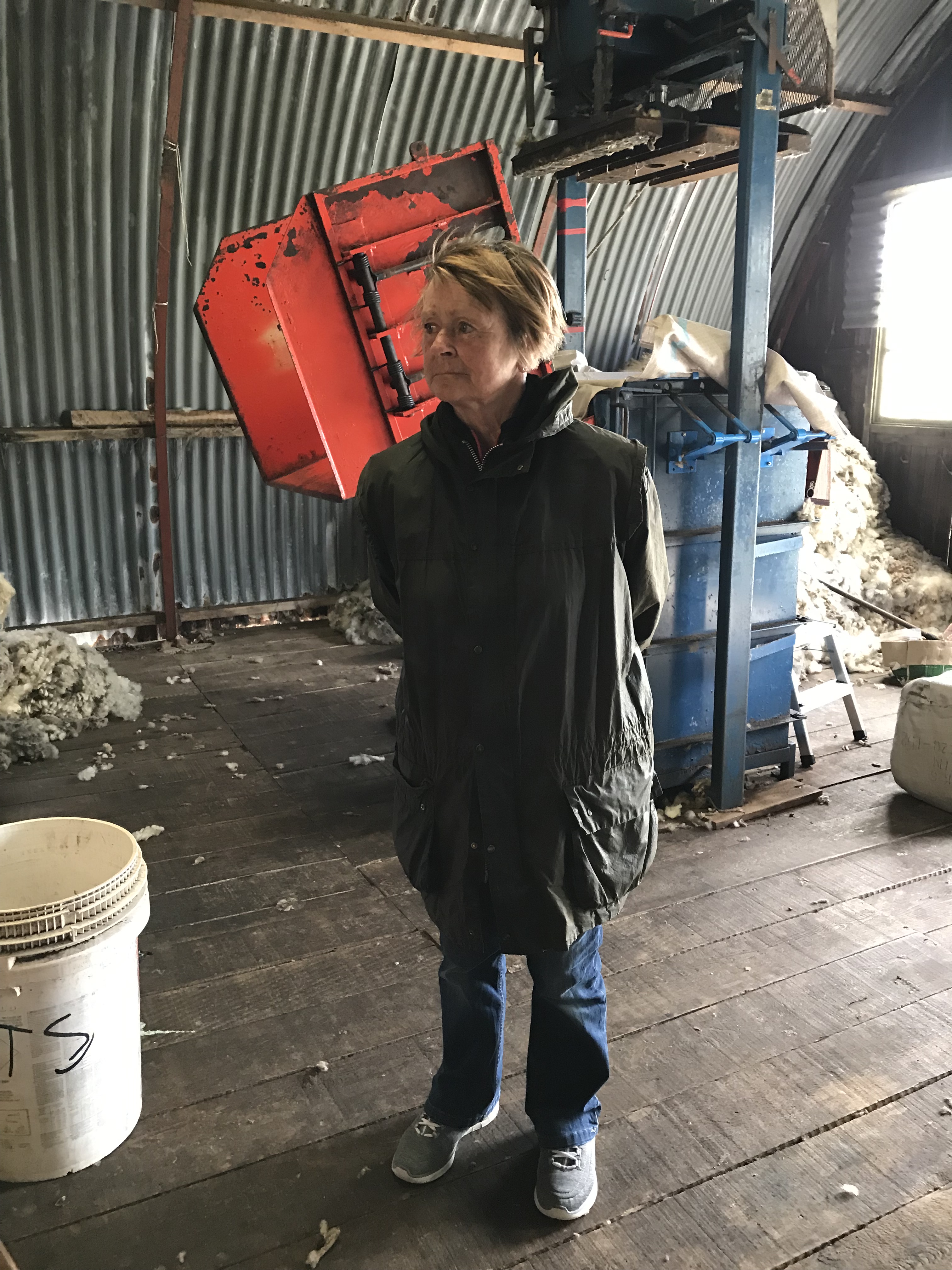
vehicles. The farm is owned by Glenda, a
77-year old woman whose husband died 14 months ago; she runs it with the help
of her son Paul, who comes weekends, sometimes with one or more of his 3
sons. They have 2500 sheep, wool being a
major part of the economy; however there is no processing plant in the islands
but rather it is sent to the UK or Uruguay for processing and
distribution.
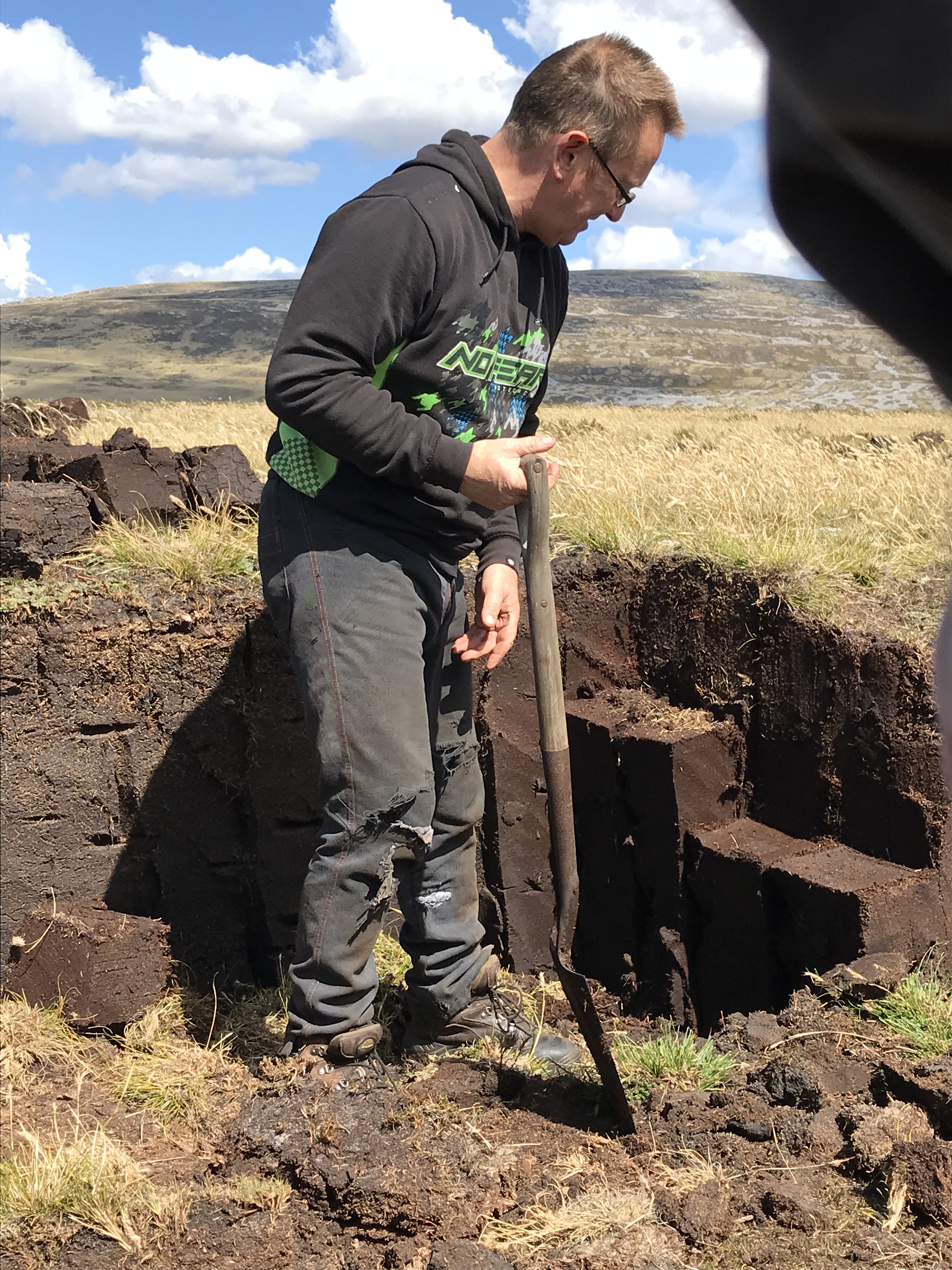
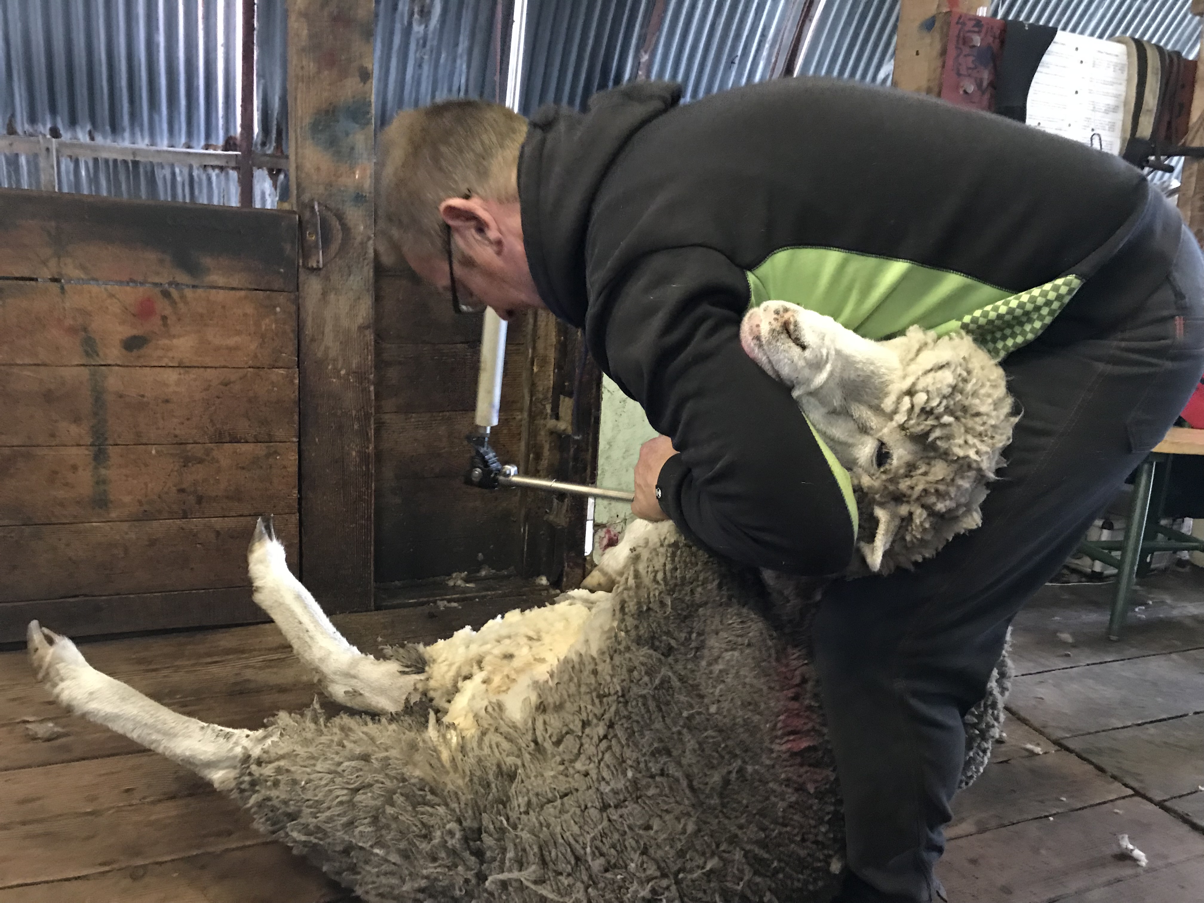
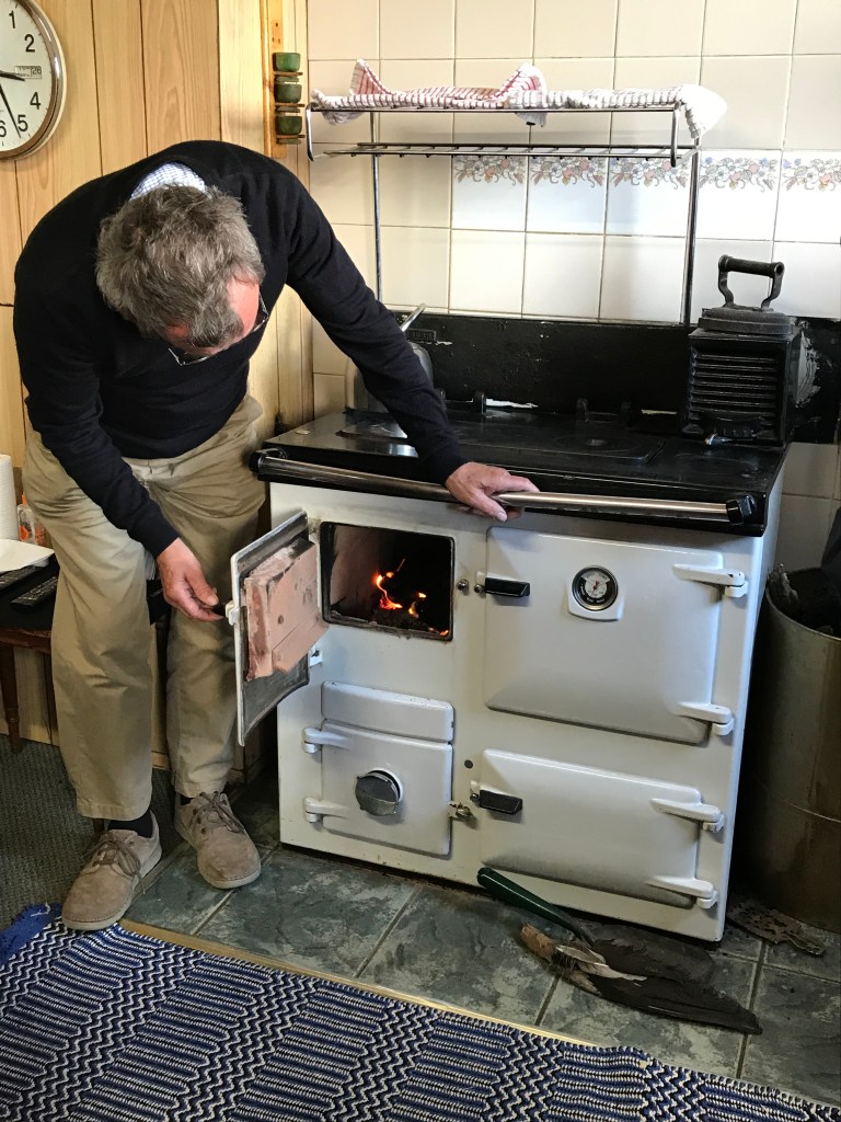
Paul
demonstrated peat cutting, which Glenda uses for fuel in an amazing stove that
has an oven, warming oven, stove top, and also pipes to send heat through the
house. Peat is now used only by about 15
households. Paul said peat cutting is
labor-intensive but it’s free, and, given the need to feed the fire during the
day, it works fine if someone is usually at home but not if the household
members all have day jobs.
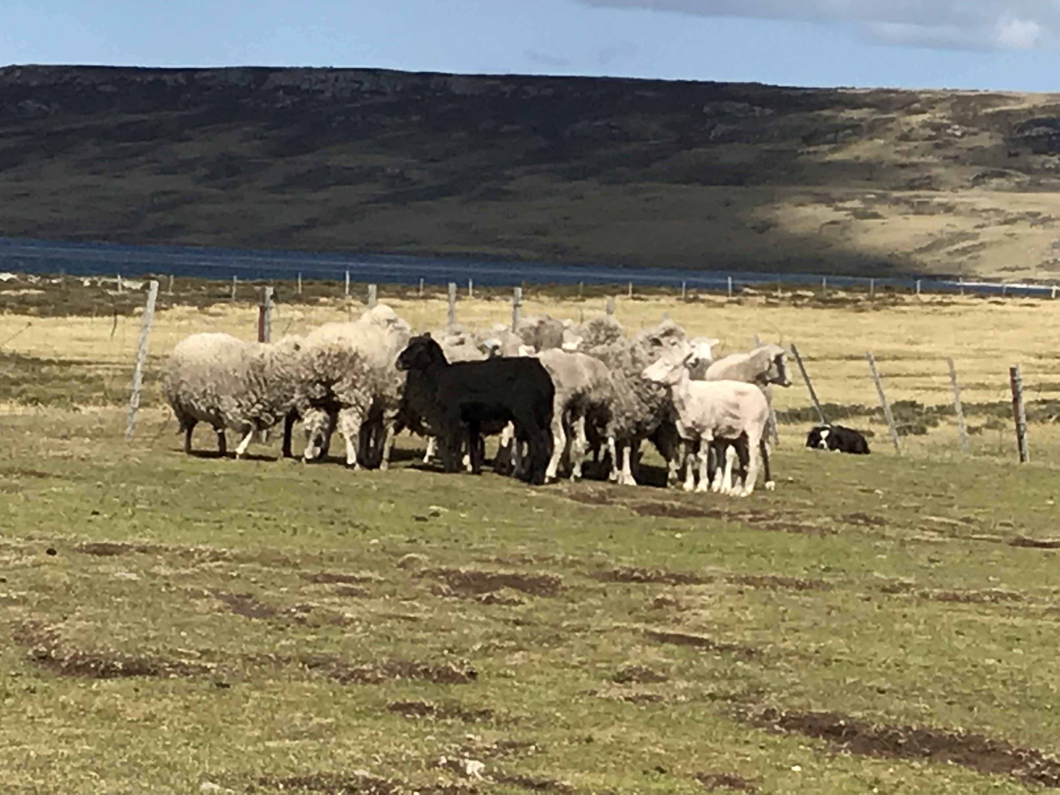
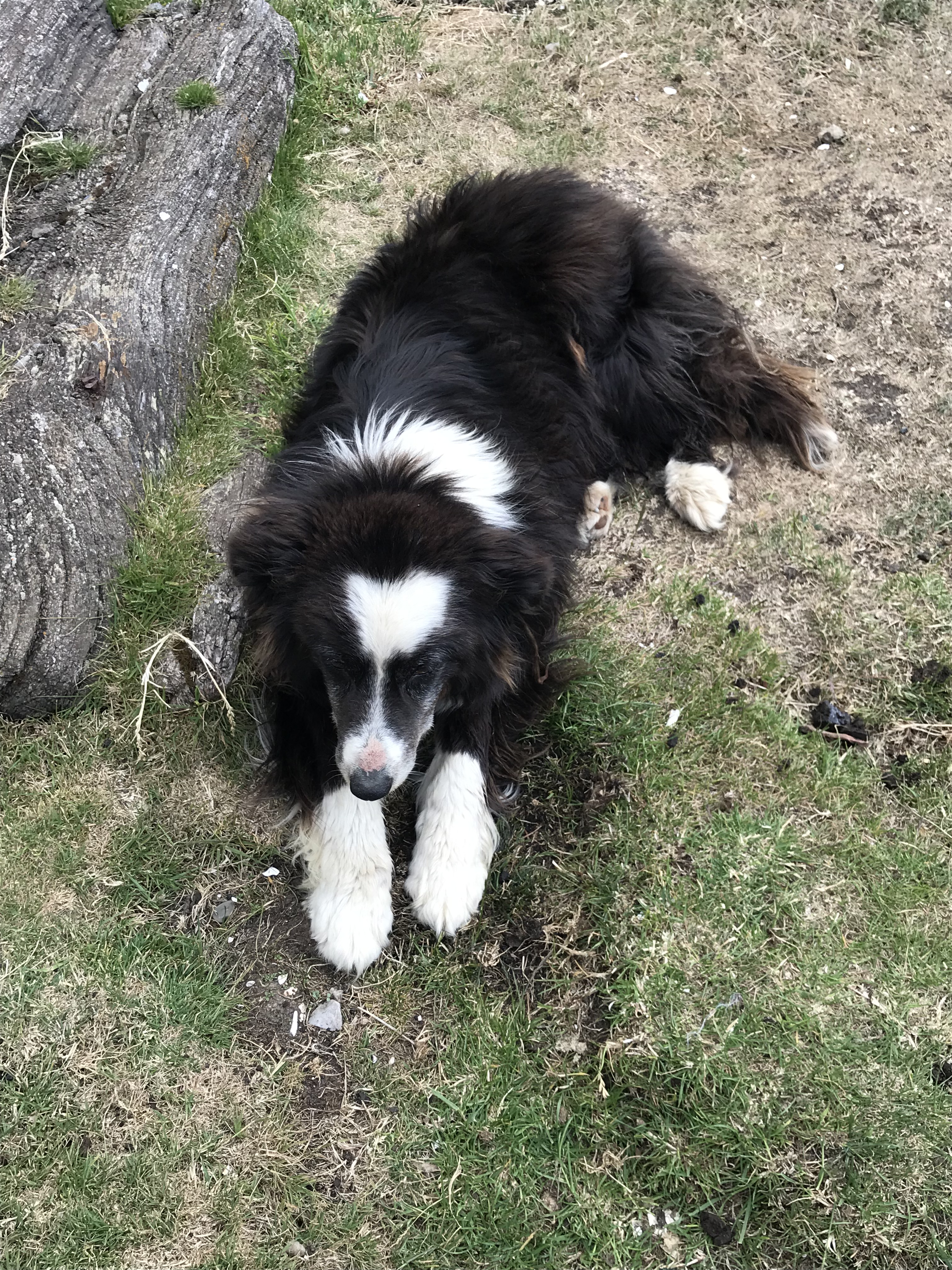
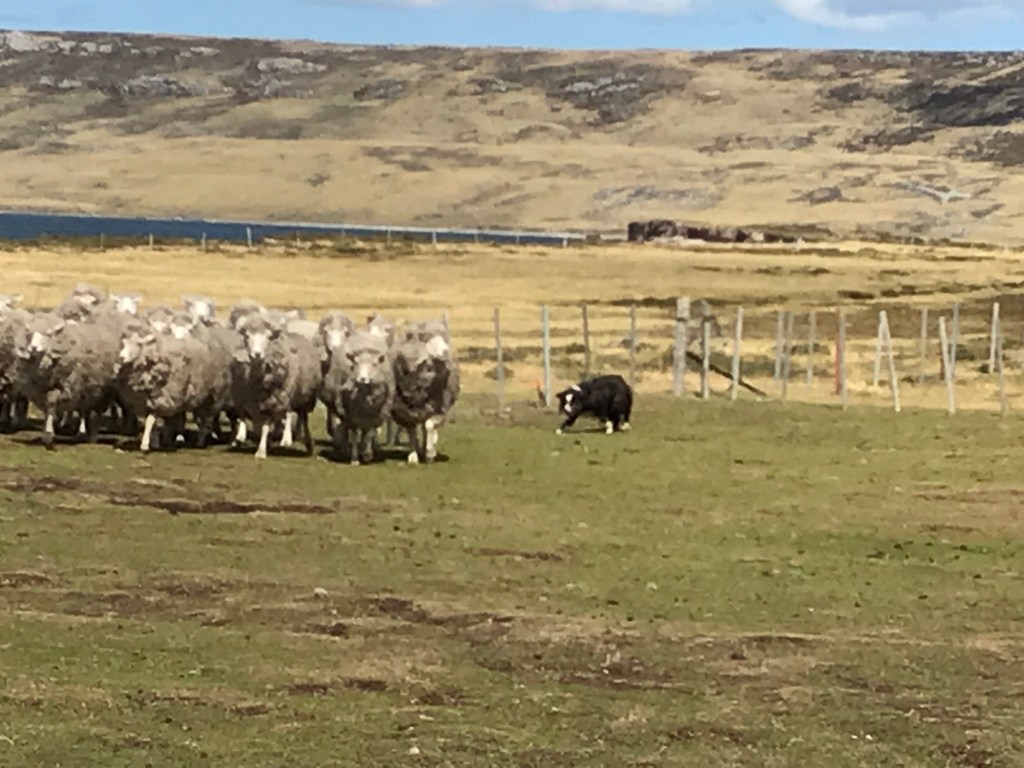
Glenda
and one of her 6 border collies demonstrated herding, and Paul demonstrated
sheep shearing. They hire help to do
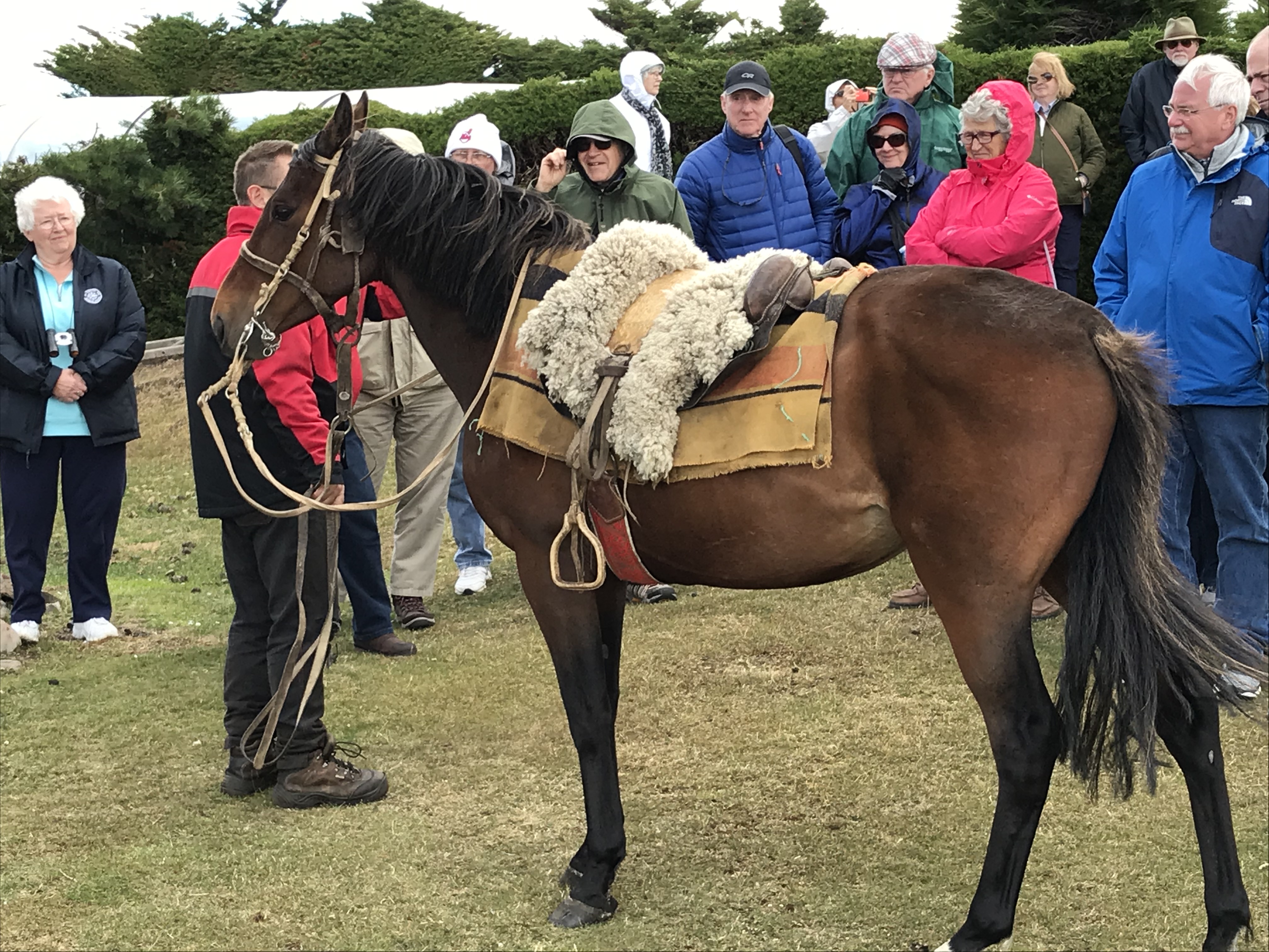
most of the shearing—at a rate of 1 ½ minutes a sheep! We were served coffee or tea plus baked
muffins & cookies in the house and then shown the horses and the type of
harnesses and saddles they use, which are Argentinean in style. Paul & Glenda were lovely people and it
was a fascinating trip.
Our guide John talked about the islands during the bus trip. They are, like Gibraltar and the Channel Islands, a territory of Great Britain but are financially independent. I’m amazed at the economy. They are governed by a governor and legislative assembly of 8 people each in charge of some departments (housing, agriculture, etc.) and the islands provide free schooling–including sending those who do well on their exams to college and university in England. They also have their own version of national health care, again free, including arrangements with a Chilean hospital to airlift patients they can’t handle on the island for hospital treatment.
It was a
glorious day—the first of several days to wear our cold-weather clothing as we
reach latitude approximately equal to London (at the Falklands) to Hudson Bay—very
windy with bright blue skies and wonderful cloud formations.
Since we were scheduled to be in port for two days, I was looking forward to our excursion the following day to an area to see penguins (3 kinds, including king penguins on the islands) and to walking around the town to buy some postcards, see local crafts, and view the inside of the cathedral. However, at dinner the captain announced, that, since it is projected to become too windy to safely tender ashore tomorrow, we were leaving tonight. We are now scheduled to arrive in Ushuaia, Argentina a day early and spend an extra day there although no excursions are yet planned. We were disappointed but Ushuaia should be interesting as well, and this sort of thing happens on ships so you just have to be flexible. Beginning with Ushuaia, we have an entire week of scenic cruising (with stops) through Cape Horn, the Beagle Channel and the Chilean fjords that I am really looking forward to. It will also give me a chance to discover whether I really brought too much cold weather clothing or not… –Cynthia
The Falklands: War and Charles Darwin. In 1982 and early in the reign of Margaret Thatcher, PM, her
Crown Colony of the Falkland Islands was invaded by the armed forces of
Argentina, which had claimed the islands for more than a century. The Islas Malvinas, as the Falklands are known
locally, include a pair of islands (and farther asea, the South Georgia and
South Sandwich Islands). With her usual
grit, Thatcher is credited with winning the conflict, with the help of her
armed forces, in a little over 2 months.
(“The Empire Struck Back!”)
Following a political settlement in 1989 the islands remain a UK possession, and although inhabited by the descendants of the original British colonists, Argentina still claims possession. I was reminded of the unfortunate conflict during our visit to East Falklands, one of the island pair that superficially resembles the more verdant, low-hilled islands off the west coast of Scotland. And more vividly by the image of the islands appearing on the side of our Patagonian tour bus, with the inscription “Las Malvinas son Argentinas”. (The one Argentinean I’ve actually asked about the caption thought it quaint but not unusual.) Further, our Argentinean map of Patagonia includes an inset of Islas Malvinas and identifies three towns: the capital, Puerto Argentino (that is, Port Stanley), Porto San Carlos (San Carlos Port) and Darwin. Not surprisingly, other geographical features are identified by Spanish names, although the one river depicted is named Rio Fitz Roy.
Whatever their lingering disagreement with
the UK, Argentineans continue to acknowledge the importance of Englishman
Charles Darwin, who in the 1830s visited the Falklands twice in HMS Beagle
(commanded by Captain Robert Fitzroy). While
there he collected numerous fossils and biological specimens and speculated (as
it turned out, incorrectly) about the origin of valleys filled with large
fragments of quartz stone – he thought them the product of earthquakes and we
now believe them to have been generated by myriad cycles of freezing and
thawing. Darwin’s journal, however,
accurately describes an island fox as the sole large carnivore, and much more
significantly, notes variations in its morphology between individuals found on
the adjacent islands. These journal entries suggest early musings about the
origin of species that would be fleshed out by subsequent notes of variations
among the finches on different Galapagos Islands, which he postulated were
derived from a single mainland species.
Unfortunately, the Falkland fox like the dodo is extinct.
Phillip Stone has a nice essay on Darwin in the
Falklands @http://nora.nerc.ac.uk/id/eprint/5311/1/Darwin4FIJ.pdf.
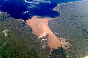
I’ve been reminded I should refer to the Estuary formed by the confluence of the Uruguay and Parana Rivers as Rio de la Plata (or Silver River) rather than ‘Plate River’. I’m still puzzled by why the name exists as all since there’s no ‘river’ of that name, just the estuary and, therefore, why it is not just called the Parana or the Uruguay. In looking it up I found this photo which shows clearly how much of a different color it is than the ocean and why it is a ‘river’ or estuary rather than a bay.
Rio de la Plata; Buenos Aires at lower right; Montevideo midway up on left
Viking
Sun passengers (‘guests’) are almost uniformly exceptionally courteous and
friendly. Partially responsible, I suspect, is the extreme courtesy and
friendliness of every member of the crew (mandated no doubt by
management). Pass any staff member and
you are greeted with a variation of “Good morning. Have a very pleasant day”
said with conviction. The ship is also
very big on cleanliness. We are
encouraged to wash hands frequently and every entrance to a dining facility
includes wash basins & soap plus a sanitizer station. The crew is constantly cleaning and
maintaining everything—washing windows, varnishing railings, etc.
Sea days
mean the return of the bridge program.
New cruise ‘guests’ replace those who left—though we don’t, as of yet,
have as many replacements as departures.
Still it’s a good crowd.
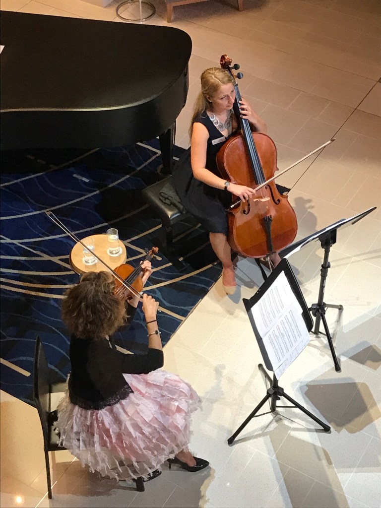
Sunday also means another interdenominational service led by our amazingly talented, versatile, and hard-working cruise director Heather. This Sunday she delivered another excellent homily and led a service of prayers, readings, and hymns to the accompaniment of a Viking pianist. For this segment of the cruise there are two passengers who are Roman Catholic priest on board and they have volunteered to do a mass as well so more opportunity for Sunday worship. (See Chris’ post below.)
Interdenominational Church Services on Sunday seem patterned on an abbreviated version of Episcopal services I’ve taken part in. These are held for a sizeable group in the Star Theater at 9:30 a.m. Each Service includes a Call to Worship (with a confession of faults); a Responsive Reading (derived from a Psalm); a Hymn; an Affirmation of Faith (a standard Creed); Prayers (of the Faithful) followed by The Lord’s Prayer; a Lectionary Text {so far, a reading from one of the Epistles); a Hymn; a Message (i.e., Homily); and finally, Blessing of Peace & Dismissal. The Hymns and texts are all very familiar, save for the mutual sharing of Peace that curiously entails fist-bumping. The Service is led by our Cruise Director, who has delivered thoughtful and articulate homilies based on the scriptural readings and with her operatic training leads as well as directs our singing.
A Holy Catholic Mass is scheduled for the second leg of the Cruise (from Buenos Aires to Valparaiso). (What a “non-holy” Mass on a Viking ship full of old fogies would look like or why the interdenominational service isn’t also “holy” escapes me! Not so, what seems to be clerical insensitivity!) The Masses are being celebrated at 8 a.m. by two priests from northeastern PA who apparently are on a Sun vacation for that period. The much smaller gathering of 50 or so fits comfortably in the ship’s nightclub and the backdrop of musical instruments are fittingly over-shadowed by a rear-projected triptych of stained glass windows, which our Cruise Director thoughtfully provided. Of course given their similar traditions, the sequence of prayers in the two services and the sentiments expressed are similar, but even with a shorter homily the Mass lasts a bit longer. It is basically a communion service and features readings from Old and New Testaments (including a Gospel passage) as well as appropriate offertory and sacrificial prayers and ritual. –Chris
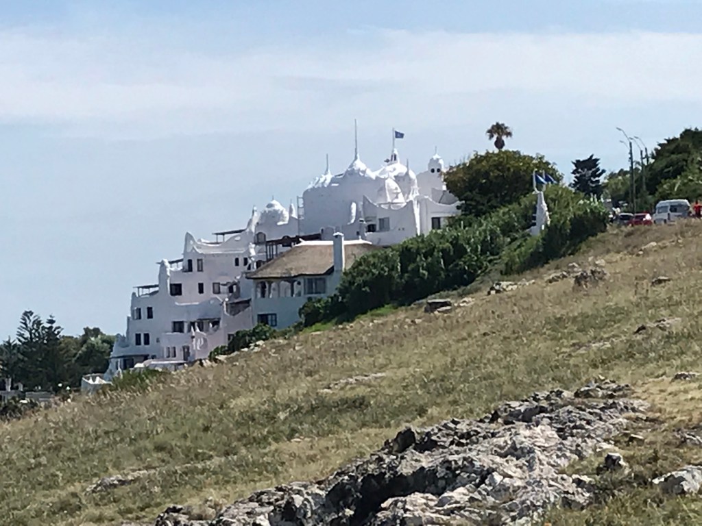
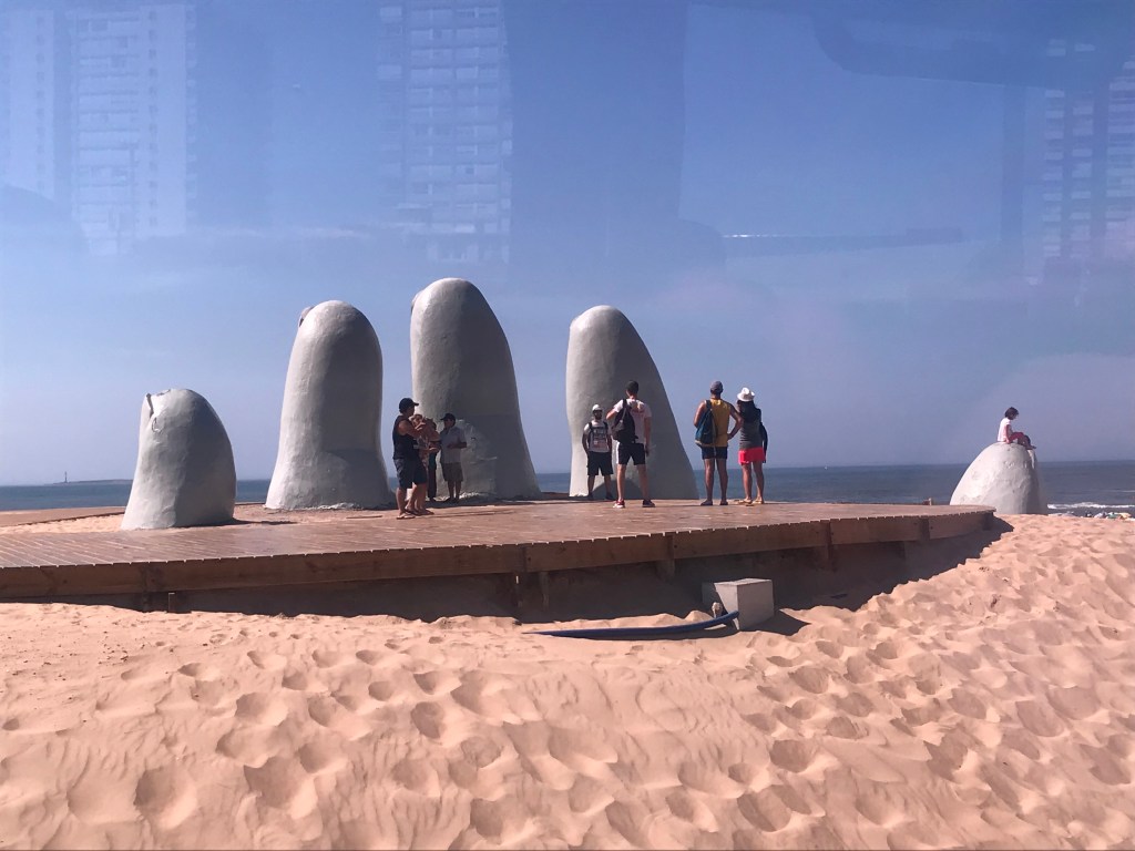
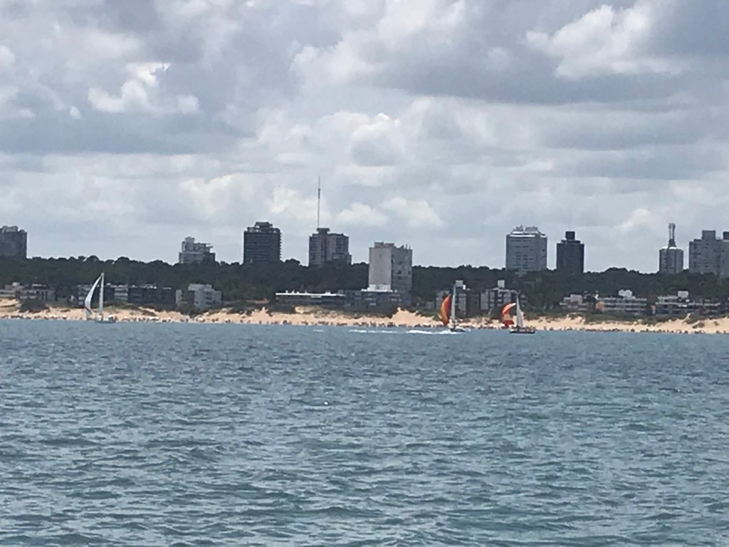
The Viking Sun moored in the lovely river bay complete with island and we tendered ashore. An expensive and beautiful resort town for mostly Argentinian and Brazilian wealthy vacationers, with beaches both on the Atlantic side (appealing to surfers) and on the calm bay side, there is a section named Beverly Hills (and some slums as well), and it will soon have a completed Trump Tower. Renowned Chilean artist Mario Irarrázabal built an incredible and huge house here and on a beach is his most famous sculpture La Mana (the hand), versions of which he also created and installed in other parts of the world. We did a short bus tour and later sat on our balcony reading as if we were in a million dollar apartment facing the beach.
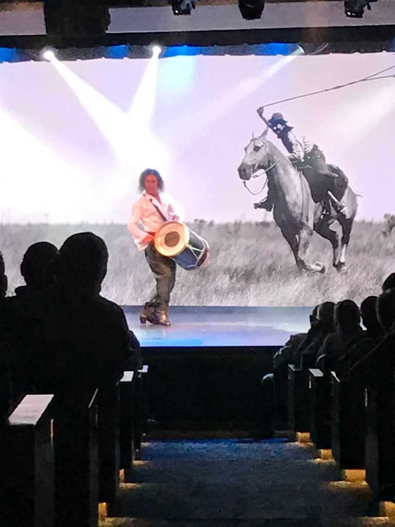
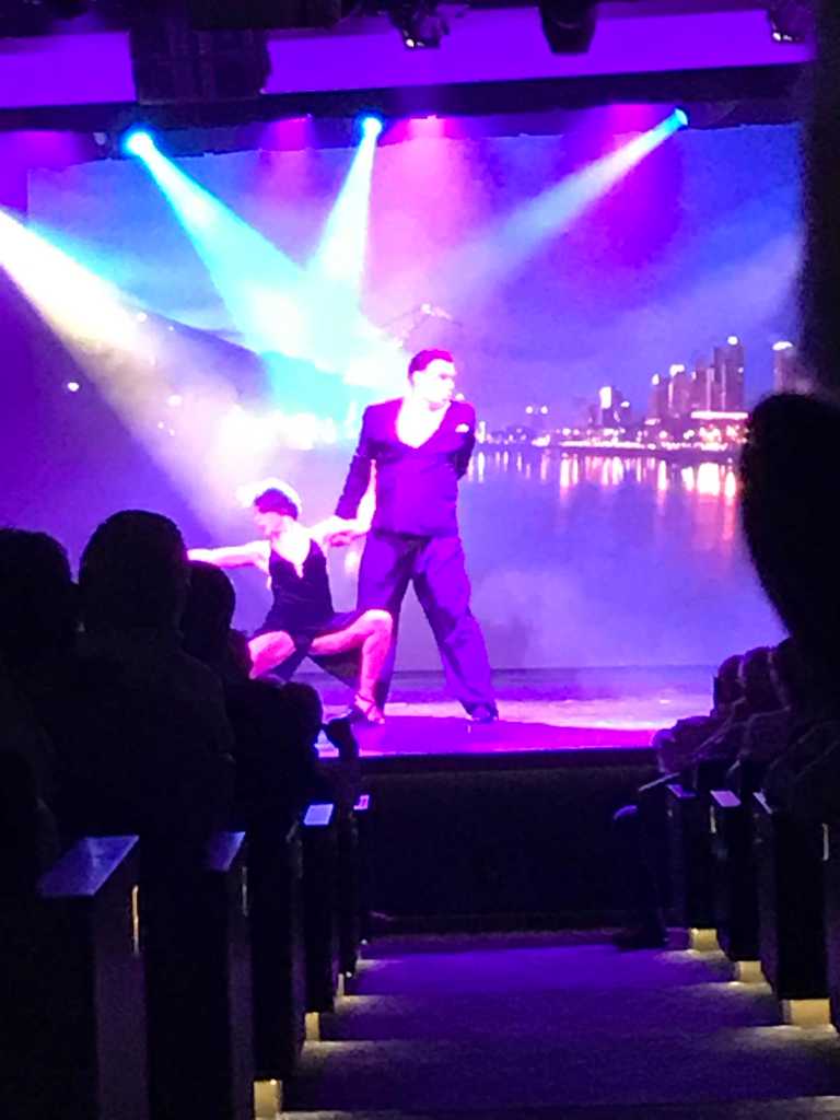
Buenos Aires lies up the Plate River/estuary and is on the opposite bank from Montevideo. We were overnight in port making it possible for Viking to bring aboard a tango troupe for an evening performance. In addition to tango, a performer dressed as a gaucho dances around with a boleadoras (or bolas), a device made of leather cords and three iron balls or stones that was thrown at the legs of an animal to entwine and immobilize it. It makes an incredible dance I can’t describe that is very rhythmic due to the striking of the balls on the floor.
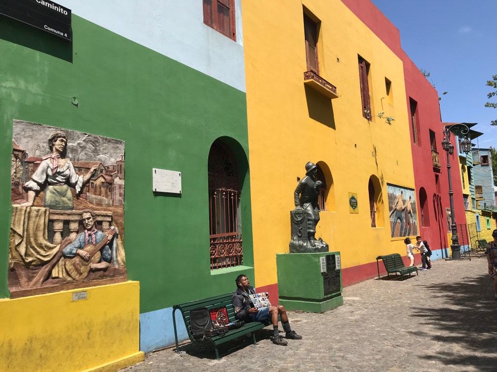
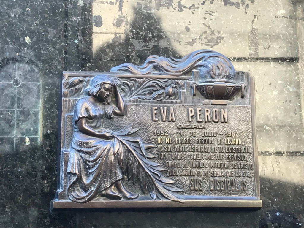
We did a bus tour of the city the first day that showed us lots of
monuments and buildings, including the brightly colored houses poor Italian
immigrants built, plus the incredible above ground cemetery where Eva Peron is
interred.
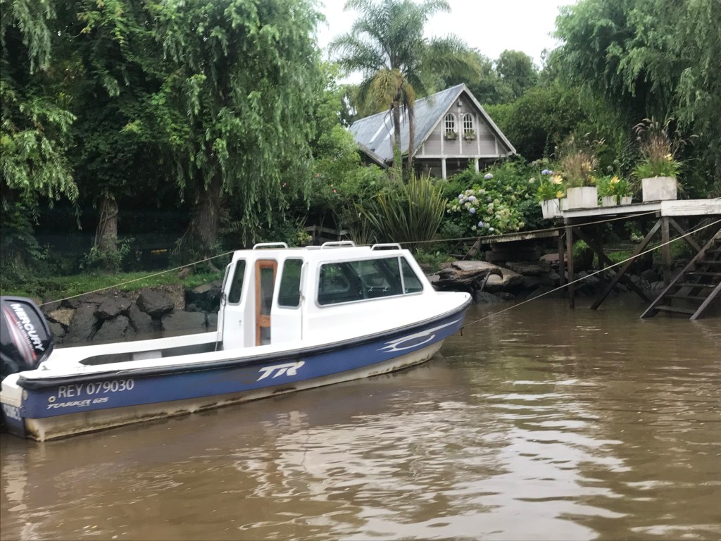
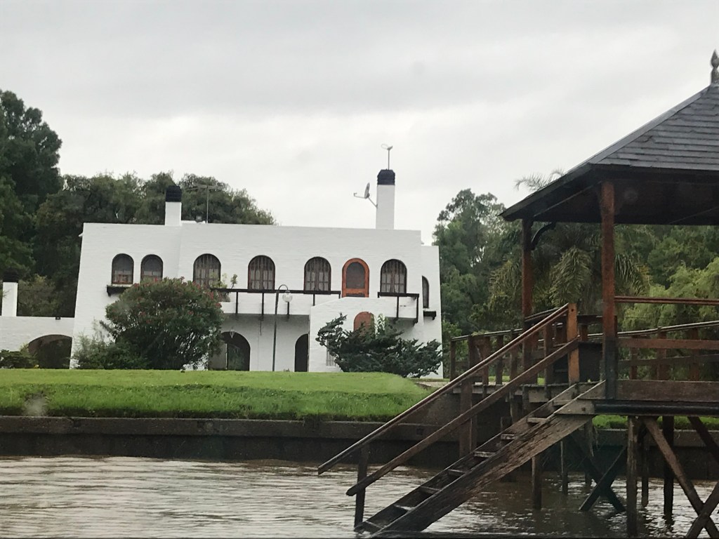
The second day we drove to the Parana delta and took a boat
ride. This was our first actual rainy
day, but the boat was enclosed so no problem.
The delta is huge (they say the biggest in the world) and also unusual
in that it empties into a river (the Plate) instead of into the ocean. In a maze of rivers and creeks, islands of the delta have
no roads, and inhabitants travel by boat.
There are bus boats for school children (primary and high schools are on
the islands) and taxis, boat supermarkets so you buy groceries at your dock, as
well as a boat bringing doctors and dentists.
Bottled water is required for drinking and cooking; otherwise water is from
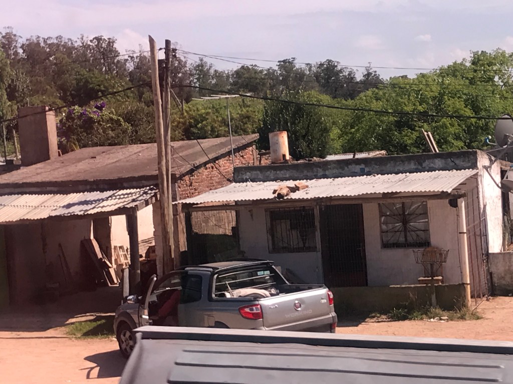
the river. I gather it was a popular
place once, but the population decreased drastically in the 1970s and a
majority of houses are unoccupied (and falling apart). But there are some nice houses and boats, and
real estate is inexpensive…
260 ‘members of the Viking family’ disembarked in Buenos Aires
(the end of the first of the five legs of the cruise) and a new group arrived
headed for Valpariso, Chile, the end of the second leg.
e